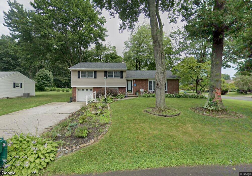
17 Sandy Dr Morrisville, PA 19067
Estimated Value: $530,000 - $603,000
3
Beds
3
Baths
2,056
Sq Ft
$268/Sq Ft
Est. Value
About This Home
This home is located at 17 Sandy Dr, Morrisville, PA 19067 and is currently estimated at $549,996, approximately $267 per square foot. 17 Sandy Dr is a home located in Bucks County with nearby schools including Eleanor Roosevelt Elementary School, Pennwood Middle School, and Pennsbury High School.
Ownership History
Date
Name
Owned For
Owner Type
Purchase Details
Closed on
Mar 30, 2010
Sold by
Karwowski Richard D and Karwowski Catherine M
Bought by
Gola Mark A
Current Estimated Value
Home Financials for this Owner
Home Financials are based on the most recent Mortgage that was taken out on this home.
Original Mortgage
$235,000
Outstanding Balance
$156,518
Interest Rate
5%
Mortgage Type
New Conventional
Estimated Equity
$393,478
Purchase Details
Closed on
Mar 31, 1988
Bought by
Karwowski Richard D and Karwowski Catherine
Create a Home Valuation Report for This Property
The Home Valuation Report is an in-depth analysis detailing your home's value as well as a comparison with similar homes in the area
Home Values in the Area
Average Home Value in this Area
Purchase History
| Date | Buyer | Sale Price | Title Company |
|---|---|---|---|
| Gola Mark A | $340,000 | First American Title Ins Co | |
| Karwowski Richard D | $143,000 | -- |
Source: Public Records
Mortgage History
| Date | Status | Borrower | Loan Amount |
|---|---|---|---|
| Open | Gola Mark A | $235,000 |
Source: Public Records
Tax History Compared to Growth
Tax History
| Year | Tax Paid | Tax Assessment Tax Assessment Total Assessment is a certain percentage of the fair market value that is determined by local assessors to be the total taxable value of land and additions on the property. | Land | Improvement |
|---|---|---|---|---|
| 2025 | $6,346 | $26,800 | $6,920 | $19,880 |
| 2024 | $6,346 | $26,800 | $6,920 | $19,880 |
| 2023 | $6,028 | $26,800 | $6,920 | $19,880 |
| 2022 | $5,897 | $26,800 | $6,920 | $19,880 |
| 2021 | $5,803 | $26,800 | $6,920 | $19,880 |
| 2020 | $5,803 | $26,800 | $6,920 | $19,880 |
| 2019 | $5,688 | $26,800 | $6,920 | $19,880 |
| 2018 | $5,588 | $26,800 | $6,920 | $19,880 |
| 2017 | $5,415 | $26,800 | $6,920 | $19,880 |
| 2016 | $5,353 | $26,800 | $6,920 | $19,880 |
| 2015 | -- | $26,800 | $6,920 | $19,880 |
| 2014 | -- | $26,800 | $6,920 | $19,880 |
Source: Public Records
Map
Nearby Homes
- 5 Patrick Ln
- 115 Winding Way
- 209 Alden Ave
- 113 Penns Grant Dr
- 211 Valley Rd
- 404 Alden Ave
- 229 Walton Dr
- 413 Alden Ave
- 329 Sherwood Dr
- 581 Nottingham Dr
- 942 Roeloffs Ct
- 866 Weber Dr
- 494 Keating Dr
- 113 Juliet Rd
- 79 Sutphin Pines
- 1706 Makefield Rd
- 5 Fayette Dr
- 96 Sutphin Pines
- 20 S Homestead Dr
- 184 Crestview Way