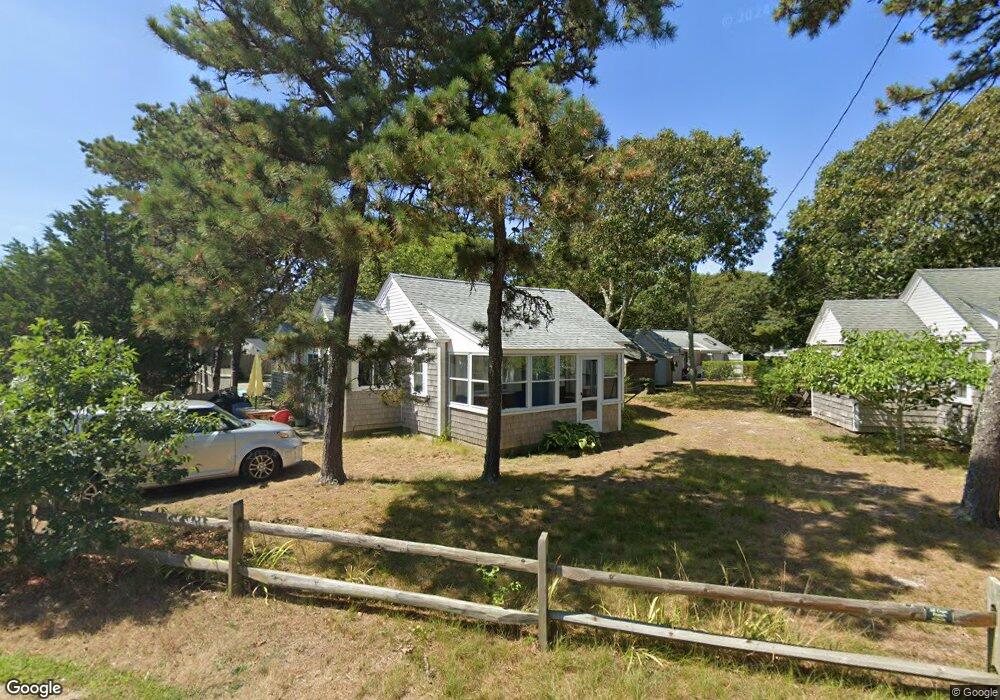
17 Sea St Unit E Dennis Port, MA 02639
Dennis Port NeighborhoodEstimated Value: $415,000 - $453,000
2
Beds
1
Bath
480
Sq Ft
$894/Sq Ft
Est. Value
About This Home
This home is located at 17 Sea St Unit E, Dennis Port, MA 02639 and is currently estimated at $429,272, approximately $894 per square foot. 17 Sea St Unit E is a home located in Barnstable County with nearby schools including Dennis-Yarmouth Regional High School and St. Pius X. School.
Ownership History
Date
Name
Owned For
Owner Type
Purchase Details
Closed on
Jun 19, 1996
Sold by
Digiovanni Silvio V and Digiovanni Charles
Bought by
Otoole Christine A
Current Estimated Value
Home Financials for this Owner
Home Financials are based on the most recent Mortgage that was taken out on this home.
Original Mortgage
$50,625
Outstanding Balance
$3,296
Interest Rate
8.21%
Mortgage Type
Purchase Money Mortgage
Estimated Equity
$425,976
Create a Home Valuation Report for This Property
The Home Valuation Report is an in-depth analysis detailing your home's value as well as a comparison with similar homes in the area
Home Values in the Area
Average Home Value in this Area
Purchase History
| Date | Buyer | Sale Price | Title Company |
|---|---|---|---|
| Otoole Christine A | $67,500 | -- | |
| Otoole Christine A | $67,500 | -- |
Source: Public Records
Mortgage History
| Date | Status | Borrower | Loan Amount |
|---|---|---|---|
| Open | Otoole Christine A | $50,625 | |
| Closed | Otoole Christine A | $50,625 |
Source: Public Records
Tax History Compared to Growth
Tax History
| Year | Tax Paid | Tax Assessment Tax Assessment Total Assessment is a certain percentage of the fair market value that is determined by local assessors to be the total taxable value of land and additions on the property. | Land | Improvement |
|---|---|---|---|---|
| 2025 | $1,821 | $420,600 | $0 | $420,600 |
| 2024 | $1,726 | $393,200 | $0 | $393,200 |
| 2023 | $1,506 | $322,500 | $0 | $322,500 |
| 2022 | $1,457 | $260,200 | $0 | $260,200 |
| 2021 | $1,446 | $239,800 | $0 | $239,800 |
| 2020 | $1,401 | $229,700 | $0 | $229,700 |
| 2019 | $1,365 | $221,200 | $0 | $221,200 |
| 2018 | $1,411 | $222,500 | $0 | $222,500 |
| 2017 | $1,368 | $222,500 | $0 | $222,500 |
| 2016 | $1,409 | $215,800 | $0 | $215,800 |
| 2015 | $1,381 | $215,800 | $0 | $215,800 |
| 2014 | $1,370 | $215,800 | $0 | $215,800 |
Source: Public Records
Map
Nearby Homes
- 37-A Beach Hills Rd
- 37 Beach Hills Rd
- 262 Old Wharf Rd Unit 67
- 262 Old Wharf Rd Unit 5
- 262 Old Wharf Rd Unit 5
- 262 Old Wharf Rd Unit 20
- 262 Old Wharf Rd Unit 87
- 241 Old Wharf Rd Unit 82
- 241 Old Wharf Rd Unit 127
- 241 Old Wharf Rd Unit 90
- 22 Ferncliff Rd
- 102 Sea St
- 217 Old Wharf Rd Unit 64
- 402 Old Wharf Rd
- 402 Old Wharf Rd
- 405 Old Wharf Rd Unit B204
- 405 Old Wharf Rd Unit B204
- 9 Chase Ave Unit 6
- 11 Ocean Park W
- 154 Old Wharf Rd Unit 26
- 17 Sea St Unit F
- 17 Sea St Unit D
- 17 Sea St Unit C
- 17 Sea St Unit B
- 17 Sea St Unit A
- 0 Pelham Dr
- 297 Old Wharf Rd Unit 11
- 297 Old Wharf Rd Unit 5
- 297 Old Wharf Rd Unit 4
- 297 Old Wharf Rd Unit 10
- 297 Old Wharf Rd Unit 2
- 297 Old Wharf Rd Unit 7
- 297 Old Wharf Rd Unit 6
- 297 Old Wharf Rd Unit 3
- 297 Old Wharf Rd Unit 9
- 297 Old Wharf Rd Unit 1
- 297 Old Wharf Rd
- 25 Sea St
- 24 Sea St
- 15 Sea St Unit 8