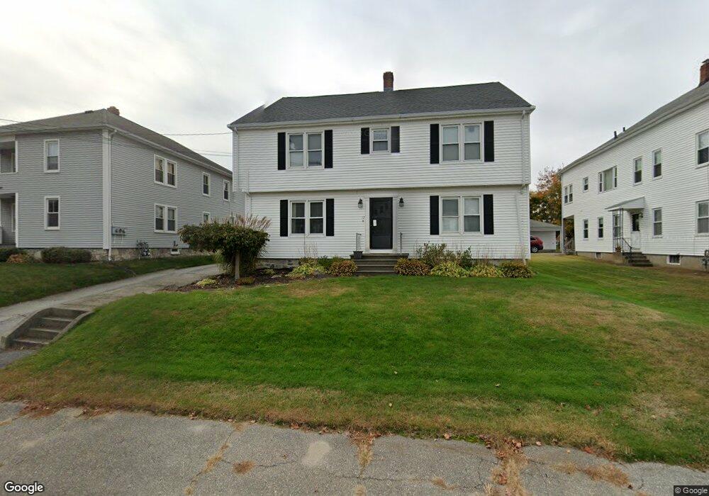
17 Slater St Webster, MA 01570
Estimated Value: $406,587 - $442,000
4
Beds
2
Baths
2,546
Sq Ft
$167/Sq Ft
Est. Value
About This Home
This home is located at 17 Slater St, Webster, MA 01570 and is currently estimated at $424,647, approximately $166 per square foot. 17 Slater St is a home located in Worcester County with nearby schools including Park Avenue Elementary School, Webster Middle School, and Bartlett High School.
Ownership History
Date
Name
Owned For
Owner Type
Purchase Details
Closed on
Aug 26, 2010
Sold by
Pakulski Francis J and Pakulski Patricia
Bought by
Soule Donald L and Soule Patricia E
Current Estimated Value
Home Financials for this Owner
Home Financials are based on the most recent Mortgage that was taken out on this home.
Original Mortgage
$158,487
Outstanding Balance
$104,281
Interest Rate
4.37%
Mortgage Type
FHA
Estimated Equity
$320,366
Create a Home Valuation Report for This Property
The Home Valuation Report is an in-depth analysis detailing your home's value as well as a comparison with similar homes in the area
Home Values in the Area
Average Home Value in this Area
Purchase History
| Date | Buyer | Sale Price | Title Company |
|---|---|---|---|
| Soule Donald L | $175,000 | -- |
Source: Public Records
Mortgage History
| Date | Status | Borrower | Loan Amount |
|---|---|---|---|
| Open | Soule Donald L | $158,487 |
Source: Public Records
Tax History Compared to Growth
Tax History
| Year | Tax Paid | Tax Assessment Tax Assessment Total Assessment is a certain percentage of the fair market value that is determined by local assessors to be the total taxable value of land and additions on the property. | Land | Improvement |
|---|---|---|---|---|
| 2025 | $3,967 | $333,900 | $56,200 | $277,700 |
| 2024 | $3,809 | $312,700 | $54,000 | $258,700 |
| 2023 | $3,250 | $260,000 | $46,800 | $213,200 |
| 2022 | $3,204 | $229,500 | $45,400 | $184,100 |
| 2021 | $3,080 | $204,000 | $45,400 | $158,600 |
| 2020 | $2,901 | $192,600 | $45,400 | $147,200 |
| 2019 | $2,884 | $188,100 | $45,400 | $142,700 |
| 2018 | $2,561 | $166,400 | $45,400 | $121,000 |
| 2017 | $2,415 | $159,600 | $44,500 | $115,100 |
| 2016 | $2,416 | $159,600 | $44,500 | $115,100 |
| 2015 | $2,299 | $156,600 | $43,600 | $113,000 |
Source: Public Records
Map
Nearby Homes
- 19 Slater St
- 15 Slater St
- 21 Slater St
- 13 Slater St
- 16 Stoughton Ave
- 12 Stoughton Ave
- 12 Stoughton Ave Unit 2
- 14 Stoughton Ave
- 18 Stoughton Ave
- 12A Stoughton Ave
- 23 Slater St
- 20 Stoughton Ave
- 14 Slater St
- 14 Slater St Unit 1
- 14 Slater St Unit 3
- 18 Slater St
- 16 Slater St
- 22 Stoughton Ave
- 22 Stoughton Ave Unit 1
- 22 Slater St