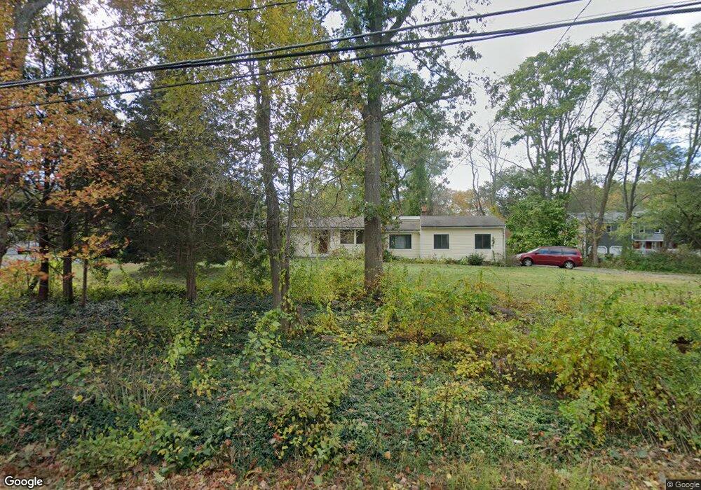
17 Stone Rd Sudbury, MA 01776
Estimated Value: $763,000 - $869,000
3
Beds
2
Baths
1,382
Sq Ft
$584/Sq Ft
Est. Value
About This Home
This home is located at 17 Stone Rd, Sudbury, MA 01776 and is currently estimated at $806,795, approximately $583 per square foot. 17 Stone Rd is a home located in Middlesex County with nearby schools including Israel Loring Elementary School, Ephraim Curtis Middle School, and Lincoln-Sudbury Regional High School.
Ownership History
Date
Name
Owned For
Owner Type
Purchase Details
Closed on
Apr 9, 1991
Sold by
Gerard Dale M
Bought by
Proctor Jeffrey S
Current Estimated Value
Create a Home Valuation Report for This Property
The Home Valuation Report is an in-depth analysis detailing your home's value as well as a comparison with similar homes in the area
Home Values in the Area
Average Home Value in this Area
Purchase History
| Date | Buyer | Sale Price | Title Company |
|---|---|---|---|
| Proctor Jeffrey S | $115,000 | -- | |
| Proctor Jeffrey S | $115,000 | -- |
Source: Public Records
Mortgage History
| Date | Status | Borrower | Loan Amount |
|---|---|---|---|
| Closed | Proctor Jeffrey S | $130,000 | |
| Closed | Proctor Jeffrey S | $130,000 | |
| Closed | Proctor Jeffrey S | $15,000 |
Source: Public Records
Tax History
| Year | Tax Paid | Tax Assessment Tax Assessment Total Assessment is a certain percentage of the fair market value that is determined by local assessors to be the total taxable value of land and additions on the property. | Land | Improvement |
|---|---|---|---|---|
| 2025 | $10,390 | $709,700 | $438,900 | $270,800 |
| 2024 | $10,039 | $687,100 | $426,100 | $261,000 |
| 2023 | $10,115 | $641,400 | $394,500 | $246,900 |
| 2022 | $10,155 | $562,600 | $362,100 | $200,500 |
| 2021 | $10,097 | $536,200 | $362,100 | $174,100 |
| 2020 | $9,893 | $536,200 | $362,100 | $174,100 |
| 2019 | $9,603 | $536,200 | $362,100 | $174,100 |
| 2018 | $9,207 | $513,500 | $386,100 | $127,400 |
| 2017 | $8,499 | $479,100 | $367,300 | $111,800 |
| 2016 | $8,197 | $460,500 | $353,300 | $107,200 |
| 2015 | $7,564 | $429,800 | $339,700 | $90,100 |
| 2014 | $7,540 | $418,200 | $329,700 | $88,500 |
Source: Public Records
Map
Nearby Homes
- 0 Robbins Rd
- 725 Boston Post Rd Unit 12
- 0 Boston Post Rd
- 30 Rolling Ln
- 24 Woodland Rd
- 11 Farmstead Ln Unit 11
- 30 Kendall Rd
- 1011 Boston Post Rd
- 123 Dutton Rd
- 32 Eaton Rd W
- 6 Mountain View Dr
- 53 Pine St
- 19 Nob Hill Dr
- 106 Baldwin Ave
- 557 Dutton Rd Unit 2
- 62 Churchill St
- 620 Edmands Rd
- 301 Windsor Dr
- 907 Windsor Dr
- 46 Brewster Rd
Your Personal Tour Guide
Ask me questions while you tour the home.