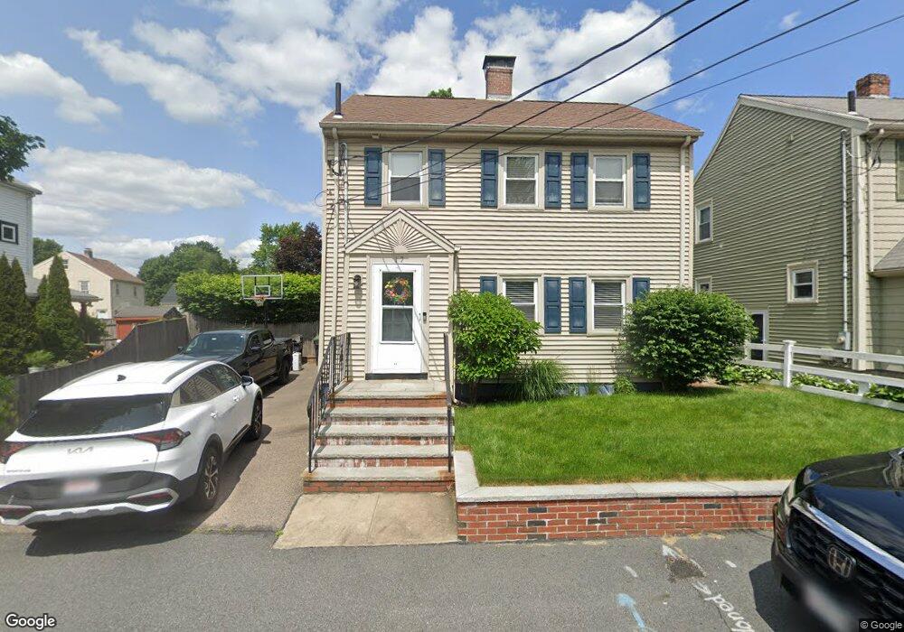
17 Sumner St Dedham, MA 02026
East Dedham NeighborhoodEstimated Value: $664,000 - $788,326
3
Beds
3
Baths
1,440
Sq Ft
$509/Sq Ft
Est. Value
About This Home
This home is located at 17 Sumner St, Dedham, MA 02026 and is currently estimated at $733,082, approximately $509 per square foot. 17 Sumner St is a home located in Norfolk County with nearby schools including Avery, Dedham Middle School, and Dedham High School.
Ownership History
Date
Name
Owned For
Owner Type
Purchase Details
Closed on
Oct 13, 2022
Sold by
Village At Norfolk Llc
Bought by
Das Debasruti and Mohanty Saswat S
Current Estimated Value
Home Financials for this Owner
Home Financials are based on the most recent Mortgage that was taken out on this home.
Original Mortgage
$592,200
Outstanding Balance
$566,092
Interest Rate
5.66%
Mortgage Type
Purchase Money Mortgage
Estimated Equity
$166,990
Purchase Details
Closed on
Feb 21, 1997
Sold by
Sharek Scott E and Sharek Randi Y
Bought by
Shephard Paul C and Shephard Elizabeth A
Home Financials for this Owner
Home Financials are based on the most recent Mortgage that was taken out on this home.
Original Mortgage
$139,000
Interest Rate
7.8%
Mortgage Type
Purchase Money Mortgage
Create a Home Valuation Report for This Property
The Home Valuation Report is an in-depth analysis detailing your home's value as well as a comparison with similar homes in the area
Home Values in the Area
Average Home Value in this Area
Purchase History
| Date | Buyer | Sale Price | Title Company |
|---|---|---|---|
| Das Debasruti | $740,363 | None Available | |
| Shephard Paul C | $159,000 | -- |
Source: Public Records
Mortgage History
| Date | Status | Borrower | Loan Amount |
|---|---|---|---|
| Open | Das Debasruti | $592,200 | |
| Previous Owner | Shephard Paul C | $198,000 | |
| Previous Owner | Shephard Paul C | $215,000 | |
| Previous Owner | Shephard Paul C | $139,000 |
Source: Public Records
Tax History
| Year | Tax Paid | Tax Assessment Tax Assessment Total Assessment is a certain percentage of the fair market value that is determined by local assessors to be the total taxable value of land and additions on the property. | Land | Improvement |
|---|---|---|---|---|
| 2025 | $7,880 | $624,400 | $255,400 | $369,000 |
| 2024 | $7,766 | $621,300 | $241,800 | $379,500 |
| 2023 | $6,966 | $542,500 | $214,700 | $327,800 |
| 2022 | $6,632 | $496,800 | $210,200 | $286,600 |
| 2021 | $6,298 | $460,700 | $205,600 | $255,100 |
| 2020 | $6,116 | $445,800 | $196,500 | $249,300 |
| 2019 | $5,715 | $403,900 | $170,900 | $233,000 |
| 2018 | $5,622 | $386,400 | $153,400 | $233,000 |
| 2017 | $5,368 | $363,700 | $143,800 | $219,900 |
| 2016 | $5,429 | $350,500 | $125,600 | $224,900 |
| 2015 | $5,093 | $320,900 | $117,500 | $203,400 |
| 2014 | $4,721 | $293,600 | $114,900 | $178,700 |
Source: Public Records
Map
Nearby Homes
- 8 Sumner St
- 111 Schiller Rd
- 25 Rockland St Unit 5
- 25R Rockland St Unit 6
- 94 Rockland St
- 109 Rockland St
- 231 Grove St
- 4 Mount Hope St
- 231-245 Grove St
- 5170 Washington St Unit 107
- 191 Glenellen Rd
- 41 Vogel St
- 2505 Centre St
- 150 Grove St
- 42 Churchill Place
- 49 Greenhood St
- 17 Vogel St
- 15 Vogel St
- 153 Colburn St
- 115 Grove St Unit 1
- 13 Sumner St
- 25 Sumner St
- 20 Willis St
- 46 Lower East St
- 14 Willis St
- 46 Lower St E
- 22 Sumner St
- 40 Lower East St
- 39 Washington St
- 35 Washington St
- 16 Sumner St
- 12 Sumner St
- 31 Washington St
- 62 Lower East St
- 47 Lower St E
- 19 Willis St
- 47 Lower East St
- 25 Willis St
- 51 Lower East St
- 51 Lower East St Unit 1
Your Personal Tour Guide
Ask me questions while you tour the home.