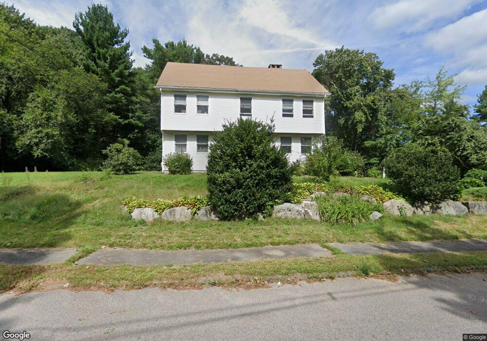
17 Sunnyrock Dr Walpole, MA 02081
Estimated Value: $936,141 - $1,221,000
3
Beds
3
Baths
2,733
Sq Ft
$391/Sq Ft
Est. Value
About This Home
This home is located at 17 Sunnyrock Dr, Walpole, MA 02081 and is currently estimated at $1,069,535, approximately $391 per square foot. 17 Sunnyrock Dr is a home located in Norfolk County with nearby schools including Fisher School, Walpole Middle School, and Walpole High School.
Create a Home Valuation Report for This Property
The Home Valuation Report is an in-depth analysis detailing your home's value as well as a comparison with similar homes in the area
Home Values in the Area
Average Home Value in this Area
Tax History
| Year | Tax Paid | Tax Assessment Tax Assessment Total Assessment is a certain percentage of the fair market value that is determined by local assessors to be the total taxable value of land and additions on the property. | Land | Improvement |
|---|---|---|---|---|
| 2025 | $11,687 | $910,900 | $406,000 | $504,900 |
| 2024 | $11,318 | $856,100 | $390,500 | $465,600 |
| 2023 | $10,719 | $771,700 | $339,500 | $432,200 |
| 2022 | $10,040 | $694,300 | $314,400 | $379,900 |
| 2021 | $9,869 | $665,000 | $296,900 | $368,100 |
| 2020 | $9,598 | $640,300 | $289,900 | $350,400 |
| 2019 | $9,259 | $613,200 | $278,800 | $334,400 |
| 2018 | $9,087 | $595,100 | $268,300 | $326,800 |
| 2017 | $8,830 | $576,000 | $257,900 | $318,100 |
| 2016 | $8,749 | $562,300 | $258,800 | $303,500 |
| 2015 | $8,567 | $545,700 | $256,200 | $289,500 |
| 2014 | $8,252 | $523,600 | $256,200 | $267,400 |
Source: Public Records
Map
Nearby Homes
- 26 Dover Dr
- 19 and 23 Arlington Ln
- 8 Mckinley Ave
- 241 Fisher St
- 111 Elm St
- 291 Plimpton St
- 56 North St
- 38 Garden Pkwy
- 26 Albemarle Rd
- 115 High St
- 104 Wood End Ln
- 260 Elm St
- 881 Main St Unit 9
- 17 Fairview Rd
- 15 Homestead Dr
- 5 Endicott St Unit 3
- 40 Endean Dr
- 40 Hearthstone Dr
- 222 School St Unit 9
- 224 School St Unit 9
Your Personal Tour Guide
Ask me questions while you tour the home.