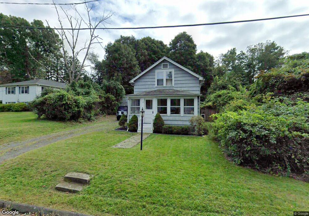
17 Townsend St Middlebury, CT 06762
Estimated Value: $318,000 - $355,000
2
Beds
1
Bath
916
Sq Ft
$368/Sq Ft
Est. Value
About This Home
This home is located at 17 Townsend St, Middlebury, CT 06762 and is currently estimated at $336,866, approximately $367 per square foot. 17 Townsend St is a home located in New Haven County with nearby schools including Middlebury Elementary School, Memorial Middle School, and Pomperaug Regional High School.
Ownership History
Date
Name
Owned For
Owner Type
Purchase Details
Closed on
Feb 7, 2022
Sold by
Osborn Katy and Osborn Isaac
Bought by
Murphy Kelly
Current Estimated Value
Home Financials for this Owner
Home Financials are based on the most recent Mortgage that was taken out on this home.
Original Mortgage
$170,000
Outstanding Balance
$157,054
Interest Rate
3.45%
Mortgage Type
Purchase Money Mortgage
Estimated Equity
$179,812
Purchase Details
Closed on
Sep 13, 2006
Sold by
Macconnie James
Bought by
Byrne Katy and Osborn Isaac
Home Financials for this Owner
Home Financials are based on the most recent Mortgage that was taken out on this home.
Original Mortgage
$173,040
Interest Rate
6.71%
Mortgage Type
Purchase Money Mortgage
Purchase Details
Closed on
Jul 28, 2000
Sold by
Cole Walter and Cole Elsie
Bought by
Macconnie James and Beare Dawn
Create a Home Valuation Report for This Property
The Home Valuation Report is an in-depth analysis detailing your home's value as well as a comparison with similar homes in the area
Home Values in the Area
Average Home Value in this Area
Purchase History
| Date | Buyer | Sale Price | Title Company |
|---|---|---|---|
| Murphy Kelly | $212,500 | None Available | |
| Murphy Kelly | $212,500 | None Available | |
| Byrne Katy | $216,300 | -- | |
| Byrne Katy | $216,300 | -- | |
| Macconnie James | $127,500 | -- | |
| Macconnie James | $127,500 | -- |
Source: Public Records
Mortgage History
| Date | Status | Borrower | Loan Amount |
|---|---|---|---|
| Open | Murphy Kelly | $170,000 | |
| Closed | Murphy Kelly | $170,000 | |
| Previous Owner | Macconnie James | $159,560 | |
| Previous Owner | Macconnie James | $173,040 | |
| Previous Owner | Macconnie James | $43,200 |
Source: Public Records
Tax History Compared to Growth
Tax History
| Year | Tax Paid | Tax Assessment Tax Assessment Total Assessment is a certain percentage of the fair market value that is determined by local assessors to be the total taxable value of land and additions on the property. | Land | Improvement |
|---|---|---|---|---|
| 2025 | $4,826 | $148,400 | $60,700 | $87,700 |
| 2024 | $4,838 | $148,400 | $60,700 | $87,700 |
| 2023 | $4,787 | $148,400 | $60,700 | $87,700 |
| 2022 | $4,639 | $148,400 | $60,700 | $87,700 |
| 2021 | $4,295 | $123,300 | $69,300 | $54,000 |
| 2020 | $4,328 | $123,300 | $69,300 | $54,000 |
| 2019 | $4,118 | $123,300 | $69,300 | $54,000 |
| 2018 | $4,008 | $123,300 | $69,300 | $54,000 |
| 2017 | $3,883 | $123,300 | $69,300 | $54,000 |
| 2016 | $4,106 | $132,400 | $81,500 | $50,900 |
| 2015 | $3,988 | $132,400 | $81,500 | $50,900 |
| 2014 | $3,885 | $132,400 | $81,500 | $50,900 |
Source: Public Records
Map
Nearby Homes
- 73 Yale Ave
- 32 Yale Ave
- 3 Pine Ridge Unit 23
- 116 Yale Ave
- 0 Ferndale Ave
- 141 Joshua Town Rd
- 1 Umberfield Rd
- 105 Jericho Rd
- 0 Mason Ave
- 126 Colonial Ave
- 120 Mason Ave
- 110 Wooster Ave
- 61 Campfield Rd
- 51 Cross Rd
- 72 Carriage Dr
- 25 Parkwood Ave
- 182 Bayberry Terrace
- 383 Leonard Rd
- 604 Lakeside Blvd W
- 55 Eastfield Rd