Estimated Value: $390,069 - $577,000
--
Bed
--
Bath
1,568
Sq Ft
$306/Sq Ft
Est. Value
About This Home
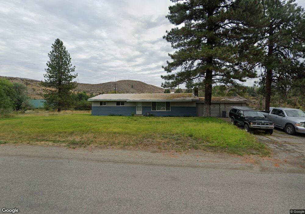
This home is located at 17 Twisp Airport Rd, Twisp, WA 98856 and is currently estimated at $480,267, approximately $306 per square foot. 17 Twisp Airport Rd is a home located in Okanogan County with nearby schools including Methow Valley Elementary School, Liberty Bell Junior/Senior High School, and Methow Valley Independent Learning Center.
Ownership History
Date
Name
Owned For
Owner Type
Purchase Details
Closed on
Jul 25, 2011
Sold by
Byram Michel R
Bought by
Schade Rudolph N
Current Estimated Value
Home Financials for this Owner
Home Financials are based on the most recent Mortgage that was taken out on this home.
Original Mortgage
$175,437
Outstanding Balance
$120,410
Interest Rate
4.46%
Mortgage Type
FHA
Estimated Equity
$359,857
Purchase Details
Closed on
Jun 23, 2011
Sold by
Byram Michel R and Estate Of Wilfred R Byram
Bought by
Byram Michel R
Home Financials for this Owner
Home Financials are based on the most recent Mortgage that was taken out on this home.
Original Mortgage
$175,437
Outstanding Balance
$120,410
Interest Rate
4.46%
Mortgage Type
FHA
Estimated Equity
$359,857
Create a Home Valuation Report for This Property
The Home Valuation Report is an in-depth analysis detailing your home's value as well as a comparison with similar homes in the area
Home Values in the Area
Average Home Value in this Area
Purchase History
| Date | Buyer | Sale Price | Title Company |
|---|---|---|---|
| Schade Rudolph N | $180,300 | Inland Professional Title | |
| Byram Michel R | -- | None Available |
Source: Public Records
Mortgage History
| Date | Status | Borrower | Loan Amount |
|---|---|---|---|
| Open | Schade Rudolph N | $175,437 |
Source: Public Records
Tax History Compared to Growth
Tax History
| Year | Tax Paid | Tax Assessment Tax Assessment Total Assessment is a certain percentage of the fair market value that is determined by local assessors to be the total taxable value of land and additions on the property. | Land | Improvement |
|---|---|---|---|---|
| 2025 | $2,532 | $351,800 | $40,200 | $311,600 |
| 2024 | $2,532 | $319,600 | $40,200 | $279,400 |
| 2022 | $2,120 | $196,700 | $26,800 | $169,900 |
| 2021 | $2,268 | $196,700 | $26,800 | $169,900 |
| 2020 | $1,794 | $196,700 | $26,800 | $169,900 |
| 2019 | $1,707 | $157,500 | $26,800 | $130,700 |
| 2018 | $1,779 | $157,500 | $26,800 | $130,700 |
| 2017 | $1,616 | $157,500 | $26,800 | $130,700 |
| 2016 | $1,407 | $138,900 | $27,000 | $111,900 |
| 2015 | $1,301 | $138,900 | $27,000 | $111,900 |
| 2013 | -- | $138,900 | $27,000 | $111,900 |
Source: Public Records
Map
Nearby Homes
- 1221 Riverside Ave
- 1110 Riverside Ave
- 0 Lot 2 Amended Surface Short Plat
- 803 D Twisp Carlton Rd
- 318 Lombard St
- 803 C Twisp Carlton
- 303 E 2nd Ave
- 136 Johnson St
- 115 Johnson St N Unit 1,2,3
- 140 Twisp Ave W Unit 204
- 0 Isabella Ln Unit NWM2400755
- 0 Isabella Ln Unit NWM2400767
- 96 Alder Creek Rd
- 799 Twisp River Rd
- 2992 Washington 153
- 48 Thurlow Rd
- 121 Finley Canyon Rd
- 54B Ross Rd Unit B
- 143 Harrier Hill Rd
- 245 Twisp Carlton Rd
- 20290 State Route 20
- 2 Ayers Rd
- 4 Ayers Rd
- 23 Twisp Airport Rd
- 20285 State Route 20
- 25 Twisp Airport Rd
- 5 Twisp Airport Rd
- 20 S Airport Rd
- 27 Twisp Airport Rd
- 0 Airport Rd Unit 29150575
- 11 Ayers Rd
- 14 Ayers Rd
- 29 Twisp Airport Rd
- 130 Evergreen Loop
- 31 Twisp Airport Rd
- 83 Twisp Airport Rd
- 126 Evergreen Loop
- 1410 Riverside Ave
- 121 Evergreen Loop
- 1406 Riverside Ave