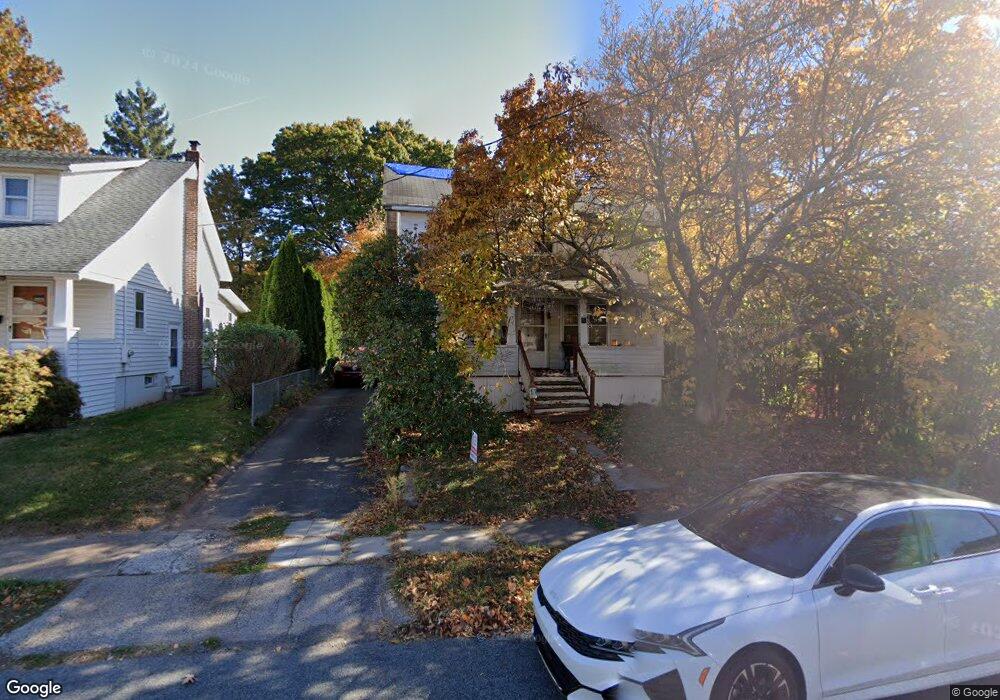
17 Uncas Rd New Britain, CT 06053
Estimated Value: $192,000 - $327,000
3
Beds
1
Bath
1,456
Sq Ft
$189/Sq Ft
Est. Value
About This Home
This home is located at 17 Uncas Rd, New Britain, CT 06053 and is currently estimated at $275,499, approximately $189 per square foot. 17 Uncas Rd is a home located in Hartford County with nearby schools including Holmes School, Pulaski Middle School, and Mountain Laurel Sudbury School.
Ownership History
Date
Name
Owned For
Owner Type
Purchase Details
Closed on
Aug 8, 1994
Sold by
Greene William T Est
Bought by
Wasik Andrea M
Current Estimated Value
Home Financials for this Owner
Home Financials are based on the most recent Mortgage that was taken out on this home.
Original Mortgage
$67,229
Interest Rate
8.4%
Mortgage Type
Unknown
Create a Home Valuation Report for This Property
The Home Valuation Report is an in-depth analysis detailing your home's value as well as a comparison with similar homes in the area
Home Values in the Area
Average Home Value in this Area
Purchase History
| Date | Buyer | Sale Price | Title Company |
|---|---|---|---|
| Wasik Andrea M | $67,680 | -- |
Source: Public Records
Mortgage History
| Date | Status | Borrower | Loan Amount |
|---|---|---|---|
| Closed | Wasik Andrea M | $67,229 |
Source: Public Records
Tax History
| Year | Tax Paid | Tax Assessment Tax Assessment Total Assessment is a certain percentage of the fair market value that is determined by local assessors to be the total taxable value of land and additions on the property. | Land | Improvement |
|---|---|---|---|---|
| 2025 | $5,129 | $130,900 | $54,670 | $76,230 |
| 2024 | $5,182 | $130,900 | $54,670 | $76,230 |
| 2023 | $5,011 | $130,900 | $54,670 | $76,230 |
| 2022 | $3,881 | $78,400 | $25,200 | $53,200 |
| 2021 | $3,881 | $78,400 | $25,200 | $53,200 |
| 2020 | $3,959 | $78,400 | $25,200 | $53,200 |
| 2019 | $3,959 | $78,400 | $25,200 | $53,200 |
| 2018 | $3,959 | $78,400 | $25,200 | $53,200 |
| 2017 | $3,539 | $70,070 | $22,960 | $47,110 |
| 2016 | $3,539 | $70,070 | $22,960 | $47,110 |
| 2015 | $3,433 | $70,070 | $22,960 | $47,110 |
| 2014 | $3,433 | $70,070 | $22,960 | $47,110 |
Source: Public Records
Map
Nearby Homes
- 53 Park Dr
- 497 Commonwealth Ave
- 182 Francis St
- 1634 Stanley St
- 45 Tunxis St
- 482 Commonwealth Ave
- 337 Allen St
- 1320 Stanley St
- 175 Amherst St
- 71 Hatch St
- 432 Mcclintock St
- 154 Allen St
- 198 Oak St
- 255 Lasalle St
- 170 Wilcox St
- 223 Lawlor St
- 50 Long St Unit 5
- 1235 East St Unit C
- 1235 East St Unit B
- 45 Atlantic St Unit C
Your Personal Tour Guide
Ask me questions while you tour the home.