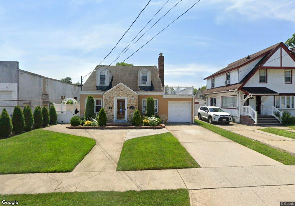
17 W Dean St Freeport, NY 11520
Estimated Value: $518,000 - $638,274
--
Bed
1
Bath
1,557
Sq Ft
$371/Sq Ft
Est. Value
About This Home
This home is located at 17 W Dean St, Freeport, NY 11520 and is currently estimated at $578,137, approximately $371 per square foot. 17 W Dean St is a home located in Nassau County with nearby schools including Caroline G. Atkinson Intermediate School, Columbus Avenue School, and John W Dodd Middle School.
Ownership History
Date
Name
Owned For
Owner Type
Purchase Details
Closed on
May 31, 2011
Sold by
Carr Deborah and Carr Gregory S
Bought by
Almonte Victor and Almonte Juan U
Current Estimated Value
Home Financials for this Owner
Home Financials are based on the most recent Mortgage that was taken out on this home.
Original Mortgage
$232,266
Outstanding Balance
$161,911
Interest Rate
4.87%
Mortgage Type
FHA
Estimated Equity
$416,226
Purchase Details
Closed on
Nov 4, 1997
Sold by
Harrison Ronald
Bought by
Carr Deborah and Carr Gregory
Create a Home Valuation Report for This Property
The Home Valuation Report is an in-depth analysis detailing your home's value as well as a comparison with similar homes in the area
Home Values in the Area
Average Home Value in this Area
Purchase History
| Date | Buyer | Sale Price | Title Company |
|---|---|---|---|
| Almonte Victor | $238,500 | -- | |
| Carr Deborah | $129,000 | -- |
Source: Public Records
Mortgage History
| Date | Status | Borrower | Loan Amount |
|---|---|---|---|
| Open | Almonte Victor | $232,266 |
Source: Public Records
Tax History Compared to Growth
Tax History
| Year | Tax Paid | Tax Assessment Tax Assessment Total Assessment is a certain percentage of the fair market value that is determined by local assessors to be the total taxable value of land and additions on the property. | Land | Improvement |
|---|---|---|---|---|
| 2025 | $8,345 | $387 | $133 | $254 |
| 2024 | $839 | $387 | $133 | $254 |
| 2023 | $7,912 | $387 | $133 | $254 |
| 2022 | $7,912 | $387 | $133 | $254 |
| 2021 | $11,248 | $370 | $127 | $243 |
| 2020 | $7,305 | $436 | $332 | $104 |
| 2019 | $6,416 | $467 | $334 | $133 |
| 2018 | $6,762 | $498 | $0 | $0 |
| 2017 | $7,281 | $605 | $356 | $249 |
| 2016 | $8,189 | $605 | $356 | $249 |
| 2015 | $874 | $605 | $356 | $249 |
| 2014 | $874 | $605 | $356 | $249 |
| 2013 | $826 | $605 | $356 | $249 |
Source: Public Records
Map
Nearby Homes
- 222 N Ocean Ave
- 27 W Woodbine Dr
- 45 Dehnhoff Ave
- 67 E Dean St
- 70 N Grove St Unit 1R
- 101 Wallace St
- 100 Randall Ave Unit 1E
- 99 Randall Ave Unit 1Q
- 47 Harding Place
- 101 Harris Ave
- 21 Connecticut Ave
- 29 Wilson Place
- 112 E Seaman Ave
- 110 Brooklyn Ave Unit 1D
- 6 New York Ave
- 92 Leonard Ave
- 161 Grand Ave
- 18 Evans Ave
- 26 Rosedale Ave
- 98 N Columbus Ave