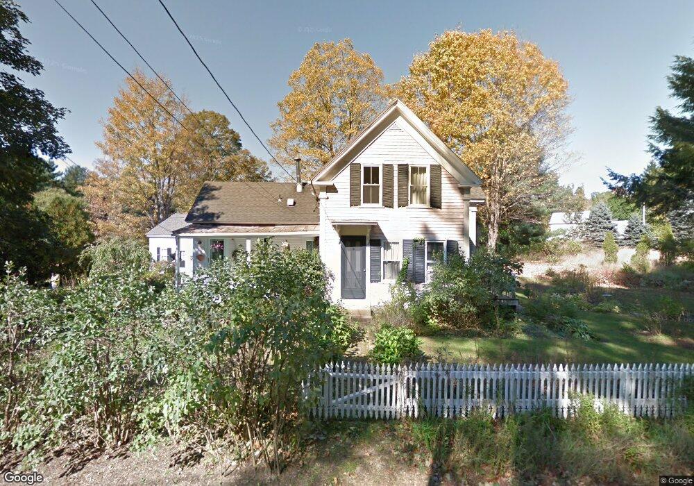
17 Waushacum St West Boylston, MA 01583
Estimated Value: $495,000 - $557,000
2
Beds
2
Baths
1,328
Sq Ft
$388/Sq Ft
Est. Value
About This Home
This home is located at 17 Waushacum St, West Boylston, MA 01583 and is currently estimated at $515,466, approximately $388 per square foot. 17 Waushacum St is a home located in Worcester County with nearby schools including Major Edwards Elementary School and West Boylston Junior/Senior High School.
Ownership History
Date
Name
Owned For
Owner Type
Purchase Details
Closed on
Sep 20, 2018
Sold by
Pratillo Eugene N and Cox-Pratillo Janice
Bought by
Pratillo Eugene N
Current Estimated Value
Purchase Details
Closed on
Apr 27, 1976
Bought by
Pratillo Eugene N and Cox Janice
Create a Home Valuation Report for This Property
The Home Valuation Report is an in-depth analysis detailing your home's value as well as a comparison with similar homes in the area
Home Values in the Area
Average Home Value in this Area
Purchase History
| Date | Buyer | Sale Price | Title Company |
|---|---|---|---|
| Pratillo Eugene N | -- | -- | |
| Pratillo Eugene N | -- | -- |
Source: Public Records
Mortgage History
| Date | Status | Borrower | Loan Amount |
|---|---|---|---|
| Previous Owner | Pratillo Eugene N | $95,000 |
Source: Public Records
Tax History Compared to Growth
Tax History
| Year | Tax Paid | Tax Assessment Tax Assessment Total Assessment is a certain percentage of the fair market value that is determined by local assessors to be the total taxable value of land and additions on the property. | Land | Improvement |
|---|---|---|---|---|
| 2025 | $67 | $485,000 | $101,500 | $383,500 |
| 2024 | $6,491 | $439,200 | $101,500 | $337,700 |
| 2023 | $6,964 | $447,000 | $100,700 | $346,300 |
| 2022 | $6,658 | $376,600 | $100,700 | $275,900 |
| 2021 | $5,955 | $322,600 | $97,700 | $224,900 |
| 2020 | $5,654 | $304,300 | $97,700 | $206,600 |
| 2019 | $5,602 | $297,200 | $97,700 | $199,500 |
| 2018 | $5,455 | $291,400 | $97,700 | $193,700 |
| 2017 | $5,548 | $295,100 | $97,700 | $197,400 |
| 2016 | $5,459 | $295,900 | $91,100 | $204,800 |
| 2015 | $5,220 | $284,600 | $90,200 | $194,400 |
Source: Public Records
Map
Nearby Homes
- 16 N Main St
- 20 Winthrop St
- 136 Sterling St Unit A3
- 287 Laurel St
- 0 Boutelle Rd
- 2 Lakeview Ave
- 18 Laurel Ave
- 61 Boutelle Rd
- 21 Myrtle Ave
- 223 Worcester Rd
- 0 North St
- 156 Prospect St
- Lot 1 Manning St
- 152 Worcester St Unit 8
- 4 Jewett Rd Unit B
- 4 Jewett Rd Unit A
- 54 Maple St
- 62 Maple St
- 15 N Cove Rd
- 43 Chace Hill Rd
- 16 Waushacum St
- 14 Waushacum St
- 64 N Main St
- 11 Reed St
- 68 N Main St
- 15 Reed St Unit 1
- 15 Reed St
- 15 Reed St Unit 15-B
- 15 Reed St Unit 15-A
- 15A Reed St
- 15B Reed St
- 34 Waushacum St
- 34 Waushacum St Unit 1
- 21 Reed St
- 49 No Main Unit 2R
- 49 N Main St Unit 2R
- 49 N Main St Unit B
- 47 N Main St
- 47 N Main St Unit 2
- 47 N Main St Unit 2F