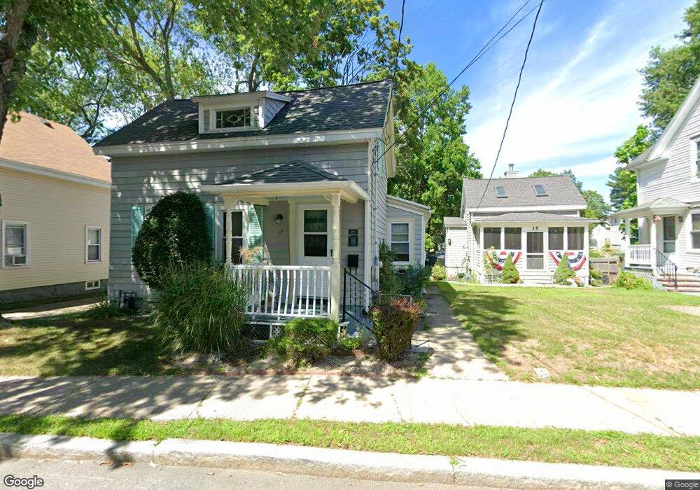
17 West St North Attleboro, MA 02760
North Attleboro NeighborhoodEstimated Value: $449,000 - $463,000
3
Beds
2
Baths
1,325
Sq Ft
$345/Sq Ft
Est. Value
About This Home
This home is located at 17 West St, North Attleboro, MA 02760 and is currently estimated at $457,060, approximately $344 per square foot. 17 West St is a home located in Bristol County with nearby schools including North Attleboro High School and Cadence Academy Preschool - North Attleborough.
Ownership History
Date
Name
Owned For
Owner Type
Purchase Details
Closed on
Nov 22, 1983
Bought by
Norcott Robert B and Norcott Kathleen M
Current Estimated Value
Create a Home Valuation Report for This Property
The Home Valuation Report is an in-depth analysis detailing your home's value as well as a comparison with similar homes in the area
Home Values in the Area
Average Home Value in this Area
Purchase History
| Date | Buyer | Sale Price | Title Company |
|---|---|---|---|
| Norcott Robert B | $60,000 | -- |
Source: Public Records
Mortgage History
| Date | Status | Borrower | Loan Amount |
|---|---|---|---|
| Open | Norcott Robert B | $85,000 | |
| Closed | Norcott Robert B | $32,000 | |
| Closed | Norcott Robert B | $20,000 |
Source: Public Records
Tax History Compared to Growth
Tax History
| Year | Tax Paid | Tax Assessment Tax Assessment Total Assessment is a certain percentage of the fair market value that is determined by local assessors to be the total taxable value of land and additions on the property. | Land | Improvement |
|---|---|---|---|---|
| 2025 | $4,315 | $366,000 | $97,200 | $268,800 |
| 2024 | $4,112 | $356,300 | $97,200 | $259,100 |
| 2023 | $4,060 | $317,400 | $97,200 | $220,200 |
| 2022 | $4,019 | $288,500 | $97,200 | $191,300 |
| 2021 | $3,589 | $251,500 | $97,200 | $154,300 |
| 2020 | $3,556 | $247,800 | $97,200 | $150,600 |
| 2019 | $3,316 | $232,900 | $88,400 | $144,500 |
| 2018 | $2,943 | $220,600 | $88,400 | $132,200 |
| 2017 | $4,034 | $208,300 | $88,400 | $119,900 |
| 2016 | $2,607 | $197,200 | $98,200 | $99,000 |
| 2015 | $2,493 | $189,700 | $103,100 | $86,600 |
| 2014 | $2,525 | $190,700 | $95,400 | $95,300 |
Source: Public Records
Map
Nearby Homes
- 20 South St
- 35-R Whiting St
- 64 Smith St
- 45 Moran St
- 68 Fisher St
- 8 Al Pace Dr Unit 8
- 188 Smith St
- 19 Church St Unit A5
- 212 Fisher St Unit A5
- 1066 Mount Hope St
- 217 Fisher St
- 16 Elizabeth St
- 16 Richards Ave Unit 106
- 85 Richards Ave
- 0 Landry 2nd Unit 73350867
- 93 Bank St
- 880 Landry Ave Unit 2
- 42 2nd Ave Unit 24
- 99 Arnold Rd
- 20 Holbrook Ave
- 21 West St
- 15 West St
- 13 West St
- 20 School St Unit 2
- 20 School St Unit 3
- 20 School St Unit 4
- 20 School St Unit 1
- 20-26 School St Unit 4
- 199 Broad St
- 11 West St
- 24 Horne St
- 193 Broad St
- 195 Broad St
- 193 Broad St Unit 2
- 193 Broad St Unit 1
- 10 School St
- 207 Broad St Unit 1
- 207 Broad St Unit 4
- 207 Broad St Unit 3
- 189 Broad St