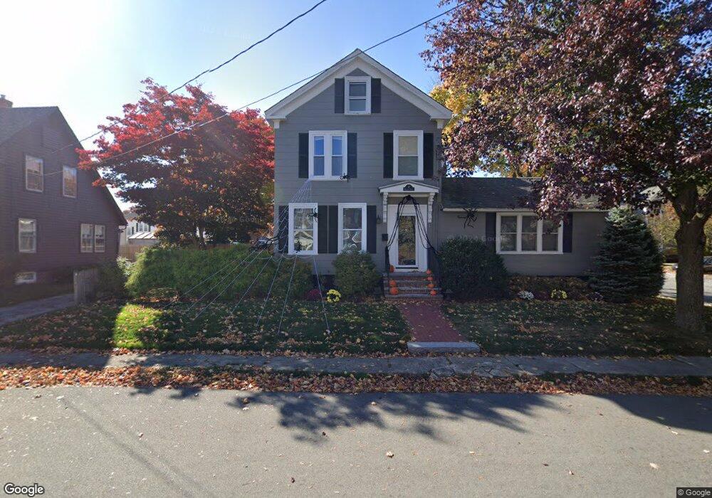
17 Whittier St Amesbury, MA 01913
Estimated Value: $636,000 - $849,000
4
Beds
2
Baths
2,246
Sq Ft
$319/Sq Ft
Est. Value
About This Home
This home is located at 17 Whittier St, Amesbury, MA 01913 and is currently estimated at $716,916, approximately $319 per square foot. 17 Whittier St is a home located in Essex County with nearby schools including Amesbury High School, River Valley Charter School, and Amesbury Seventh-Day Adventist School.
Ownership History
Date
Name
Owned For
Owner Type
Purchase Details
Closed on
May 27, 2010
Sold by
Mckeon Mary Deborah and Mckeon Mary D
Bought by
Testa Michael B and Testa Mary L
Current Estimated Value
Home Financials for this Owner
Home Financials are based on the most recent Mortgage that was taken out on this home.
Original Mortgage
$255,064
Interest Rate
5.13%
Mortgage Type
Purchase Money Mortgage
Purchase Details
Closed on
Dec 30, 1988
Sold by
Fitch Kathleen E
Bought by
Mckeon Jeffery A
Create a Home Valuation Report for This Property
The Home Valuation Report is an in-depth analysis detailing your home's value as well as a comparison with similar homes in the area
Home Values in the Area
Average Home Value in this Area
Purchase History
| Date | Buyer | Sale Price | Title Company |
|---|---|---|---|
| Testa Michael B | $258,500 | -- | |
| Mckeon Jeffery A | $180,000 | -- |
Source: Public Records
Mortgage History
| Date | Status | Borrower | Loan Amount |
|---|---|---|---|
| Open | Mckeon Jeffery A | $276,000 | |
| Closed | Mckeon Jeffery A | $255,064 |
Source: Public Records
Tax History Compared to Growth
Tax History
| Year | Tax Paid | Tax Assessment Tax Assessment Total Assessment is a certain percentage of the fair market value that is determined by local assessors to be the total taxable value of land and additions on the property. | Land | Improvement |
|---|---|---|---|---|
| 2025 | $8,124 | $531,000 | $229,600 | $301,400 |
| 2024 | $7,678 | $490,900 | $216,600 | $274,300 |
| 2023 | $7,559 | $462,600 | $188,300 | $274,300 |
| 2022 | $6,915 | $390,900 | $163,800 | $227,100 |
| 2021 | $6,915 | $378,900 | $132,000 | $246,900 |
| 2020 | $6,199 | $360,800 | $126,900 | $233,900 |
| 2019 | $6,191 | $337,000 | $126,900 | $210,100 |
| 2018 | $5,965 | $314,100 | $120,900 | $193,200 |
| 2017 | $5,708 | $286,100 | $120,900 | $165,200 |
| 2016 | $5,660 | $279,100 | $120,900 | $158,200 |
| 2015 | $5,560 | $270,700 | $120,900 | $149,800 |
| 2014 | $5,352 | $255,200 | $120,900 | $134,300 |
Source: Public Records
Map
Nearby Homes
- 15 Sparhawk St Unit 3
- 17 Lincoln Ct
- 13 Lincoln Ct
- 19 Perkins St
- 4 Lincoln Ct
- 49 W Greenwood St
- 2 Hitching Post Ln
- 8 Greenwood St
- 129 Friend St
- 6 Wells Ave Unit C
- 43 Aubin St Unit 1
- 36 Hillside Ave
- 24 Aubin St Unit 2
- 37 Millyard Unit 204
- 81 High St Unit 27
- 179 Lions Mouth Rd
- 17 Linwood Place
- 53 Market St
- 3 Pinecrest Ave
- 5 Moncrief St Unit 1
- 19 Whittier St
- 6 Harrison Ave
- 35 Harrison Ave
- 21 Whittier St
- 18 Whittier St
- 15 Whittier St
- 16 Whittier St
- 2 Carver St
- 5 1/2 Harrison Ave Unit A
- 3 Harrison Ave
- 5 1/2 Harrison Ave Unit 5A
- 3 1/2 Harrison Ave Unit 3A
- 5.5 Harrison Ave Unit 5.5
- 3 Harrison Ave Unit 3
- 3 1/2 Harrison Ave Unit 3 1/2
- 5-1/2 Harrison Ave Unit 5 1/2
- 5 Harrison Ave
- 5 Harrison Ave Unit 5
- 8 Harrison Ave
- 3-5 Harrison Ave