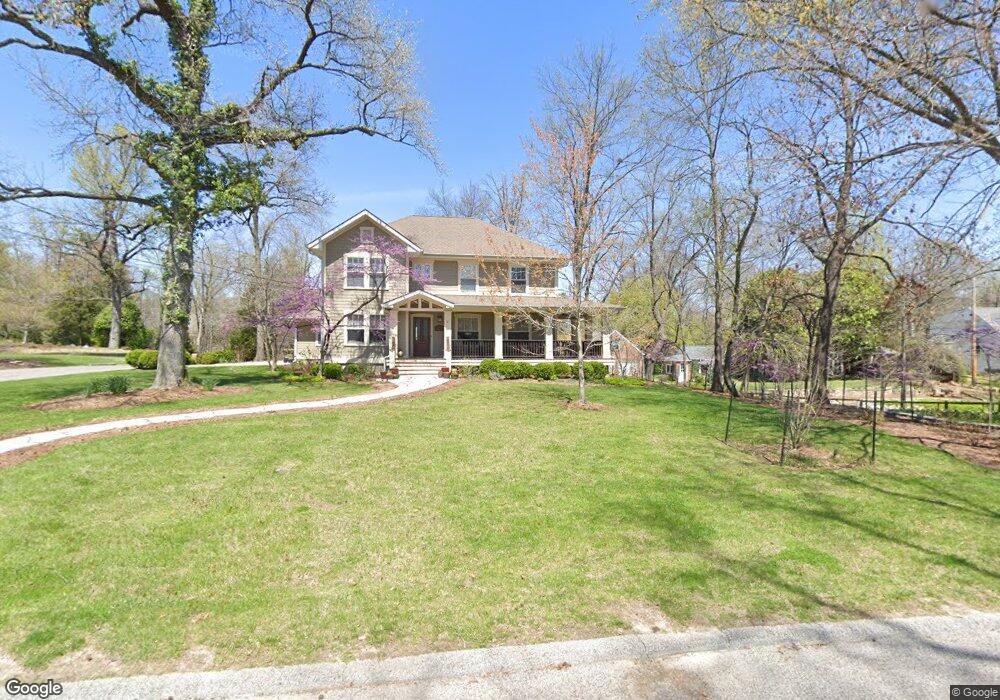
17 Windsor Ln Saint Louis, MO 63122
Estimated Value: $719,879 - $831,000
4
Beds
3
Baths
3,205
Sq Ft
$245/Sq Ft
Est. Value
About This Home
This home is located at 17 Windsor Ln, Saint Louis, MO 63122 and is currently estimated at $784,220, approximately $244 per square foot. 17 Windsor Ln is a home located in St. Louis County with nearby schools including George R. Robinson Elementary School, Nipher Middle School, and Kirkwood Senior High School.
Ownership History
Date
Name
Owned For
Owner Type
Purchase Details
Closed on
Mar 27, 2007
Sold by
Shotwell Michael V and Shotwell Heather D
Bought by
Shotwell Michael and Shotwell Heather D
Current Estimated Value
Purchase Details
Closed on
Aug 24, 2005
Sold by
Central Place Properties Llc
Bought by
Shotwell Michael and Shotwell Heather D
Purchase Details
Closed on
Aug 26, 2004
Sold by
Gravel Jeannette T
Bought by
Central Place Properties Llc
Home Financials for this Owner
Home Financials are based on the most recent Mortgage that was taken out on this home.
Original Mortgage
$220,000
Interest Rate
5.97%
Mortgage Type
Purchase Money Mortgage
Purchase Details
Closed on
May 22, 2003
Sold by
Rehnquist Design & Build Inc
Bought by
Page Sam L and Page Jennifer
Purchase Details
Closed on
May 30, 2002
Sold by
Gravel Jeannette T
Bought by
Phillips Jill Gravel and Fillo Gay Gravel
Create a Home Valuation Report for This Property
The Home Valuation Report is an in-depth analysis detailing your home's value as well as a comparison with similar homes in the area
Home Values in the Area
Average Home Value in this Area
Purchase History
| Date | Buyer | Sale Price | Title Company |
|---|---|---|---|
| Shotwell Michael | -- | Ort | |
| Shotwell Michael | $675,500 | Abstar Title Company | |
| Central Place Properties Llc | $220,000 | -- | |
| Page Sam L | $478,000 | -- | |
| Phillips Jill Gravel | -- | -- |
Source: Public Records
Mortgage History
| Date | Status | Borrower | Loan Amount |
|---|---|---|---|
| Previous Owner | Central Place Properties Llc | $220,000 |
Source: Public Records
Tax History Compared to Growth
Tax History
| Year | Tax Paid | Tax Assessment Tax Assessment Total Assessment is a certain percentage of the fair market value that is determined by local assessors to be the total taxable value of land and additions on the property. | Land | Improvement |
|---|---|---|---|---|
| 2025 | $5,354 | $101,400 | $55,420 | $45,980 |
| 2024 | $5,354 | $86,150 | $42,750 | $43,400 |
| 2023 | $5,269 | $86,150 | $42,750 | $43,400 |
| 2022 | $7,582 | $115,850 | $47,030 | $68,820 |
| 2021 | $7,483 | $115,850 | $47,030 | $68,820 |
| 2020 | $8,008 | $119,260 | $41,630 | $77,630 |
| 2019 | $8,091 | $119,260 | $41,630 | $77,630 |
| 2018 | $5,255 | $68,280 | $27,510 | $40,770 |
| 2017 | $5,248 | $68,280 | $27,510 | $40,770 |
| 2016 | $5,308 | $69,610 | $23,710 | $45,900 |
| 2015 | $5,244 | $69,610 | $23,710 | $45,900 |
| 2014 | $6,129 | $79,650 | $8,400 | $71,250 |
Source: Public Records
Map
Nearby Homes
- 1053 Geyer Grove Unit 9
- 1211 S Geyer Rd
- 1016 Forest Ave
- 1 Boxwood Ln
- 1264 Wilton Ln
- 1074 Brooksgate Manor Dr
- 1011 Brooksgate Manor Dr
- 1010 Station Bend Ln
- 303 Danworth Ct
- 222 Charmers Ct Unit 222
- 717 Mclain Ln
- 420 W Rose Hill Ave
- 10835 Big Bend Rd
- 558 S Geyer Rd
- 11922 Big Bend Rd
- 621 Crest Ct
- 680 Craigwoods Dr
- 517 S Harrison Ave
- 506 Coverdale Ln
- 530 Nirk Ave Unit F