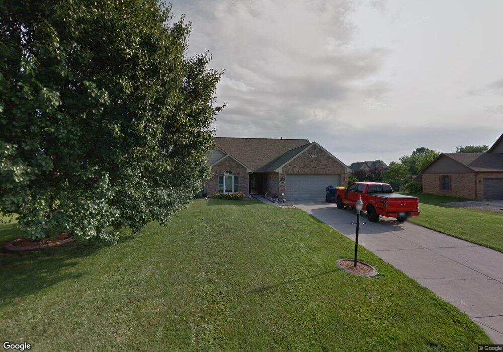
170 Deborah Ln Whiteland, IN 46184
Estimated Value: $344,000 - $380,000
3
Beds
2
Baths
1,684
Sq Ft
$216/Sq Ft
Est. Value
About This Home
This home is located at 170 Deborah Ln, Whiteland, IN 46184 and is currently estimated at $364,342, approximately $216 per square foot. 170 Deborah Ln is a home located in Johnson County with nearby schools including Whiteland Elementary School, Clark-Pleasant Middle School, and Whiteland Community High School.
Ownership History
Date
Name
Owned For
Owner Type
Purchase Details
Closed on
Jul 16, 2021
Sold by
Bartl Ricky R and Bartl Diane L
Bought by
Kababek James W and Kababek Janet L
Current Estimated Value
Home Financials for this Owner
Home Financials are based on the most recent Mortgage that was taken out on this home.
Original Mortgage
$240,000
Outstanding Balance
$217,962
Interest Rate
2.96%
Mortgage Type
New Conventional
Estimated Equity
$146,380
Create a Home Valuation Report for This Property
The Home Valuation Report is an in-depth analysis detailing your home's value as well as a comparison with similar homes in the area
Home Values in the Area
Average Home Value in this Area
Purchase History
| Date | Buyer | Sale Price | Title Company |
|---|---|---|---|
| Kababek James W | $302,500 | None Available |
Source: Public Records
Mortgage History
| Date | Status | Borrower | Loan Amount |
|---|---|---|---|
| Open | Kababek James W | $240,000 |
Source: Public Records
Tax History Compared to Growth
Tax History
| Year | Tax Paid | Tax Assessment Tax Assessment Total Assessment is a certain percentage of the fair market value that is determined by local assessors to be the total taxable value of land and additions on the property. | Land | Improvement |
|---|---|---|---|---|
| 2025 | $3,375 | $322,100 | $47,700 | $274,400 |
| 2024 | $3,375 | $322,300 | $47,700 | $274,600 |
| 2023 | $3,432 | $325,300 | $47,700 | $277,600 |
| 2022 | $2,997 | $290,400 | $47,700 | $242,700 |
| 2021 | $1,945 | $189,500 | $34,100 | $155,400 |
| 2020 | $1,930 | $186,600 | $34,100 | $152,500 |
| 2019 | $1,890 | $182,800 | $34,100 | $148,700 |
| 2018 | $1,732 | $161,000 | $31,600 | $129,400 |
| 2017 | $1,530 | $147,100 | $31,600 | $115,500 |
| 2016 | $1,531 | $155,200 | $31,600 | $123,600 |
| 2014 | $1,302 | $125,200 | $31,600 | $93,600 |
| 2013 | $1,302 | $127,300 | $31,600 | $95,700 |
Source: Public Records
Map
Nearby Homes
- 8 Marys Ct
- 241 Deborah Ln
- 254 Halldale Dr
- 83 Palmetto Dr
- 372 Wert Ln
- 272 Mcnair Rd
- 288 Mcnair Rd
- 338 Mcnair Rd
- 800 Beechwood Ct
- 818 Beechwood Ct
- 1139 Beechwood Ct
- 836 Beechwood Ct
- 1047 Beechwood Ct
- 807 Beechwood Ct
- 752 Beechwood Ct
- 899 Beechwood Ct
- 835 Beechwood Ct
- 867 Beechwood Ct
- Hudson with 3-Car Garage Plan at Briar Creek - Estates
- Columbia with 3-Car Garage Plan at Briar Creek - Estates
- 160 Deborah Ln
- 180 Deborah Ln
- 173 Park Forest Dr N
- 163 Park Forest Dr N
- 150 Deborah Ln
- 190 Deborah Ln
- 183 Park Forest Dr N
- 153 Park Forest Dr N
- 171 Deborah Ln
- 161 Deborah Ln
- 181 Deborah Ln
- 193 Park Forest Dr N
- 151 Deborah Ln
- 143 Park Forest Dr N
- 140 Deborah Ln
- 200 Deborah Ln
- 141 Deborah Ln
- 201 Deborah Ln
- 203 Park Forest Dr N
- 133 Park Forest Dr N