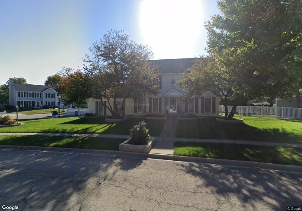
170 Devonshire Dr Dekalb, IL 60115
Estimated Value: $316,894 - $351,000
4
Beds
3
Baths
--
Sq Ft
10,890
Sq Ft Lot
About This Home
This home is located at 170 Devonshire Dr, Dekalb, IL 60115 and is currently estimated at $340,974. 170 Devonshire Dr is a home located in DeKalb County with nearby schools including Lincoln Elementary School, Huntley Middle School, and De Kalb High School.
Ownership History
Date
Name
Owned For
Owner Type
Purchase Details
Closed on
Jan 18, 2011
Sold by
Neill Todd T
Bought by
Obrien Neill Laura K
Current Estimated Value
Purchase Details
Closed on
Sep 30, 2005
Sold by
Neill Todd T
Bought by
Neill Todd T and Obrien Neill Laura K
Purchase Details
Closed on
Jun 24, 2005
Sold by
Planert Lawrence E
Bought by
Neill Todd T and Obrien Neill Laura K
Home Financials for this Owner
Home Financials are based on the most recent Mortgage that was taken out on this home.
Original Mortgage
$188,800
Interest Rate
5.69%
Mortgage Type
New Conventional
Create a Home Valuation Report for This Property
The Home Valuation Report is an in-depth analysis detailing your home's value as well as a comparison with similar homes in the area
Home Values in the Area
Average Home Value in this Area
Purchase History
| Date | Buyer | Sale Price | Title Company |
|---|---|---|---|
| Obrien Neill Laura K | -- | -- | |
| Neill Todd T | -- | -- | |
| Neill Todd T | $236,000 | -- |
Source: Public Records
Mortgage History
| Date | Status | Borrower | Loan Amount |
|---|---|---|---|
| Previous Owner | Neill Todd T | $188,800 |
Source: Public Records
Tax History
| Year | Tax Paid | Tax Assessment Tax Assessment Total Assessment is a certain percentage of the fair market value that is determined by local assessors to be the total taxable value of land and additions on the property. | Land | Improvement |
|---|---|---|---|---|
| 2024 | $6,949 | $91,386 | $13,210 | $78,176 |
| 2023 | $6,949 | $79,681 | $11,518 | $68,163 |
| 2022 | $6,758 | $72,748 | $13,145 | $59,603 |
| 2021 | $6,899 | $68,231 | $12,329 | $55,902 |
| 2020 | $7,044 | $67,143 | $12,132 | $55,011 |
| 2019 | $6,878 | $64,504 | $11,655 | $52,849 |
| 2018 | $6,692 | $62,317 | $11,260 | $51,057 |
| 2017 | $6,727 | $59,903 | $10,824 | $49,079 |
| 2016 | $6,634 | $58,391 | $10,551 | $47,840 |
| 2015 | -- | $55,326 | $9,997 | $45,329 |
| 2014 | -- | $54,916 | $14,465 | $40,451 |
| 2013 | -- | $57,685 | $15,194 | $42,491 |
Source: Public Records
Map
Nearby Homes
- 340 Manning Dr
- 216 Pardridge Place
- TBD 8.67 Acres Fairview Dr
- 527 Fairlane Ave
- 1811 S 7th St
- 1212 Bellevue Dr
- 255 Bent Grass Cir
- 623 Colonial Dr
- 253 Bent Grass Cir
- TBD Peace Rd
- 18.6 Acre Lot Fairview Dr
- TBD Fairview Dr
- 100 Warren Place
- 925 Haish Blvd
- Lot 66 Pebble Beach Ct
- Lot 77 Pebble Beach Ct
- Lot 78 Pebble Beach Ct
- 8750 Gurler Rd
- 235 Saint Andrews Dr
- 228 W Taylor St
- 2191 Cambridge Ct
- 162 Berkshire Dr
- 165 Devonshire Dr
- 2225 Cambridge Ct
- 2188 Cambridge Ct
- 2170 Cambridge Ct
- 171 Devonshire Dr
- 2158 Cambridge Ct
- 158 Berkshire Dr
- 2200 Cambridge Ct
- 174 Devonshire Dr
- 159 Devonshire Dr
- 2226 Cambridge Ct
- 154 Berkshire Dr
- 2257 Cambridge Ct
- 2305 Concord Ct
- 158 Devonshire Dr
- 134 Cobblestone Trail
- 2309 Concord Ct
- 153 Devonshire Dr
Your Personal Tour Guide
Ask me questions while you tour the home.