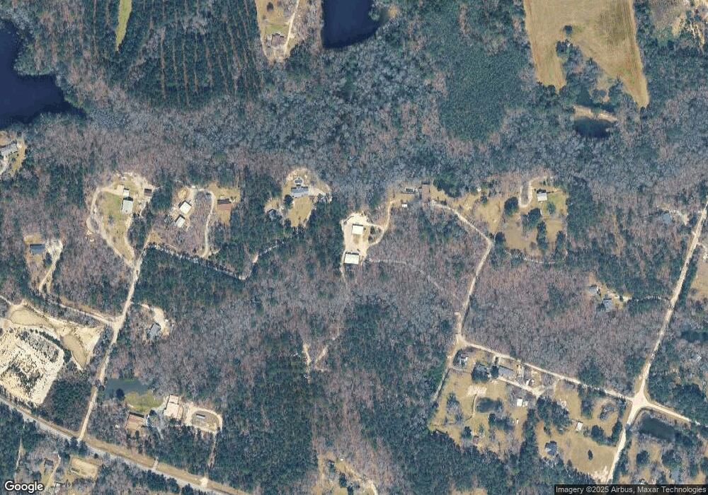
170 Dusty Rd Camden, SC 29020
Estimated Value: $201,802 - $402,000
--
Bed
--
Bath
1,728
Sq Ft
$168/Sq Ft
Est. Value
About This Home
This home is located at 170 Dusty Rd, Camden, SC 29020 and is currently estimated at $289,451, approximately $167 per square foot. 170 Dusty Rd is a home with nearby schools including Pine Tree Hill Elementary School, Camden Middle School, and Camden High School.
Ownership History
Date
Name
Owned For
Owner Type
Purchase Details
Closed on
May 12, 2021
Sold by
Eugene Westfall Eric
Bought by
Westfall Eric Eugene and Westfall Scotty E
Current Estimated Value
Purchase Details
Closed on
May 10, 2021
Sold by
Eugene Westfall Eric
Bought by
Westfall Eric Eugene and Westfall Scotty E
Purchase Details
Closed on
Apr 28, 2015
Sold by
Westfall Larry E
Bought by
Westfall Larry E
Purchase Details
Closed on
Mar 8, 1991
Sold by
Ives Harry L and Ives Goldstein W
Bought by
Westfall Larry E
Create a Home Valuation Report for This Property
The Home Valuation Report is an in-depth analysis detailing your home's value as well as a comparison with similar homes in the area
Home Values in the Area
Average Home Value in this Area
Purchase History
| Date | Buyer | Sale Price | Title Company |
|---|---|---|---|
| Westfall Eric Eugene | -- | Savage Royall & Sheheen Llp | |
| Westfall Eric Eugene | -- | Savage Royall & Sheheen Llp | |
| Westfall Larry E | -- | -- | |
| Westfall Larry E | $47,000 | -- |
Source: Public Records
Tax History Compared to Growth
Tax History
| Year | Tax Paid | Tax Assessment Tax Assessment Total Assessment is a certain percentage of the fair market value that is determined by local assessors to be the total taxable value of land and additions on the property. | Land | Improvement |
|---|---|---|---|---|
| 2025 | $1,949 | $93,500 | $10,600 | $82,900 |
| 2024 | $1,949 | $94,400 | $10,600 | $83,800 |
| 2023 | $30 | $94,400 | $10,600 | $83,800 |
| 2022 | $697 | $96,100 | $10,600 | $85,500 |
| 2021 | $1,977 | $125,100 | $39,600 | $85,500 |
| 2020 | $577 | $87,300 | $5,600 | $81,700 |
| 2019 | $619 | $87,279 | $5,579 | $81,700 |
| 2018 | $224 | $22,379 | $5,579 | $16,800 |
| 2017 | $545 | $22,379 | $5,579 | $16,800 |
| 2016 | $461 | $87,279 | $5,579 | $81,700 |
| 2015 | $107 | $9,677 | $677 | $9,000 |
| 2014 | $107 | $0 | $0 | $0 |
Source: Public Records
Map
Nearby Homes
- 0 Black River Rd Unit 611769
- 1135 Black River Rd
- 764 Saint Matthews Rd
- 754 Beulah Church Rd
- 754 Beulah Church (Lot 9) Rd
- Julie II Plan at Beulah Church Road
- Benton II Plan at Beulah Church Road
- Bradley II Plan at Beulah Church Road
- Bentcreek II Plan at Beulah Church Road
- Porter II Plan at Beulah Church Road
- 221 Ascot Dr
- 0 Elkwood Ln
- 106 Colony Dr
- 1135 Elkwood Ln
- 364 Cantey Ln
- 481 Cantey Ln
- 605 Dove Rd Unit 63
- 214 Bobwhite Cir Unit 15
- 70 Rapid Run
- 134 Rapid Run
- 178 Dusty Rd
- 59 Briar Patch Rd
- 101 Dusty Rd
- 49 Briar Patch Rd
- 71 Geno Branch Rd
- 55 Geno Branch Rd
- 10 acres Geno Branch Rd
- 33 Geno Branch Rd
- 10 acres Geno
- 20 Briar Patch Rd
- 27 Briar Patch Rd
- 56 Geno Branch Rd
- 1004 Black River Rd
- 984 Black River Rd
- 480 Cleveland School Rd
- 85 Geno Branch Rd
- 426 Cleveland School Rd
- 923 Black River Rd
- 34 Geno Branch Rd
- 1012 Black River Rd
