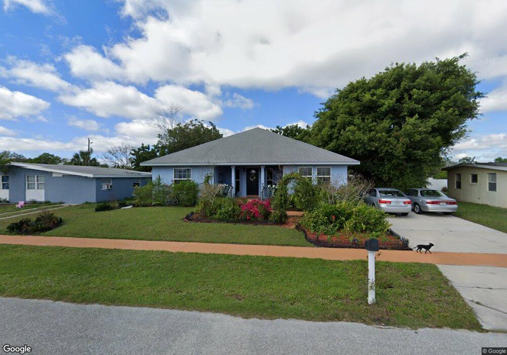
170 Duxbury Ave Port Charlotte, FL 33952
Estimated Value: $224,000 - $354,000
2
Beds
2
Baths
1,810
Sq Ft
$162/Sq Ft
Est. Value
About This Home
This home is located at 170 Duxbury Ave, Port Charlotte, FL 33952 and is currently estimated at $293,868, approximately $162 per square foot. 170 Duxbury Ave is a home located in Charlotte County with nearby schools including Peace River Elementary School, Port Charlotte Middle School, and Charlotte High School.
Ownership History
Date
Name
Owned For
Owner Type
Purchase Details
Closed on
Jul 5, 2001
Sold by
Hackett Robert E
Bought by
Taylor Robert J and Taylor Kristen D
Current Estimated Value
Home Financials for this Owner
Home Financials are based on the most recent Mortgage that was taken out on this home.
Original Mortgage
$49,508
Outstanding Balance
$19,204
Interest Rate
7.23%
Mortgage Type
FHA
Estimated Equity
$274,664
Purchase Details
Closed on
Sep 15, 2000
Sold by
Housing & Urban
Bought by
Hackett Robert E
Purchase Details
Closed on
Sep 27, 1999
Sold by
Court Clerk Circuit
Bought by
Chase Manhattan Mtg Corp
Create a Home Valuation Report for This Property
The Home Valuation Report is an in-depth analysis detailing your home's value as well as a comparison with similar homes in the area
Home Values in the Area
Average Home Value in this Area
Purchase History
| Date | Buyer | Sale Price | Title Company |
|---|---|---|---|
| Taylor Robert J | $49,900 | -- | |
| Hackett Robert E | $32,800 | -- | |
| Chase Manhattan Mtg Corp | -- | -- |
Source: Public Records
Mortgage History
| Date | Status | Borrower | Loan Amount |
|---|---|---|---|
| Open | Taylor Robert J | $49,508 |
Source: Public Records
Tax History Compared to Growth
Tax History
| Year | Tax Paid | Tax Assessment Tax Assessment Total Assessment is a certain percentage of the fair market value that is determined by local assessors to be the total taxable value of land and additions on the property. | Land | Improvement |
|---|---|---|---|---|
| 2023 | $1,856 | $112,000 | $0 | $0 |
| 2022 | $1,771 | $108,738 | $0 | $0 |
| 2021 | $1,754 | $105,571 | $0 | $0 |
| 2020 | $1,707 | $104,113 | $0 | $0 |
| 2019 | $1,620 | $101,772 | $0 | $0 |
| 2018 | $1,479 | $99,874 | $0 | $0 |
| 2017 | $1,459 | $97,820 | $0 | $0 |
| 2016 | $1,444 | $95,808 | $0 | $0 |
| 2015 | $1,429 | $95,142 | $0 | $0 |
| 2014 | $1,404 | $94,387 | $0 | $0 |
Source: Public Records
Map
Nearby Homes
- 181 Duxbury Ave
- 141 Duxbury Ave
- 300 Dalton Blvd
- 471 Sharon Cir
- 400 Dalton Blvd
- 520 Sharon Cir
- 3782 Tamiami Trail Unit B
- 301 Palmetto Dr NE
- 3688 Brooklyn Ave
- 4045 Conway Blvd
- 370 Weber Terrace
- 645 Dalton Blvd
- 205 Martin Dr NE
- 640 Dalton Blvd
- 4371 Conway Blvd
- 330 Weber Terrace
- 681 Dalton Blvd
- 3627 Easy St
- 3585 Brooklyn Ave
- 540 Palmetto Dr NE