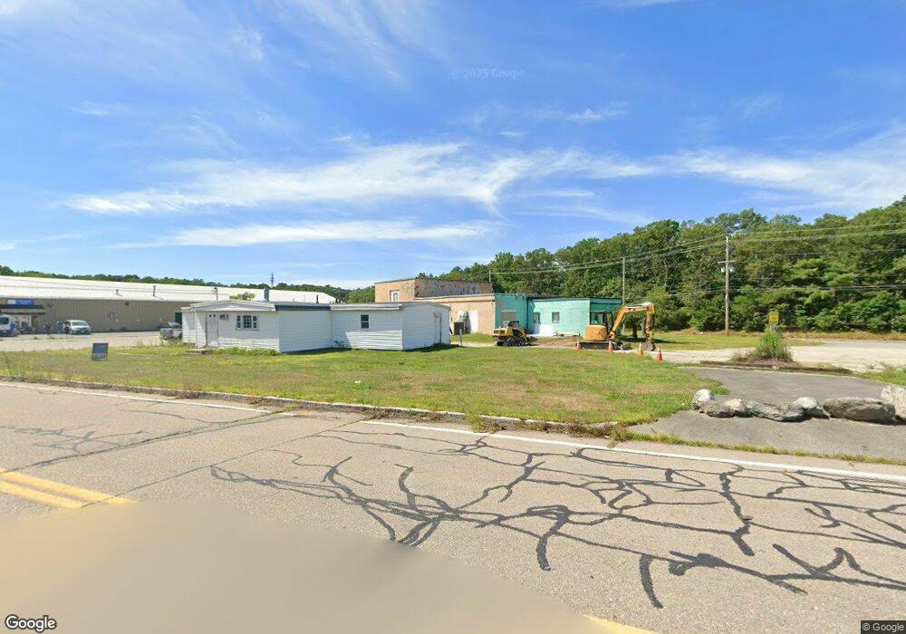
170 E Bacon St Plainville, MA 02762
Estimated Value: $831,671
--
Bed
1
Bath
1,800
Sq Ft
$462/Sq Ft
Est. Value
About This Home
This home is located at 170 E Bacon St, Plainville, MA 02762 and is currently estimated at $831,671, approximately $462 per square foot. 170 E Bacon St is a home located in Norfolk County with nearby schools including Anna Ware Jackson School, Beatrice H. Wood Elementary School, and Cadence Academy Preschool - North Attleborough.
Ownership History
Date
Name
Owned For
Owner Type
Purchase Details
Closed on
Mar 14, 2025
Sold by
Bacon Rt and Coffey
Bought by
East Bacon Realty Llc
Current Estimated Value
Purchase Details
Closed on
Nov 18, 1988
Sold by
Larsson Walter
Bought by
Coffey Patrick J
Home Financials for this Owner
Home Financials are based on the most recent Mortgage that was taken out on this home.
Original Mortgage
$280,000
Interest Rate
10.28%
Mortgage Type
Commercial
Create a Home Valuation Report for This Property
The Home Valuation Report is an in-depth analysis detailing your home's value as well as a comparison with similar homes in the area
Home Values in the Area
Average Home Value in this Area
Purchase History
| Date | Buyer | Sale Price | Title Company |
|---|---|---|---|
| East Bacon Realty Llc | $800,000 | None Available | |
| Coffey Patrick J | $350,000 | -- |
Source: Public Records
Mortgage History
| Date | Status | Borrower | Loan Amount |
|---|---|---|---|
| Previous Owner | Coffey Patrick J | $280,000 |
Source: Public Records
Tax History Compared to Growth
Tax History
| Year | Tax Paid | Tax Assessment Tax Assessment Total Assessment is a certain percentage of the fair market value that is determined by local assessors to be the total taxable value of land and additions on the property. | Land | Improvement |
|---|---|---|---|---|
| 2025 | $0 | $606,000 | $306,400 | $299,600 |
| 2024 | $9,912 | $627,300 | $320,500 | $306,800 |
| 2023 | $0 | $627,300 | $320,500 | $306,800 |
| 2022 | $0 | $559,700 | $305,500 | $254,200 |
| 2021 | $0 | $559,700 | $305,500 | $254,200 |
| 2020 | $9,912 | $559,700 | $305,500 | $254,200 |
| 2019 | $9,813 | $556,000 | $349,500 | $206,500 |
| 2018 | $9,769 | $556,000 | $349,500 | $206,500 |
| 2017 | $9,758 | $556,000 | $349,500 | $206,500 |
| 2016 | $9,479 | $563,900 | $349,500 | $214,400 |
| 2015 | $8,898 | $539,300 | $322,800 | $216,500 |
| 2014 | $8,700 | $543,100 | $322,800 | $220,300 |
Source: Public Records
Map
Nearby Homes
- 28 Messenger St
- 166 E Bacon St Unit 4
- 2 George St Unit C
- 33 Dublin Way
- 52 George St Unit B
- 15 Old Wood Rd
- 2 Woodridge St Unit 2
- 116 George St
- 6 Hilltop Rd Unit 122
- 16 Raymond Hall Dr
- 56B Taunton St
- 22 Potter Ave Unit 5
- 24 Red Coat Ln
- 130 Washington St
- 126 Washington St
- 124 Washington St
- Lot 5 Jeffrey Dr
- 158 Washington St
- 10 Sleepy Hollow Cir
- 11 Landry Ave
- 170 E Bacon St (Front)
- 172 E Bacon St Unit 3
- 172 E Bacon St
- 1 George St Unit 2
- 1 George St Unit 2B
- 21 Messenger St Unit 207
- 21 Messenger St Unit 308
- 21 Messenger St Unit 302
- 21 Messenger St Unit 105
- 21 Messenger St Unit 305
- 21 Messenger St Unit 306
- 21 Messenger St Unit 107
- 21 Messenger St Unit 204
- 21 Messenger St Unit 304
- 21 Messenger St Unit 208
- 21 Messenger St Unit 106
- 21 Messenger St Unit 203
- 21 Messenger St Unit 301
- 21 Messenger St Unit 202
- 21 Messenger St Unit 102