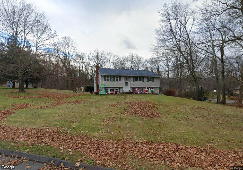
170 Fieldstone Ln Coventry, CT 06238
Estimated Value: $367,000 - $405,000
3
Beds
3
Baths
1,242
Sq Ft
$313/Sq Ft
Est. Value
About This Home
This home is located at 170 Fieldstone Ln, Coventry, CT 06238 and is currently estimated at $388,679, approximately $312 per square foot. 170 Fieldstone Ln is a home located in Tolland County with nearby schools including Coventry Grammar School, George Hersey Robertson School, and Capt. Nathan Hale School.
Ownership History
Date
Name
Owned For
Owner Type
Purchase Details
Closed on
Sep 28, 1998
Sold by
Shaw David and Shaw Susan
Bought by
Hathaway Michael and Hathaway Michelle
Current Estimated Value
Home Financials for this Owner
Home Financials are based on the most recent Mortgage that was taken out on this home.
Original Mortgage
$119,200
Interest Rate
6.87%
Create a Home Valuation Report for This Property
The Home Valuation Report is an in-depth analysis detailing your home's value as well as a comparison with similar homes in the area
Home Values in the Area
Average Home Value in this Area
Purchase History
| Date | Buyer | Sale Price | Title Company |
|---|---|---|---|
| Hathaway Michael | $149,000 | -- | |
| Hathaway Michael | $149,000 | -- |
Source: Public Records
Mortgage History
| Date | Status | Borrower | Loan Amount |
|---|---|---|---|
| Open | Hathaway Michael | $30,000 | |
| Open | Hathaway Michael | $129,000 | |
| Closed | Hathaway Michael | $149,200 | |
| Closed | Hathaway Michael | $119,200 |
Source: Public Records
Tax History Compared to Growth
Tax History
| Year | Tax Paid | Tax Assessment Tax Assessment Total Assessment is a certain percentage of the fair market value that is determined by local assessors to be the total taxable value of land and additions on the property. | Land | Improvement |
|---|---|---|---|---|
| 2025 | $6,270 | $263,900 | $56,700 | $207,200 |
| 2024 | $5,193 | $155,900 | $47,000 | $108,900 |
| 2023 | $4,948 | $155,900 | $47,000 | $108,900 |
| 2022 | $4,856 | $155,900 | $47,000 | $108,900 |
| 2021 | $4,856 | $155,900 | $47,000 | $108,900 |
| 2020 | $4,859 | $155,900 | $47,000 | $108,900 |
| 2019 | $5,017 | $155,800 | $47,000 | $108,800 |
| 2018 | $4,589 | $142,500 | $47,000 | $95,500 |
| 2017 | $4,560 | $142,500 | $47,000 | $95,500 |
| 2016 | $4,446 | $142,500 | $47,000 | $95,500 |
| 2015 | $4,446 | $142,500 | $47,000 | $95,500 |
| 2014 | $4,646 | $163,200 | $56,800 | $106,400 |
Source: Public Records
Map
Nearby Homes
- 0 Boston Turnpike Unit 24128587
- 38 John Paul Ln
- 54 Wolf Hill Rd Unit TBB
- 54 Wolf Hill (Lot#49) Rd
- 30 Tolland Rd
- 37 Wolf Hill Rd Unit Lot 40
- 37 Wolf Hill Lot (#40) Rd
- 20 Fernwood Dr
- 65 Bolton Branch Rd
- 5 Laurelwood Ln Unit lot 16
- 395 Grant Hill (Mill Race Drive) Lot #21 Rd
- 395 Grant Hill Rd Unit Lot21
- 687 Hop River Rd
- 7 Laurelwood Ln Unit Lot 15
- 12 Laurelwood Ln Unit lot 8
- 285 Carpenter Rd
- 66 Barnsbee Ln
- 676 Bolton Rd
- 16 Julia Rd
- 0 Skinner Hill Rd Unit 24077239
- 186 Fieldstone Ln
- 33 Oakwood Dr
- 150 Fieldstone Ln
- 28 Oakwood Dr
- 177 Fieldstone Ln
- 189 Fieldstone Ln
- 153 Fieldstone Ln
- 200 Fieldstone Ln
- 50 Oakwood Dr
- 59 Oakwood Dr
- 207 Fieldstone Ln
- 91 Fieldstone Ln
- 59 Fieldstone Ln
- 142 Northfield Rd
- 70 Oakwood Dr
- 37 Fieldstone Ln
- 162 Northfield Rd
- 134 Fieldstone Ln
- 110 Northfield Rd
- 21 Fieldstone Ln