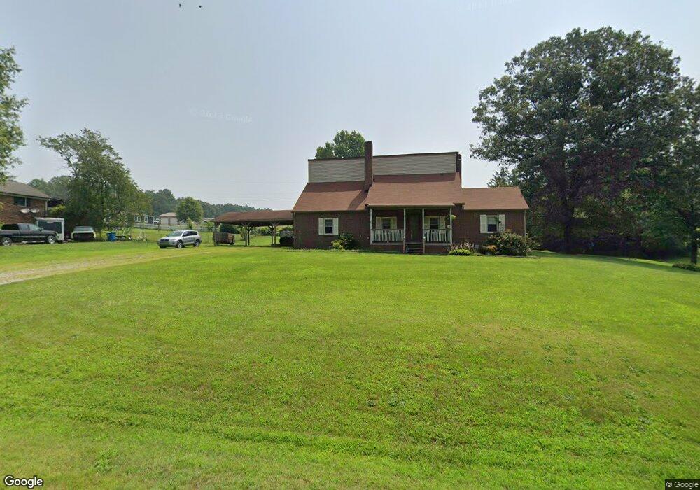
170 Hill Top Dr Advance, NC 27006
Estimated Value: $299,000 - $373,000
5
Beds
3
Baths
2,765
Sq Ft
$120/Sq Ft
Est. Value
About This Home
This home is located at 170 Hill Top Dr, Advance, NC 27006 and is currently estimated at $330,565, approximately $119 per square foot. 170 Hill Top Dr is a home located in Davie County with nearby schools including Cornatzer Elementary School, William Ellis Middle School, and Davie County High School.
Ownership History
Date
Name
Owned For
Owner Type
Purchase Details
Closed on
Sep 30, 2008
Sold by
Prudential Relocation Inc
Bought by
Harding Steven D and Harding Theresa M
Current Estimated Value
Home Financials for this Owner
Home Financials are based on the most recent Mortgage that was taken out on this home.
Original Mortgage
$112,200
Interest Rate
5.03%
Mortgage Type
New Conventional
Purchase Details
Closed on
Sep 24, 2008
Sold by
Brooks Richard W and Brooks Colleen E
Bought by
Prudential Relocation Inc
Home Financials for this Owner
Home Financials are based on the most recent Mortgage that was taken out on this home.
Original Mortgage
$112,200
Interest Rate
5.03%
Mortgage Type
New Conventional
Purchase Details
Closed on
Oct 1, 1995
Create a Home Valuation Report for This Property
The Home Valuation Report is an in-depth analysis detailing your home's value as well as a comparison with similar homes in the area
Home Values in the Area
Average Home Value in this Area
Purchase History
| Date | Buyer | Sale Price | Title Company |
|---|---|---|---|
| Harding Steven D | $110,000 | -- | |
| Prudential Relocation Inc | $110,000 | None Available | |
| -- | $90,000 | -- |
Source: Public Records
Mortgage History
| Date | Status | Borrower | Loan Amount |
|---|---|---|---|
| Previous Owner | Harding Steven D | $112,200 | |
| Previous Owner | Prudential Relocation Inc | $112,200 |
Source: Public Records
Tax History Compared to Growth
Tax History
| Year | Tax Paid | Tax Assessment Tax Assessment Total Assessment is a certain percentage of the fair market value that is determined by local assessors to be the total taxable value of land and additions on the property. | Land | Improvement |
|---|---|---|---|---|
| 2025 | $1,512 | $219,620 | $23,190 | $196,430 |
| 2024 | $1,115 | $144,220 | $19,030 | $125,190 |
| 2023 | $1,115 | $144,220 | $19,030 | $125,190 |
| 2022 | $1,115 | $144,220 | $19,030 | $125,190 |
| 2021 | $1,115 | $144,220 | $19,030 | $125,190 |
| 2020 | $1,034 | $132,680 | $19,030 | $113,650 |
| 2019 | $1,034 | $132,680 | $19,030 | $113,650 |
| 2018 | $1,032 | $132,680 | $19,030 | $113,650 |
| 2017 | $1,020 | $132,680 | $0 | $0 |
| 2016 | $1,054 | $137,120 | $0 | $0 |
| 2015 | $1,054 | $137,120 | $0 | $0 |
| 2014 | $906 | $137,120 | $0 | $0 |
| 2013 | -- | $137,120 | $0 | $0 |
Source: Public Records
Map
Nearby Homes
- 1670 Frank Hulin Rd
- 806 Frank Hulin Rd
- 197 Broadway Rd
- 183 Mullins Rd
- 1438 Tyro School Rd
- 3361 N Goat Pasture Rd
- 2010 Broadway Rd
- 5300 S Nc Highway 150
- 229 Rebecca Ave
- 139 Crestwood Cir
- 143 Reserve Dr
- 224 Squire Ave
- 108 Daniel Dr
- 331 Hw Phillips Rd
- 822 Turrentine Church Rd
- Cali Plan at Harvest Fields
- 6340 W Old Highway 64
- 417 Daniel Dr
- 129 N Lake Louise Dr
- 121 Asbury Place
- 182 Hill Top Dr
- 136 Hill Top Dr
- 473 Riverview Rd
- 165 Topcat Ln
- 535 Riverview Rd
- 543 Riverview Rd
- 179 Phelps Way
- 00 Riverview Rd
- 000 Riverview Rd
- 151 Phelps Way
- Lot 3 Seaford Rd
- Lot 4 Seaford Rd
- 00 Seaford Rd
- 407 Seaford Rd
- 559 Riverview Rd
- 686 Riverview Rd
- 280 Seaford Rd
- 389 Seaford Rd
- 00 Starr Ln
- 377 Seaford Rd