170 Lasalle St Mansfield, OH 44906
Estimated Value: $182,000 - $204,000
3
Beds
2
Baths
1,428
Sq Ft
$134/Sq Ft
Est. Value
About This Home
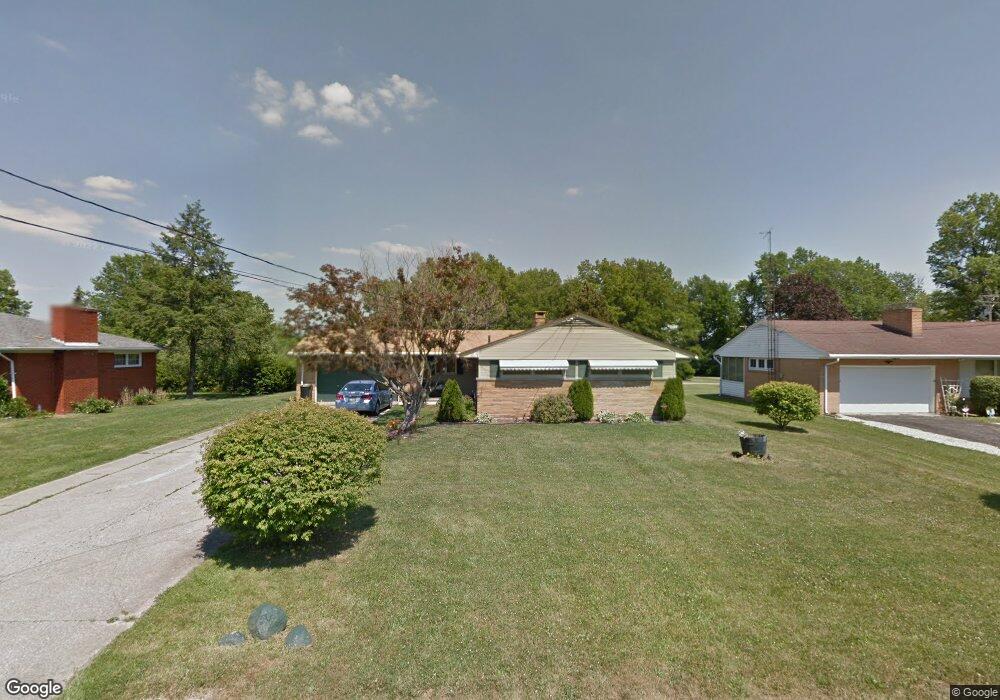
This home is located at 170 Lasalle St, Mansfield, OH 44906 and is currently estimated at $190,858, approximately $133 per square foot. 170 Lasalle St is a home located in Richland County with nearby schools including The Richland School of Academic Arts, Mansfield Elective Academy, and Goal Digital Academy.
Ownership History
Date
Name
Owned For
Owner Type
Purchase Details
Closed on
Apr 27, 1999
Sold by
Beard Paul A
Bought by
Mask Ronald and Mask Monique
Current Estimated Value
Home Financials for this Owner
Home Financials are based on the most recent Mortgage that was taken out on this home.
Original Mortgage
$93,727
Interest Rate
7.17%
Mortgage Type
FHA
Purchase Details
Closed on
Sep 25, 1991
Sold by
Mack Cecil I
Bought by
Beard Paul A
Create a Home Valuation Report for This Property
The Home Valuation Report is an in-depth analysis detailing your home's value as well as a comparison with similar homes in the area
Home Values in the Area
Average Home Value in this Area
Purchase History
We collect this data history from publicly available records. To have your information removed, we recommend requesting removal directly through your county’s website.
| Date | Buyer | Sale Price | Title Company |
|---|---|---|---|
| Mask Ronald | $94,500 | -- | |
| Beard Paul A | $67,400 | -- |
Source: Public Records
Mortgage History
We collect this data history from publicly available records. To have your information removed, we recommend requesting removal directly through your county’s website.
| Date | Status | Borrower | Loan Amount |
|---|---|---|---|
| Previous Owner | Mask Ronald | $93,727 |
Source: Public Records
Tax History
| Year | Tax Paid | Tax Assessment Tax Assessment Total Assessment is a certain percentage of the fair market value that is determined by local assessors to be the total taxable value of land and additions on the property. | Land | Improvement |
|---|---|---|---|---|
| 2025 | $1,865 | $40,740 | $4,620 | $36,120 |
| 2024 | $1,865 | $40,740 | $4,620 | $36,120 |
| 2023 | $1,908 | $40,740 | $4,620 | $36,120 |
| 2022 | $1,765 | $31,590 | $4,200 | $27,390 |
| 2021 | $1,777 | $31,590 | $4,200 | $27,390 |
| 2020 | $1,817 | $31,590 | $4,200 | $27,390 |
| 2019 | $2,014 | $31,590 | $4,200 | $27,390 |
| 2018 | $1,987 | $31,590 | $4,200 | $27,390 |
| 2017 | $1,979 | $31,590 | $4,200 | $27,390 |
| 2016 | $2,026 | $32,100 | $6,500 | $25,600 |
| 2015 | $1,935 | $32,100 | $6,500 | $25,600 |
| 2014 | $1,910 | $32,100 | $6,500 | $25,600 |
| 2012 | $728 | $32,100 | $6,840 | $25,260 |
Source: Public Records
Map
Nearby Homes
- 255 Wimbledon Dr
- 1400 Silver Ln
- 187 Buckeye Ave
- 1240 W 4th St
- 1471 Frederick Ct
- 1496 W 4th St
- 0 W Fourth St - Trimble Lenox
- 64 Maple Ln
- 257 Harvard Ave
- 216 S Trimble Rd Unit 218
- 955 Maumee Ave
- 242 S Trimble Rd
- 252 Avalon Dr
- 244 S Trimble Rd Unit 246
- 925 Maumee Ave
- 1711 Scarlett's Way
- 1721 Scarlett's Way
- 1025 Pearce Dr
- 186 Marlow Rd
- 0 Lantz Rd
- 178 Lasalle St
- 162 Lasalle St
- 175 Lasalle St
- 183 Lasalle St
- 1319 Emery Ct
- 190 Lasalle St
- 146 Lasalle St
- 165 Lasalle St
- 191 Lasalle St
- 204 Lasalle St
- 1277 Silver Ln
- 145 Lasalle St
- 140 Lasalle St
- 197 Wimbledon Dr
- 185 Wimbledon Dr
- 197 Lasalle St
- 203 Lasalle St
- 172 Brookwood Way N
- 162 Brookwood Way N
- 184 Brookwood Way N
Your Personal Tour Guide
Ask me questions while you tour the home.