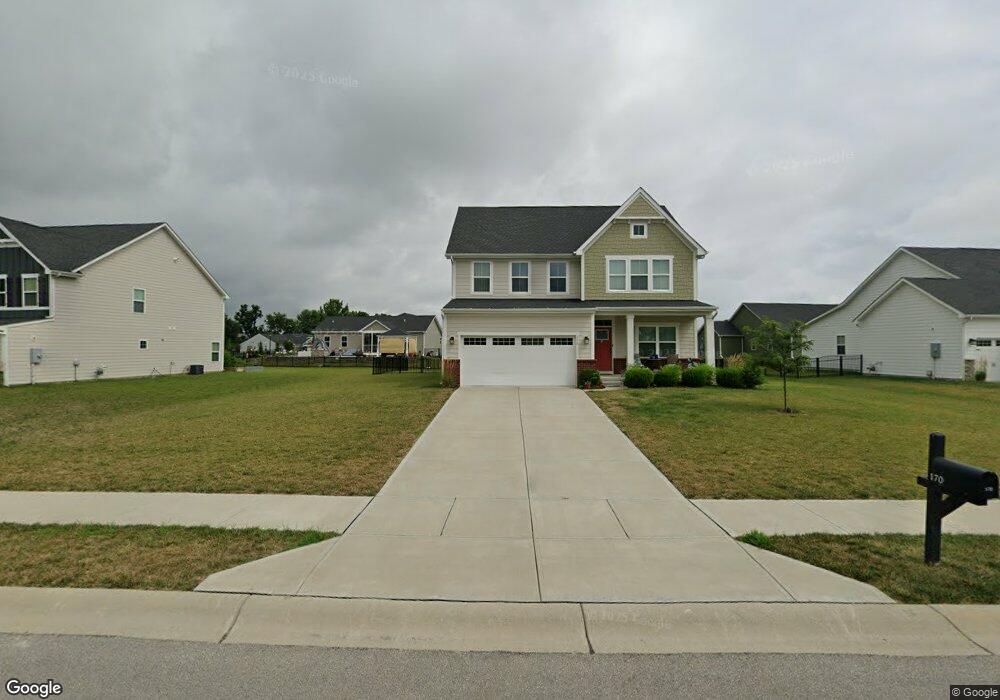
170 Lone Eagle Ln Whiteland, IN 46184
Estimated Value: $360,502 - $429,000
3
Beds
3
Baths
2,344
Sq Ft
$169/Sq Ft
Est. Value
About This Home
This home is located at 170 Lone Eagle Ln, Whiteland, IN 46184 and is currently estimated at $395,126, approximately $168 per square foot. 170 Lone Eagle Ln is a home with nearby schools including Whiteland Elementary School, Clark-Pleasant Middle School, and Whiteland Community High School.
Ownership History
Date
Name
Owned For
Owner Type
Purchase Details
Closed on
Dec 30, 2020
Sold by
Nvr Inc
Bought by
Akpanekong Emem
Current Estimated Value
Home Financials for this Owner
Home Financials are based on the most recent Mortgage that was taken out on this home.
Original Mortgage
$343,660
Outstanding Balance
$306,718
Interest Rate
2.71%
Mortgage Type
New Conventional
Estimated Equity
$88,408
Purchase Details
Closed on
Sep 11, 2020
Sold by
Briar Creek Development Llc
Bought by
Nvr Inc
Create a Home Valuation Report for This Property
The Home Valuation Report is an in-depth analysis detailing your home's value as well as a comparison with similar homes in the area
Home Values in the Area
Average Home Value in this Area
Purchase History
| Date | Buyer | Sale Price | Title Company |
|---|---|---|---|
| Akpanekong Emem | -- | None Available | |
| Nvr Inc | -- | None Available |
Source: Public Records
Mortgage History
| Date | Status | Borrower | Loan Amount |
|---|---|---|---|
| Open | Akpanekong Emem | $343,660 |
Source: Public Records
Tax History
| Year | Tax Paid | Tax Assessment Tax Assessment Total Assessment is a certain percentage of the fair market value that is determined by local assessors to be the total taxable value of land and additions on the property. | Land | Improvement |
|---|---|---|---|---|
| 2025 | $3,827 | $418,100 | $40,300 | $377,800 |
| 2024 | $3,827 | $365,100 | $40,300 | $324,800 |
| 2023 | $3,814 | $365,100 | $40,300 | $324,800 |
| 2022 | $3,347 | $320,800 | $35,400 | $285,400 |
| 2021 | $2,698 | $257,900 | $25,300 | $232,600 |
| 2020 | $10 | $400 | $400 | $0 |
Source: Public Records
Map
Nearby Homes
- 161 Kiawah Dr
- 254 Halldale Dr
- 83 Palmetto Dr
- 288 Mcnair Rd
- 272 Mcnair Rd
- 182 Johns Island Way
- 121 Halldale Dr
- 213 Mcnair Rd
- 79 Gnarled Oak Ln
- 62 Wild Turkey Run
- 8 Marys Ct
- 4810 N Centerline Rd
- 4156 Magnolia Dr
- 661 Woodview Dr
- 35 Lynwood Dr
- 800 Beechwood Ct
- 818 Beechwood Ct
- 836 Beechwood Ct
- 752 Beechwood Ct
- 899 Beechwood Ct
- 160 Lone Eagle Ln
- 180 Lone Eagle Ln
- 179 Lone Eagle Ln
- 288 Larimar Dr
- 278 Larimar Dr
- 190 Lone Eagle Ln
- 298 Larimar Dr
- 169 Lone Eagle Ln
- 262 Wild Turkey Run
- 210 Lone Eagle Ln
- 308 Larimar Dr
- 272 Wild Turkey Run
- 242 Wild Turkey Run
- 209 Lone Eagle Ln
- 282 Wild Turkey Run
- 295 Wild Turkey Run
- 220 Lone Eagle Ln
- 318 Larimar Dr
Your Personal Tour Guide
Ask me questions while you tour the home.