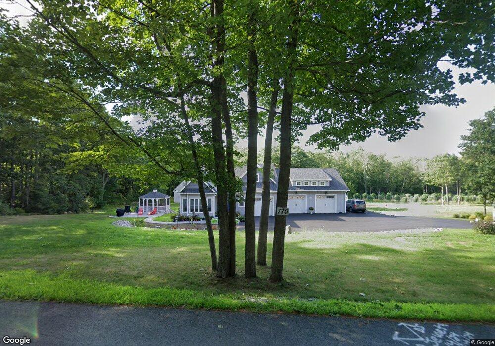
170 Oak Ridge Rd Kennebunkport, ME 04046
Estimated Value: $711,000 - $1,159,000
3
Beds
3
Baths
2,225
Sq Ft
$442/Sq Ft
Est. Value
About This Home
This home is located at 170 Oak Ridge Rd, Kennebunkport, ME 04046 and is currently estimated at $982,713, approximately $441 per square foot. 170 Oak Ridge Rd is a home with nearby schools including Kennebunk High School.
Ownership History
Date
Name
Owned For
Owner Type
Purchase Details
Closed on
Nov 15, 2018
Sold by
Veilleux Kathryn S and Veilleux Stephen C
Bought by
Read Stephen C and Read Katherine J
Current Estimated Value
Purchase Details
Closed on
Oct 31, 2016
Sold by
Marcotte Raymond R and Marcotte Gayle M
Bought by
Veilleux Stephen C and Veilleux Kathryn S
Home Financials for this Owner
Home Financials are based on the most recent Mortgage that was taken out on this home.
Original Mortgage
$250,000
Interest Rate
3.5%
Mortgage Type
New Conventional
Create a Home Valuation Report for This Property
The Home Valuation Report is an in-depth analysis detailing your home's value as well as a comparison with similar homes in the area
Home Values in the Area
Average Home Value in this Area
Purchase History
| Date | Buyer | Sale Price | Title Company |
|---|---|---|---|
| Read Stephen C | -- | -- | |
| Veilleux Stephen C | -- | -- |
Source: Public Records
Mortgage History
| Date | Status | Borrower | Loan Amount |
|---|---|---|---|
| Previous Owner | Veilleux Stephen C | $250,000 |
Source: Public Records
Tax History Compared to Growth
Tax History
| Year | Tax Paid | Tax Assessment Tax Assessment Total Assessment is a certain percentage of the fair market value that is determined by local assessors to be the total taxable value of land and additions on the property. | Land | Improvement |
|---|---|---|---|---|
| 2024 | $5,663 | $871,300 | $185,300 | $686,000 |
| 2023 | $5,412 | $865,900 | $185,300 | $680,600 |
| 2022 | $5,195 | $865,900 | $185,300 | $680,600 |
| 2021 | $4,344 | $452,500 | $95,500 | $357,000 |
| 2020 | $3,302 | $349,400 | $95,500 | $253,900 |
| 2019 | $902 | $95,500 | $95,500 | $0 |
| 2018 | $725 | $95,500 | $95,500 | $0 |
| 2017 | $831 | $95,500 | $95,500 | $0 |
| 2016 | $791 | $95,500 | $95,500 | $0 |
| 2015 | $725 | $94,100 | $94,100 | $0 |
| 2014 | $718 | $94,100 | $94,100 | $0 |
Source: Public Records
Map
Nearby Homes
- 6 Proctor Rd
- 0 Cole Benson Rd
- 258 Guinea Rd
- 380 Guinea Rd
- 391 West St Unit 2
- 286 Goose Rocks Rd
- 276 West St
- 4 Windward Ridge
- 5 Moxie Ln
- 3 Moxie Ln
- Lot 4 Prospect Reserve Way
- 5 Quarry Ln
- 6 Rockwood Dr
- Lot 11 Prospect Reserve Way
- Lot 1 Prospect Reserve Way
- 4 Prospect Reserve Way
- 32 Beaver Pond Rd
- Lot 3 Jasper Ln
- Lot 4 Jasper Ln
- Lot 5 Jasper Ln
- 000 Oak Ridge Rd
- 167 Oak Ridge Rd
- 158 Oak Ridge Rd
- 22 Fox Farm Rd
- 1 Regina Dr
- 21 Fox Farm Rd
- 157 Oak Ridge Rd
- 3 Regina Dr
- 156 Oak Ridge Rd
- 20 Fox Farm Rd
- 2 Regina Dr
- 5 Regina Dr
- 152 Oak Ridge Rd
- 4 Regina Dr
- 5 Caitlyns Way
- 34 Road To Misery
- 3 High Pine Dr
- 19 Fox Farm Rd
- 19 & 14 Fox Farm Rd
- 6 High Pine Dr