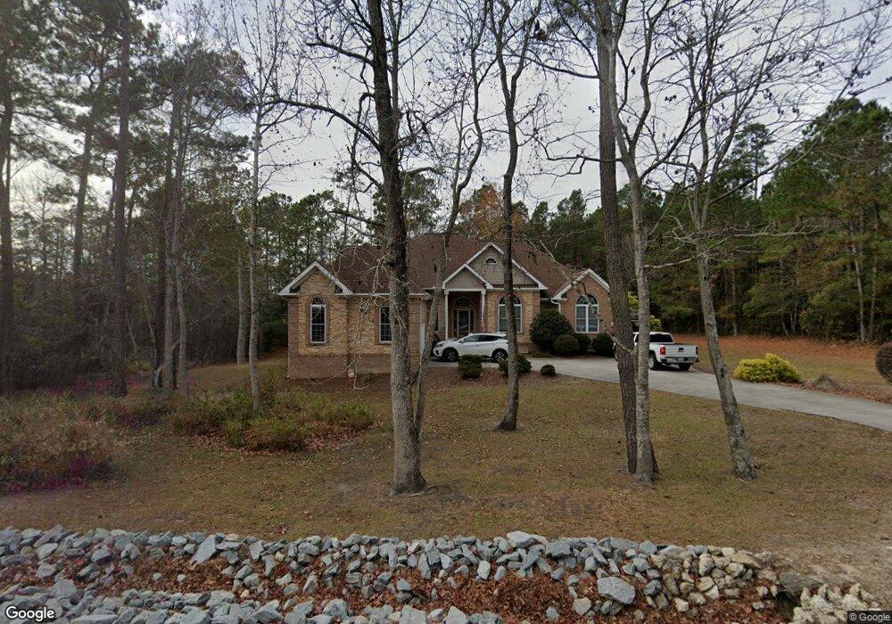
170 Olde Point Rd Hampstead, NC 28443
Estimated Value: $652,000 - $810,000
4
Beds
4
Baths
3,330
Sq Ft
$215/Sq Ft
Est. Value
About This Home
This home is located at 170 Olde Point Rd, Hampstead, NC 28443 and is currently estimated at $714,656, approximately $214 per square foot. 170 Olde Point Rd is a home located in Pender County with nearby schools including Topsail Elementary School, Topsail Middle School, and Topsail High School.
Ownership History
Date
Name
Owned For
Owner Type
Purchase Details
Closed on
May 16, 2010
Sold by
Branch Banking And Trust Co
Bought by
Lowder Robert A and Lowder Dorothy M
Current Estimated Value
Home Financials for this Owner
Home Financials are based on the most recent Mortgage that was taken out on this home.
Original Mortgage
$320,000
Outstanding Balance
$210,844
Interest Rate
5.02%
Mortgage Type
New Conventional
Estimated Equity
$503,812
Purchase Details
Closed on
Feb 2, 2009
Sold by
East Coast Custom Builders Llc
Bought by
Branch Banking And Trust Co
Create a Home Valuation Report for This Property
The Home Valuation Report is an in-depth analysis detailing your home's value as well as a comparison with similar homes in the area
Home Values in the Area
Average Home Value in this Area
Purchase History
| Date | Buyer | Sale Price | Title Company |
|---|---|---|---|
| Lowder Robert A | $400,000 | -- | |
| Branch Banking And Trust Co | $382,500 | -- |
Source: Public Records
Mortgage History
| Date | Status | Borrower | Loan Amount |
|---|---|---|---|
| Open | Lowder Robert A | $320,000 |
Source: Public Records
Tax History
| Year | Tax Paid | Tax Assessment Tax Assessment Total Assessment is a certain percentage of the fair market value that is determined by local assessors to be the total taxable value of land and additions on the property. | Land | Improvement |
|---|---|---|---|---|
| 2025 | $4,089 | $705,034 | $144,120 | $560,914 |
| 2024 | $4,089 | $420,390 | $89,260 | $331,130 |
| 2023 | $3,720 | $420,390 | $89,260 | $331,130 |
| 2022 | $3,720 | $420,390 | $89,260 | $331,130 |
| 2021 | $3,720 | $420,390 | $89,260 | $331,130 |
| 2020 | $3,602 | $406,248 | $89,260 | $316,988 |
| 2019 | $1,491 | $152,658 | $89,260 | $63,398 |
| 2018 | $3,702 | $399,127 | $88,000 | $311,127 |
| 2017 | $3,702 | $399,127 | $88,000 | $311,127 |
| 2016 | $3,662 | $399,127 | $88,000 | $311,127 |
| 2015 | $3,627 | $399,127 | $88,000 | $311,127 |
| 2014 | $2,845 | $399,127 | $88,000 | $311,127 |
| 2013 | -- | $399,127 | $88,000 | $311,127 |
| 2012 | -- | $399,127 | $88,000 | $311,127 |
Source: Public Records
Map
Nearby Homes
- 151 Olde Point Rd
- 105 White Heron Cove Rd
- 218 Olde Point Loop
- 557 Button Bush Ln
- 610 Sawgrass Rd
- 496 Captain Beam Blvd
- 480 Captain Beam Blvd
- 1984 Kings Landing Rd
- 1966 Kings Landing Rd
- 108 Deer Cove Rd
- 2001 Cordgrass Rd
- 420 Kings Landing Rd
- 703 Brown Pelican Ln
- 203 W Weatherbee Way
- 754 Country Club Dr
- 1475 Kings Landing Rd
- 1406 Kings Landing Rd
- 130 Iris Way
- 378 Aster Place
- 85 Waldorf Way
- 166 Olde Point Rd
- 343 Sawgrass Rd
- 603 Sawgrass Rd
- 164 Olde Point Rd
- 162 Olde Point Rd
- 160 Olde Point Rd
- 113 Olde Point Rd
- 608 Sawgrass Rd
- 157 Olde Point Rd
- 158 Olde Point Rd
- 609 Sawgrass Rd
- 156 Olde Point Rd
- 156 Olde Point Rd
- 155 Olde Point Rd
- 600 Cordgrass Rd
- 612 Sawgrass Rd
- 702 Cordgrass Rd
- 702 Cordgrass Rd Unit 4
- 113 White Heron Cove
- 115 White Heron Cove
Your Personal Tour Guide
Ask me questions while you tour the home.