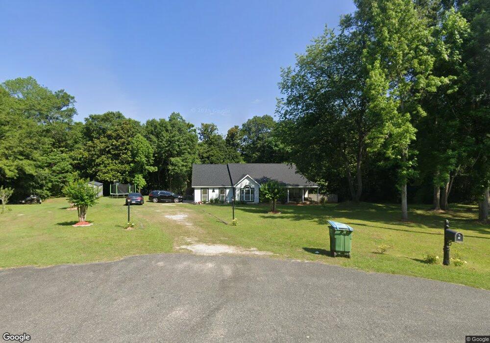
170 Quail Roost Dr W Quincy, FL 32352
Estimated Value: $333,673 - $528,000
4
Beds
2
Baths
2,292
Sq Ft
$176/Sq Ft
Est. Value
About This Home
This home is located at 170 Quail Roost Dr W, Quincy, FL 32352 and is currently estimated at $402,418, approximately $175 per square foot. 170 Quail Roost Dr W is a home located in Gadsden County.
Ownership History
Date
Name
Owned For
Owner Type
Purchase Details
Closed on
Sep 24, 2010
Sold by
U S Bank National Association
Bought by
Butler Ocbkisha R
Current Estimated Value
Home Financials for this Owner
Home Financials are based on the most recent Mortgage that was taken out on this home.
Original Mortgage
$146,033
Outstanding Balance
$98,512
Interest Rate
4.87%
Mortgage Type
FHA
Estimated Equity
$303,906
Purchase Details
Closed on
Feb 9, 2010
Sold by
Deveas Vincent K and Deveas Michelle S
Bought by
Us Bank National Association
Create a Home Valuation Report for This Property
The Home Valuation Report is an in-depth analysis detailing your home's value as well as a comparison with similar homes in the area
Home Values in the Area
Average Home Value in this Area
Purchase History
| Date | Buyer | Sale Price | Title Company |
|---|---|---|---|
| Butler Ocbkisha R | $148,000 | Working Title Llc | |
| Us Bank National Association | -- | Attorney |
Source: Public Records
Mortgage History
| Date | Status | Borrower | Loan Amount |
|---|---|---|---|
| Open | Butler Ocbkisha R | $146,033 |
Source: Public Records
Tax History Compared to Growth
Tax History
| Year | Tax Paid | Tax Assessment Tax Assessment Total Assessment is a certain percentage of the fair market value that is determined by local assessors to be the total taxable value of land and additions on the property. | Land | Improvement |
|---|---|---|---|---|
| 2024 | $1,883 | $171,354 | -- | -- |
| 2023 | $1,822 | $166,364 | $0 | $0 |
| 2022 | $1,759 | $161,519 | $0 | $0 |
| 2021 | $1,739 | $156,815 | $0 | $0 |
| 2020 | $1,703 | $154,650 | $14,000 | $140,650 |
| 2019 | $1,768 | $156,257 | $14,000 | $142,257 |
| 2018 | $1,799 | $156,257 | $0 | $0 |
| 2017 | $1,808 | $156,257 | $0 | $0 |
| 2016 | $1,865 | $157,865 | $0 | $0 |
| 2015 | $1,929 | $159,473 | $0 | $0 |
| 2014 | $1,964 | $161,080 | $0 | $0 |
Source: Public Records
Map
Nearby Homes
- 2861 Solomon Dairy Rd
- Tbd Quail Roost Dr
- XXXX Red Bird Rd
- 171 Beech Ave
- 244 Beech Ave
- 212 Beech Ave
- 2nd Street
- 0 Juniper Creek Rd Unit 772830
- 0 Grrensboro Hwy Unit 375316
- XX Railroad St
- 379 Glory Rd
- 000 Solomon Dairy Rd
- 0300 Shade Farm Rd
- 0200 Shade Farm Rd
- XX Hardaway Hwy
- 0 Hobley Ave Unit R10935797
- 360 Dewey Johnson Way
- Lot#6 Glory Rd
- Lot#5 Glory Rd
- Lot#4 Glory Rd
- 170 Quail Roost Dr W Unit 1
- 60 Quail Roost Dr W
- 20 Quail Roost Dr W
- 310 Leafy Ln Unit 2
- 310 Leafy Ln
- 0 Leafy Ln Unit 318529
- 0 Leafy Ln Unit 181510
- 0 Leafy Ln Unit 2 188757
- 0 Leafy Ln Unit 2 188758
- 0 Leafy Ln Unit 192282
- 0 Leafy Ln Unit 195558
- 0 Leafy Ln Unit 2 209757
- 0 Leafy Ln Unit 2-Vacant Land 214699
- 0 Leafy Ln Unit 2 217140
- 0 Leafy Ln Unit 226485
- 0 Leafy Ln Unit 2 280909
- 370 Leafy Ln Unit 2
- 370 Leafy Ln
- 645 Quail Roost Dr
- 411 Leafy Ln