Estimated Value: $402,000 - $541,000
--
Bed
2
Baths
1,744
Sq Ft
$270/Sq Ft
Est. Value
About This Home
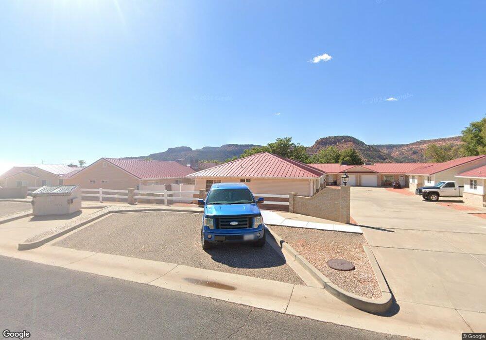
This home is located at 170 S 200 W Unit 10, Kanab, UT 84741 and is currently estimated at $471,500, approximately $270 per square foot. 170 S 200 W Unit 10 is a home located in Kane County with nearby schools including Kanab Elementary School, Kanab Middle School, and Kanab High School.
Ownership History
Date
Name
Owned For
Owner Type
Purchase Details
Closed on
Apr 21, 2017
Sold by
Brekke Taffy R
Bought by
Amaya Melanie S
Current Estimated Value
Purchase Details
Closed on
Sep 26, 2012
Sold by
Schlanger Sarah H
Bought by
Schlanger Sarah H and Larralde Signa L
Purchase Details
Closed on
Aug 1, 2011
Sold by
Stoner William R
Bought by
Schlanger Arah H
Home Financials for this Owner
Home Financials are based on the most recent Mortgage that was taken out on this home.
Original Mortgage
$121,600
Interest Rate
4.46%
Purchase Details
Closed on
Jun 14, 2010
Sold by
Mers
Bought by
Halliday Paul M
Purchase Details
Closed on
Jul 21, 2008
Sold by
Wells Fargo Bank Na
Bought by
Wells Fargo Financial National Bank
Home Financials for this Owner
Home Financials are based on the most recent Mortgage that was taken out on this home.
Original Mortgage
$140,000
Interest Rate
6.04%
Purchase Details
Closed on
Jun 19, 2008
Sold by
Davis Carla J
Bought by
Stoner William R
Home Financials for this Owner
Home Financials are based on the most recent Mortgage that was taken out on this home.
Original Mortgage
$140,000
Interest Rate
6.04%
Create a Home Valuation Report for This Property
The Home Valuation Report is an in-depth analysis detailing your home's value as well as a comparison with similar homes in the area
Home Values in the Area
Average Home Value in this Area
Purchase History
| Date | Buyer | Sale Price | Title Company |
|---|---|---|---|
| Amaya Melanie S | -- | -- | |
| Schlanger Sarah H | -- | -- | |
| Schlanger Arah H | -- | -- | |
| Halliday Paul M | -- | -- | |
| Wells Fargo Financial National Bank | -- | -- | |
| Stoner William R | -- | -- |
Source: Public Records
Mortgage History
| Date | Status | Borrower | Loan Amount |
|---|---|---|---|
| Previous Owner | Schlanger Arah H | $121,600 | |
| Previous Owner | Stoner William R | $140,000 |
Source: Public Records
Tax History Compared to Growth
Tax History
| Year | Tax Paid | Tax Assessment Tax Assessment Total Assessment is a certain percentage of the fair market value that is determined by local assessors to be the total taxable value of land and additions on the property. | Land | Improvement |
|---|---|---|---|---|
| 2025 | $1,495 | $164,912 | $22,037 | $142,875 |
| 2024 | $1,495 | $173,771 | $22,037 | $151,734 |
| 2023 | $1,343 | $159,977 | $22,037 | $137,940 |
| 2022 | $1,184 | $139,618 | $14,218 | $125,400 |
| 2021 | $1,101 | $194,739 | $25,850 | $168,889 |
| 2020 | $1,120 | $192,389 | $23,500 | $168,889 |
| 2019 | $1,165 | $194,969 | $23,496 | $171,473 |
| 2018 | $1,152 | $191,053 | $19,580 | $171,473 |
| 2017 | $1,097 | $173,690 | $17,800 | $155,890 |
| 2016 | $961 | $147,810 | $17,800 | $130,010 |
| 2015 | $961 | $137,475 | $17,800 | $119,675 |
| 2014 | $961 | $147,084 | $17,817 | $129,267 |
| 2013 | -- | $80,896 | $0 | $0 |
Source: Public Records
Map
Nearby Homes
- 2550 S
- 0 Wapiti Unit 1408825
- 65 & 75 200
- 325 S Main St
- 75 N 200 W
- 176 S 100 E
- 2660 S Antelope Canyon Bldg 9 Unit 1
- 163 N 200 W
- 197 N 200 W
- 23 S 100 E
- 143 E 100 S Unit 2
- 143 E 100 S Unit 1
- 400 S Moki Dr Unit I-1
- 400 S Moki Dr Unit H-2
- 335 S Tala Cir
- 513 Winchester Unit 351
- 513 Winchester
- Lot 350 Winchester
- 253 N 240 W Unit 4
- 530 W Powell Dr
- 170 S 200 W Unit 9
- 170 S 200 W Unit 8
- 170 S 200 W Unit 7
- 170 S 200 W Unit 6
- 170 S 200 W Unit 5
- 170 S 200 W Unit 4
- 170 S 200 W Unit 3
- 170 S 200 W Unit 2
- 170 S 200 W Unit 12
- 170 S 200 W Unit 11
- 212 W 200 S
- 170 W 200 S Unit 1
- 191 S 200 W
- 169 S 200 W
- 148 S 200 W
- 168 W 200 S
- 169 W 200 S
- 132 S 200 W
- 156 W 200 S
- 171 W 200 S