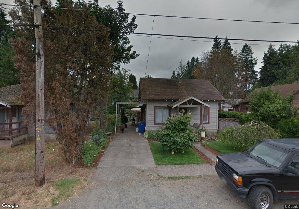
170 SE Grove St Mill City, OR 97360
Estimated Value: $234,950 - $318,000
3
Beds
1
Bath
892
Sq Ft
$310/Sq Ft
Est. Value
About This Home
This home is located at 170 SE Grove St, Mill City, OR 97360 and is currently estimated at $276,475, approximately $309 per square foot. 170 SE Grove St is a home with nearby schools including Santiam Elementary School and Santiam Junior/Senior High School.
Ownership History
Date
Name
Owned For
Owner Type
Purchase Details
Closed on
Jan 22, 2004
Sold by
Payseno Gerald G
Bought by
Koenig Dennis E
Current Estimated Value
Home Financials for this Owner
Home Financials are based on the most recent Mortgage that was taken out on this home.
Original Mortgage
$25,000
Interest Rate
5.74%
Mortgage Type
Seller Take Back
Purchase Details
Closed on
Jan 3, 2004
Sold by
Koenig Dennis E
Bought by
Jefferson Andrew D
Home Financials for this Owner
Home Financials are based on the most recent Mortgage that was taken out on this home.
Original Mortgage
$25,000
Interest Rate
5.74%
Mortgage Type
Seller Take Back
Create a Home Valuation Report for This Property
The Home Valuation Report is an in-depth analysis detailing your home's value as well as a comparison with similar homes in the area
Home Values in the Area
Average Home Value in this Area
Purchase History
| Date | Buyer | Sale Price | Title Company |
|---|---|---|---|
| Koenig Dennis E | $39,511 | Ticor Title | |
| Jefferson Andrew D | $30,000 | Lawyers Title Ins |
Source: Public Records
Mortgage History
| Date | Status | Borrower | Loan Amount |
|---|---|---|---|
| Previous Owner | Jefferson Andrew D | $25,000 |
Source: Public Records
Tax History Compared to Growth
Tax History
| Year | Tax Paid | Tax Assessment Tax Assessment Total Assessment is a certain percentage of the fair market value that is determined by local assessors to be the total taxable value of land and additions on the property. | Land | Improvement |
|---|---|---|---|---|
| 2025 | $1,158 | $63,820 | -- | -- |
| 2024 | $1,129 | $61,970 | -- | -- |
| 2023 | $1,095 | $60,170 | $0 | $0 |
| 2022 | $1,074 | $58,420 | $0 | $0 |
| 2021 | $1,044 | $56,720 | $0 | $0 |
| 2020 | $1,011 | $55,070 | $0 | $0 |
| 2019 | $997 | $53,470 | $0 | $0 |
| 2018 | $846 | $51,920 | $0 | $0 |
| 2017 | $822 | $50,410 | $0 | $0 |
| 2016 | $798 | $48,950 | $0 | $0 |
| 2015 | $785 | $47,530 | $0 | $0 |
| 2014 | $741 | $46,150 | $0 | $0 |
Source: Public Records
Map
Nearby Homes
- 328 S 1st Ave
- 390 SE Grove St
- 222 SE Whitten Rd
- 171 SE Kingwood Ave
- 195 NE Santiam Pointe Lp
- 150 Santiam Pointe Lp NE
- 1030 SW 1st Ave
- 344 SW Ivy St
- 483 SE Hazel St
- 40111 SE Fairview St
- 410 SW Broadway St
- 1090 SE 3rd Ave
- 713 NW 7th Place
- 1176 SE 4th Ave
- 365 SW 7th Ave
- 1270 SW 1st Ave
- 1231 SW 3rd Ave
- Tax ID#0011235 NW High St
- 13594 Hudel Rd SE
- 940 SW Main Ave
- 180 SE Grove St
- 156 SE Grove St
- 190 SE Grove St
- 191 SE Grove St
- 149 SE Grove St
- 155 SE Hazel St
- 8th (R41880) Place
- 171 SE Hazel St
- 171 SE Hazel (- 187) St
- 0 NW Alder (Parcel #41848) Unit 744108
- 628 S 1st Ave
- 0 8th Place
- 0 Fishermans (Parcel #0389326) Rd Unit 754456
- 0 Beech (Parcel #R41876) Unit 762790
- Parcel#R41876 Beech
- 0 8th Parcels R41880+ Place Unit 760993
- 0 SW Tuers Ln
- 0 Santiam Pointe Loop NE Unit 729904
- 0 Santiam Pointe Loop NE Unit 729899
- 0 Santiam Pointe Loop NE Unit 729903