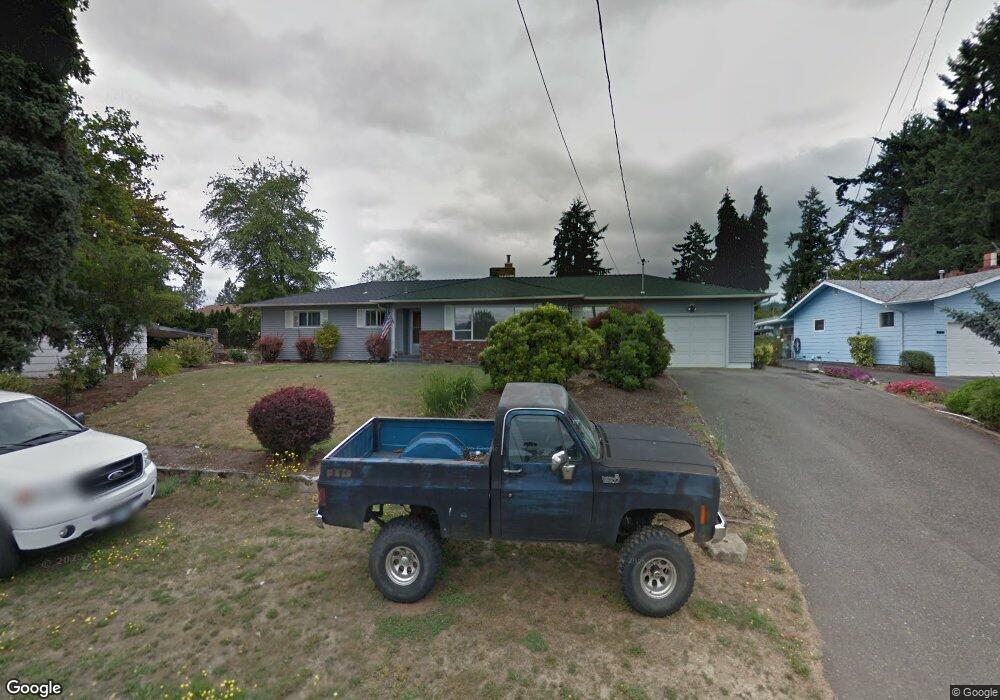
170 SW Newton Dr Winston, OR 97496
Estimated Value: $320,000 - $422,000
3
Beds
2
Baths
1,787
Sq Ft
$201/Sq Ft
Est. Value
About This Home
This home is located at 170 SW Newton Dr, Winston, OR 97496 and is currently estimated at $359,097, approximately $200 per square foot. 170 SW Newton Dr is a home located in Douglas County with nearby schools including Douglas High School.
Ownership History
Date
Name
Owned For
Owner Type
Purchase Details
Closed on
May 19, 2011
Sold by
Neifert Randall G
Bought by
Joers Shiloh D and Joers April L
Current Estimated Value
Home Financials for this Owner
Home Financials are based on the most recent Mortgage that was taken out on this home.
Original Mortgage
$160,621
Outstanding Balance
$110,622
Interest Rate
4.84%
Mortgage Type
New Conventional
Estimated Equity
$248,475
Purchase Details
Closed on
Apr 14, 2004
Sold by
Va
Bought by
Neifert Randall G
Home Financials for this Owner
Home Financials are based on the most recent Mortgage that was taken out on this home.
Original Mortgage
$108,000
Interest Rate
5.38%
Mortgage Type
Purchase Money Mortgage
Create a Home Valuation Report for This Property
The Home Valuation Report is an in-depth analysis detailing your home's value as well as a comparison with similar homes in the area
Home Values in the Area
Average Home Value in this Area
Purchase History
| Date | Buyer | Sale Price | Title Company |
|---|---|---|---|
| Joers Shiloh D | $155,000 | Ticor Title Company Oregon | |
| Neifert Randall G | $135,000 | Fidelity Natl Title Co Or |
Source: Public Records
Mortgage History
| Date | Status | Borrower | Loan Amount |
|---|---|---|---|
| Open | Joers Shiloh D | $160,621 | |
| Previous Owner | Neifert Randall G | $108,000 | |
| Closed | Neifert Randall G | $27,000 |
Source: Public Records
Tax History Compared to Growth
Tax History
| Year | Tax Paid | Tax Assessment Tax Assessment Total Assessment is a certain percentage of the fair market value that is determined by local assessors to be the total taxable value of land and additions on the property. | Land | Improvement |
|---|---|---|---|---|
| 2025 | $3,263 | $196,373 | -- | -- |
| 2024 | $3,172 | $190,654 | -- | -- |
| 2023 | $3,082 | $185,101 | $0 | $0 |
| 2022 | $2,990 | $179,710 | $0 | $0 |
| 2021 | $2,909 | $174,476 | $0 | $0 |
| 2020 | $2,826 | $169,395 | $0 | $0 |
| 2019 | $2,758 | $164,462 | $0 | $0 |
| 2018 | $2,684 | $159,672 | $0 | $0 |
| 2017 | $2,614 | $155,022 | $0 | $0 |
| 2016 | $2,540 | $150,507 | $0 | $0 |
| 2015 | $2,413 | $146,124 | $0 | $0 |
| 2014 | $2,357 | $141,868 | $0 | $0 |
| 2013 | -- | $136,902 | $0 | $0 |
Source: Public Records
Map
Nearby Homes
- 260 SW Ford Ave
- 0 SW Main St
- 301 NW Midway St
- 120 SE Edwards Ave
- 68 NW Rose St
- 0 SE Gregory Dr
- 308 NW Civil Bend Ave
- 841 NW Lori St
- 364 NW Teal St
- 350 SE Park St
- 151 Sherry St
- 0 NW Galaxy Dr
- 210 NW Timothy Ave
- 110 SE Darrell Ave
- 90 SE Darrell Ave
- 271 SE Robinson St
- 173 NE Main St
- 310 NW Lost Ln
- 222 NW Broc Dr
- 291 SE Shigley St
- 180 SW Newton Dr
- 150 SW Newton Dr
- 130 SW Newton Dr
- 181 SW Newton Dr
- 131 SW Newton Dr
- 151 SW Civil Bend Ave
- 200 SW Newton Dr
- 201 SW Newton Dr
- 121 SW Newton Dr
- 141 SW Civil Bend Ave
- 110 SW Newton Dr Unit 1
- 110 SW Newton Dr
- 151 SW Brantley Dr
- 230 SW Newton Dr
- 153 SW Brantley Dr
- 221 SW Newton Dr
- 111 SW Newton Dr
- 150 SW Brantley Dr
- 155 SW Brantley Dr Unit 1
- 155 SW Brantley Dr