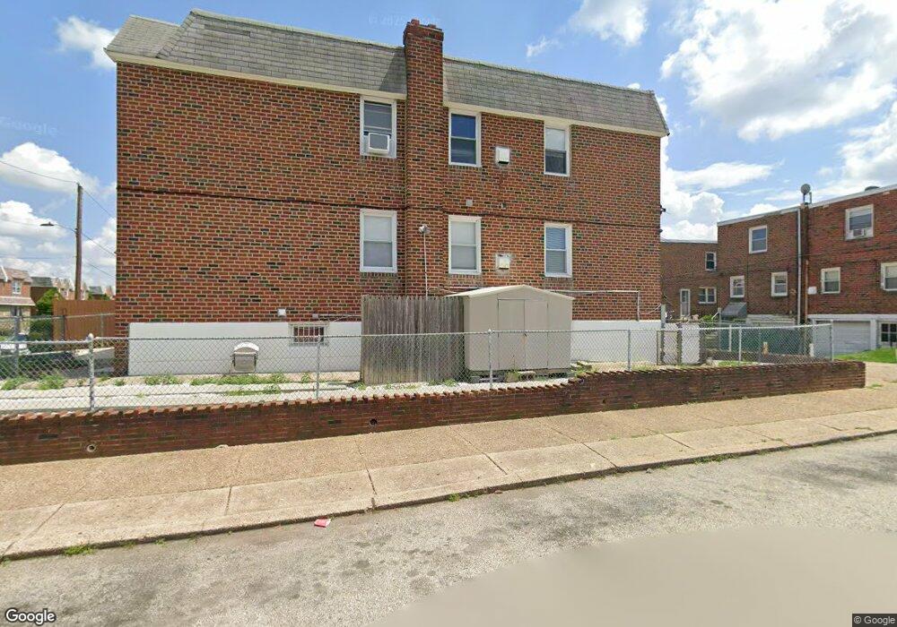
1700 Danforth St Philadelphia, PA 19152
Rhawnhurst NeighborhoodEstimated Value: $355,000 - $489,096
4
Beds
2
Baths
1,748
Sq Ft
$243/Sq Ft
Est. Value
About This Home
This home is located at 1700 Danforth St, Philadelphia, PA 19152 and is currently estimated at $424,699, approximately $242 per square foot. 1700 Danforth St is a home located in Philadelphia County with nearby schools including Farrell Louis H School, Northeast High School, and Tacony Academy Charter School.
Ownership History
Date
Name
Owned For
Owner Type
Purchase Details
Closed on
Dec 30, 1999
Sold by
Maj Marek and Maj Bozena
Bought by
Cardona Lolimar
Current Estimated Value
Home Financials for this Owner
Home Financials are based on the most recent Mortgage that was taken out on this home.
Original Mortgage
$91,800
Interest Rate
7.73%
Mortgage Type
Commercial
Purchase Details
Closed on
Mar 14, 1995
Sold by
Catanzaro Gloria and Ulanski Helen
Bought by
Maj Marek and Maj Bozena
Create a Home Valuation Report for This Property
The Home Valuation Report is an in-depth analysis detailing your home's value as well as a comparison with similar homes in the area
Home Values in the Area
Average Home Value in this Area
Purchase History
| Date | Buyer | Sale Price | Title Company |
|---|---|---|---|
| Cardona Lolimar | $108,000 | -- | |
| Maj Marek | $79,000 | -- |
Source: Public Records
Mortgage History
| Date | Status | Borrower | Loan Amount |
|---|---|---|---|
| Closed | Cardona Lolimar | $91,800 | |
| Closed | Cardona Lolimar | $10,800 |
Source: Public Records
Tax History
| Year | Tax Paid | Tax Assessment Tax Assessment Total Assessment is a certain percentage of the fair market value that is determined by local assessors to be the total taxable value of land and additions on the property. | Land | Improvement |
|---|---|---|---|---|
| 2026 | $4,110 | $394,800 | $78,960 | $315,840 |
| 2025 | $4,110 | $394,800 | $78,960 | $315,840 |
| 2024 | $4,110 | $394,800 | $78,960 | $315,840 |
| 2023 | $4,110 | $293,600 | $58,720 | $234,880 |
| 2022 | $4,110 | $293,600 | $58,720 | $234,880 |
| 2021 | $2,990 | $0 | $0 | $0 |
| 2020 | $2,990 | $0 | $0 | $0 |
| 2019 | $2,800 | $0 | $0 | $0 |
| 2018 | $2,597 | $0 | $0 | $0 |
| 2017 | $2,597 | $0 | $0 | $0 |
Source: Public Records
Map
Nearby Homes
- 1701 Bergen St
- 1812 Kendrick St
- 1821 Kendrick St
- 1629 Strahle St
- 1605 Strahle St
- 1827 Arnold St
- 1608 Strahle St
- 1621 Benson St
- 1734 Strahle St
- 1826 Fox Chase Rd
- 1804 Mower St
- 8513 Bustleton Ave
- 1804 Hoffnagle St
- 8557 Castor Ave
- 2034 Bergen St
- 8572 Benton Ave
- 1810 Stanwood St
- 1715 Rhawn St
- 8000 Algon Ave
- 1445 Rhawn St
- 1702 Danforth St
- 1704 Danforth St
- 1706 Danforth St
- 1703 Bergen St
- 1705 Bergen St
- 1708 Danforth St
- 1710 Danforth St
- 1707 Bergen St
- 8382 Summerdale Ave
- 8384 Summerdale Ave
- 8380 Summerdale Ave
- 1709 Bergen St
- 1701 Danforth St
- 8386 Summerdale Ave
- 8378 Summerdale Ave
- 1705 Danforth St
- 1711 Bergen St
- 1712 Danforth St
- 8388 Summerdale Ave
- 1707 Danforth St
Your Personal Tour Guide
Ask me questions while you tour the home.