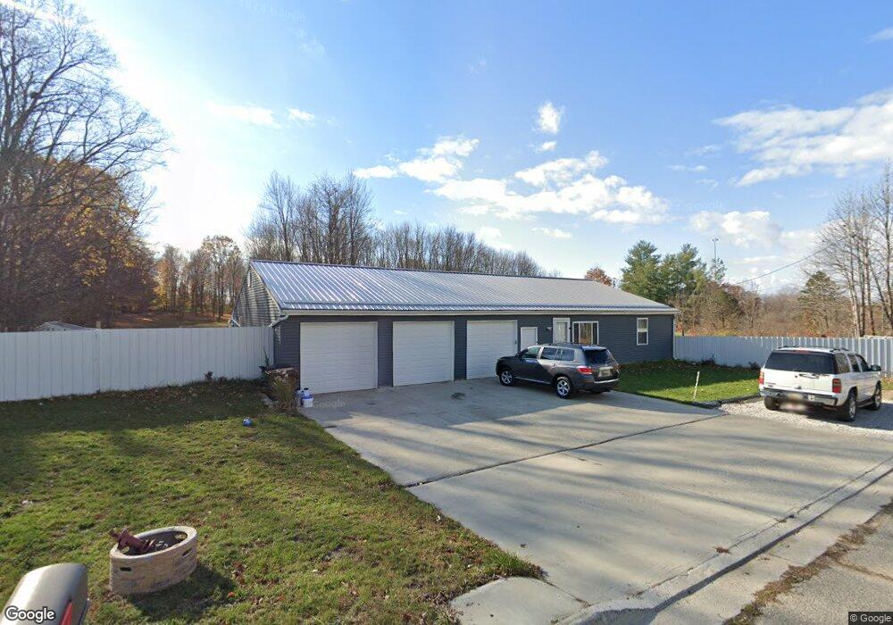
1700 Dell Rd Lansing, MI 48911
South Lansing NeighborhoodEstimated Value: $196,000 - $298,702
2
Beds
2
Baths
1,200
Sq Ft
$201/Sq Ft
Est. Value
About This Home
This home is located at 1700 Dell Rd, Lansing, MI 48911 and is currently estimated at $241,676, approximately $201 per square foot. 1700 Dell Rd is a home with nearby schools including Forest View School, Attwood School, and Everett High School.
Ownership History
Date
Name
Owned For
Owner Type
Purchase Details
Closed on
Sep 21, 2021
Sold by
Tower Sam and Tower Lisa
Bought by
Tower Sam and Tower Lisa
Current Estimated Value
Purchase Details
Closed on
May 7, 2019
Sold by
Chronister Bob J and Chronister Jane P
Bought by
Tower Lisa and Tower Sam
Purchase Details
Closed on
Dec 13, 2017
Sold by
Chronister Bob J
Bought by
Chronister Bob J and Chronister Jane P
Purchase Details
Closed on
Oct 21, 2014
Sold by
Karkau Leif and Karkau Kahtleen R
Bought by
Karkau Leif A and Karkau Kathleen R
Purchase Details
Closed on
Feb 11, 2000
Sold by
Woodcock Dale and Woodcock Janet
Bought by
Chronister Bob J and Karkan Leif
Purchase Details
Closed on
Oct 30, 1998
Sold by
Leason Frances M
Bought by
Woodcock Dale
Create a Home Valuation Report for This Property
The Home Valuation Report is an in-depth analysis detailing your home's value as well as a comparison with similar homes in the area
Home Values in the Area
Average Home Value in this Area
Purchase History
| Date | Buyer | Sale Price | Title Company |
|---|---|---|---|
| Tower Sam | -- | None Available | |
| Tower Lisa | $70,000 | Transnation Title Agency | |
| Chronister Bob J | -- | None Available | |
| Karkau Leif A | -- | None Available | |
| Chronister Bob J | $47,000 | First American Title Ins Co | |
| Woodcock Dale | $13,000 | -- |
Source: Public Records
Tax History Compared to Growth
Tax History
| Year | Tax Paid | Tax Assessment Tax Assessment Total Assessment is a certain percentage of the fair market value that is determined by local assessors to be the total taxable value of land and additions on the property. | Land | Improvement |
|---|---|---|---|---|
| 2025 | $5,430 | $112,700 | $26,900 | $85,800 |
| 2024 | $44 | $105,900 | $26,900 | $79,000 |
| 2023 | $5,087 | $98,400 | $26,900 | $71,500 |
| 2022 | $4,579 | $76,100 | $9,700 | $66,400 |
| 2021 | $4,991 | $82,300 | $9,700 | $72,600 |
| 2020 | $6,397 | $81,100 | $9,700 | $71,400 |
| 2019 | $744 | $9,700 | $9,700 | $0 |
| 2018 | $718 | $9,700 | $9,700 | $0 |
| 2017 | $707 | $9,700 | $9,700 | $0 |
| 2016 | $1,327 | $9,700 | $9,700 | $0 |
| 2015 | $1,327 | $9,700 | $0 | $0 |
| 2014 | $1,327 | $9,700 | $0 | $0 |
Source: Public Records
Map
Nearby Homes
- 6347 Beechfield Dr
- 6704 Mill Stream Ln
- 1516 Cedarview Ln
- 6309 Beechfield Dr Unit 45
- 4502 Bowline Ct
- 6300 Beechfield Dr Unit 87
- 4485 Helmsway Dr
- 6815 Aurelius Rd
- 6223 Beechfield Dr Unit 8
- 2702 Yachtsman Dr
- 2670 Brigantine Dr
- 7061 W Bickett Blvd
- 7011 Aurelius Rd
- 4434 Willoughby Rd
- 4348 Norway St
- 2564 Winterberry St Unit 12
- 2520 Winterberry St
- 4452 Cricket Ridge Dr Unit 202
- 4314 Ringneck Ln
- 4662 Tolland Ave
- 000000 Dell Rd
- 1713 Dell Rd
- 1730 Dell Rd
- 1725 Dell Rd
- 1805 Dell Rd
- 1614 Lockbridge Dr
- 1608 Lockbridge Dr
- 1622 Lockbridge Dr
- 1600 Lockbridge Dr
- 1700 Lockbridge Dr
- 1516 Lockbridge Dr
- 1824 Dell Rd
- 6510 Floyd St
- 1825 Dell Rd
- 1508 Lockbridge Dr
- 1611 Lockbridge Dr
- 6431 Marscot Dr
- 6423 Lerner Way
- 1500 Lockbridge Dr
- 1830 Dell Rd