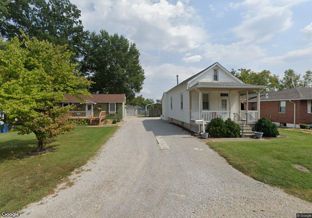
1700 Duncan Ave Swansea, IL 62226
Estimated Value: $66,924 - $100,000
--
Bed
--
Bath
608
Sq Ft
$134/Sq Ft
Est. Value
About This Home
This home is located at 1700 Duncan Ave, Swansea, IL 62226 and is currently estimated at $81,731, approximately $134 per square foot. 1700 Duncan Ave is a home located in St. Clair County with nearby schools including High Mount Elementary School, Elite Scholars STEAM Academy, and St Teresa Catholic School.
Ownership History
Date
Name
Owned For
Owner Type
Purchase Details
Closed on
Jul 14, 2004
Sold by
Hutchison Roseann
Bought by
Campbell Randy Dale and Campbell Carol Rose
Current Estimated Value
Home Financials for this Owner
Home Financials are based on the most recent Mortgage that was taken out on this home.
Original Mortgage
$28,400
Interest Rate
6.37%
Mortgage Type
Purchase Money Mortgage
Create a Home Valuation Report for This Property
The Home Valuation Report is an in-depth analysis detailing your home's value as well as a comparison with similar homes in the area
Home Values in the Area
Average Home Value in this Area
Purchase History
| Date | Buyer | Sale Price | Title Company |
|---|---|---|---|
| Campbell Randy Dale | $35,500 | Town & Country Title Co |
Source: Public Records
Mortgage History
| Date | Status | Borrower | Loan Amount |
|---|---|---|---|
| Closed | Campbell Randy Dale | $28,400 |
Source: Public Records
Tax History Compared to Growth
Tax History
| Year | Tax Paid | Tax Assessment Tax Assessment Total Assessment is a certain percentage of the fair market value that is determined by local assessors to be the total taxable value of land and additions on the property. | Land | Improvement |
|---|---|---|---|---|
| 2024 | $1,573 | $19,082 | $3,004 | $16,078 |
| 2023 | $1,710 | $19,993 | $2,964 | $17,029 |
| 2022 | $1,614 | $18,208 | $2,699 | $15,509 |
| 2021 | $1,584 | $17,460 | $2,588 | $14,872 |
| 2020 | $1,528 | $16,260 | $2,410 | $13,850 |
| 2019 | $1,601 | $17,555 | $2,506 | $15,049 |
| 2018 | $1,602 | $17,107 | $2,442 | $14,665 |
| 2017 | $784 | $16,652 | $2,377 | $14,275 |
| 2016 | $1,561 | $16,078 | $2,295 | $13,783 |
| 2014 | $578 | $13,781 | $2,389 | $11,392 |
| 2013 | $1,172 | $13,781 | $2,389 | $11,392 |
Source: Public Records
Map
Nearby Homes
- 1 Schae Fries Dr
- 145 Marilyn Dr
- 1708 Anna Rose Dr
- 244 Brackett St
- 213 Brackett St
- 222 Brackett St
- 1601 N 17th St
- 204 Gilbert St
- 110 Fullerton Rd
- 1014 Caseyville Ave
- 1900 N 17th St
- 1627 W J St
- 1903 N 17th St
- 1601 Foster Dr
- 212 Castellano Dr
- 604 N 17th St
- 0 Smelting Works Rd
- 605 N 17th St
- 8 Grace Ct
- 141 N 31st St
- 1702 Duncan Ave
- 1624 Duncan Ave
- 1622 Duncan Ave
- 1710 Duncan Ave
- 1621 Schobert Dr
- 1711 Schobert Dr
- 1619 Schobert Dr
- 1701 Duncan Ave
- 1625 Duncan Ave
- 1618 Duncan Ave
- 1700 Allen Dr
- 1712 Duncan Ave
- 1612 Duncan Ave
- 1700 Schobert Dr
- 1624 Schobert Dr
- 1702 Schobert Dr
- 1620 Schobert Dr
- 1714 Duncan Ave
- 1622 Schobert Dr
- 1610 Duncan Ave