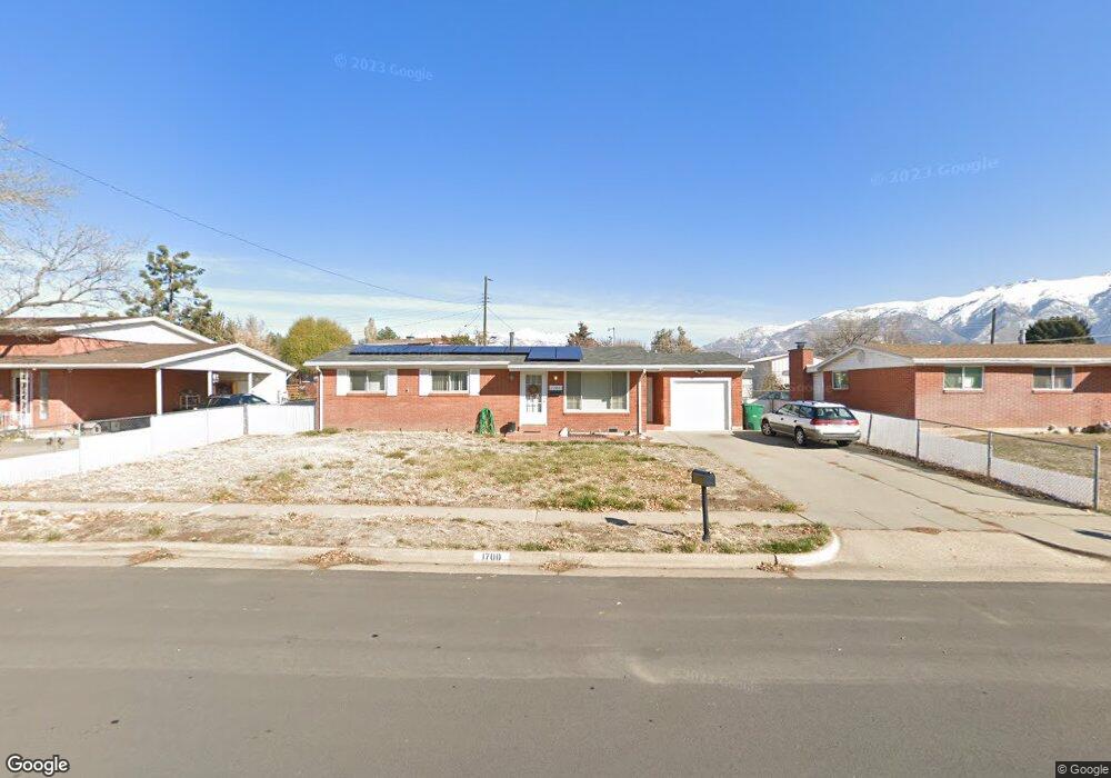
1700 Forbes St Layton, UT 84041
Estimated Value: $397,000 - $433,000
2
Beds
2
Baths
1,580
Sq Ft
$262/Sq Ft
Est. Value
About This Home
This home is located at 1700 Forbes St, Layton, UT 84041 and is currently estimated at $413,617, approximately $261 per square foot. 1700 Forbes St is a home located in Davis County with nearby schools including Lincoln Elementary School, North Layton Junior High School, and Northridge High School.
Ownership History
Date
Name
Owned For
Owner Type
Purchase Details
Closed on
Apr 22, 2020
Sold by
Bryce Stacy and Bryce Jarett
Bought by
Bryce Jarett and Bryce Stacy
Current Estimated Value
Home Financials for this Owner
Home Financials are based on the most recent Mortgage that was taken out on this home.
Original Mortgage
$203,000
Outstanding Balance
$179,492
Interest Rate
3.3%
Mortgage Type
New Conventional
Estimated Equity
$234,125
Purchase Details
Closed on
Oct 5, 2018
Sold by
Kirkpatrick Roxie E
Bought by
Bryce Stacy and Bryce Jarett
Home Financials for this Owner
Home Financials are based on the most recent Mortgage that was taken out on this home.
Original Mortgage
$202,730
Interest Rate
4.5%
Mortgage Type
New Conventional
Create a Home Valuation Report for This Property
The Home Valuation Report is an in-depth analysis detailing your home's value as well as a comparison with similar homes in the area
Home Values in the Area
Average Home Value in this Area
Purchase History
| Date | Buyer | Sale Price | Title Company |
|---|---|---|---|
| Bryce Jarett | -- | Blackman Titel Servi | |
| Bryce Stacy | -- | Backman Title Services |
Source: Public Records
Mortgage History
| Date | Status | Borrower | Loan Amount |
|---|---|---|---|
| Open | Bryce Jarett | $203,000 | |
| Closed | Bryce Stacy | $202,730 |
Source: Public Records
Tax History
| Year | Tax Paid | Tax Assessment Tax Assessment Total Assessment is a certain percentage of the fair market value that is determined by local assessors to be the total taxable value of land and additions on the property. | Land | Improvement |
|---|---|---|---|---|
| 2025 | $1,944 | $204,050 | $100,178 | $103,872 |
| 2024 | $1,878 | $198,551 | $116,837 | $81,714 |
| 2023 | $1,813 | $338,000 | $139,920 | $198,080 |
| 2022 | $1,815 | $183,700 | $73,674 | $110,026 |
| 2021 | $1,683 | $254,000 | $102,544 | $151,456 |
| 2020 | $1,533 | $222,000 | $86,619 | $135,381 |
| 2019 | $1,544 | $219,000 | $82,576 | $136,424 |
| 2018 | $1,369 | $195,000 | $82,576 | $112,424 |
| 2016 | $1,210 | $88,881 | $26,164 | $62,717 |
| 2015 | $1,139 | $79,421 | $26,164 | $53,257 |
| 2014 | $1,108 | $79,009 | $26,164 | $52,845 |
| 2013 | -- | $85,768 | $24,816 | $60,952 |
Source: Public Records
Map
Nearby Homes
- 1715 N Alder St
- 538 W 1875 N
- 1683 N 250 W
- 247 W 1925 N
- 1571 N 160 W
- 1500 N Angel St Unit 12
- 1500 N Angel St Unit 22
- 1908 N 200 W
- 2149 N 750 W
- 1094 N Angel St W
- 2211 N 525 W
- 506 W 2200 N
- 1148 N 350 W
- 1857 N 50 W
- 1617 N Angel St
- 2236 N 525 W
- 14 W Belvedere Way
- 1615 N Angel St W
- 2234 N 450 W
- 1627 N Angel St
- 1688 W Forbes St
- 1712 Forbes St
- 1688 Forbes St
- 631 W 1800 N
- 1717 Bennett St
- 1729 Bennett St
- 1724 Forbes St
- 1676 Forbes St
- 1701 N Forbes St
- 1701 Forbes St
- 617 W 1800 N
- 1711 Bennett St
- 1709 Forbes Ave W
- 621 Paul Ave
- 1677 Forbes St
- 1677 Forbes Ave W
- 1733 Bennett St
- 1701 Bennett St
- 1664 Forbes St
- 640 Delayne Cir
Your Personal Tour Guide
Ask me questions while you tour the home.