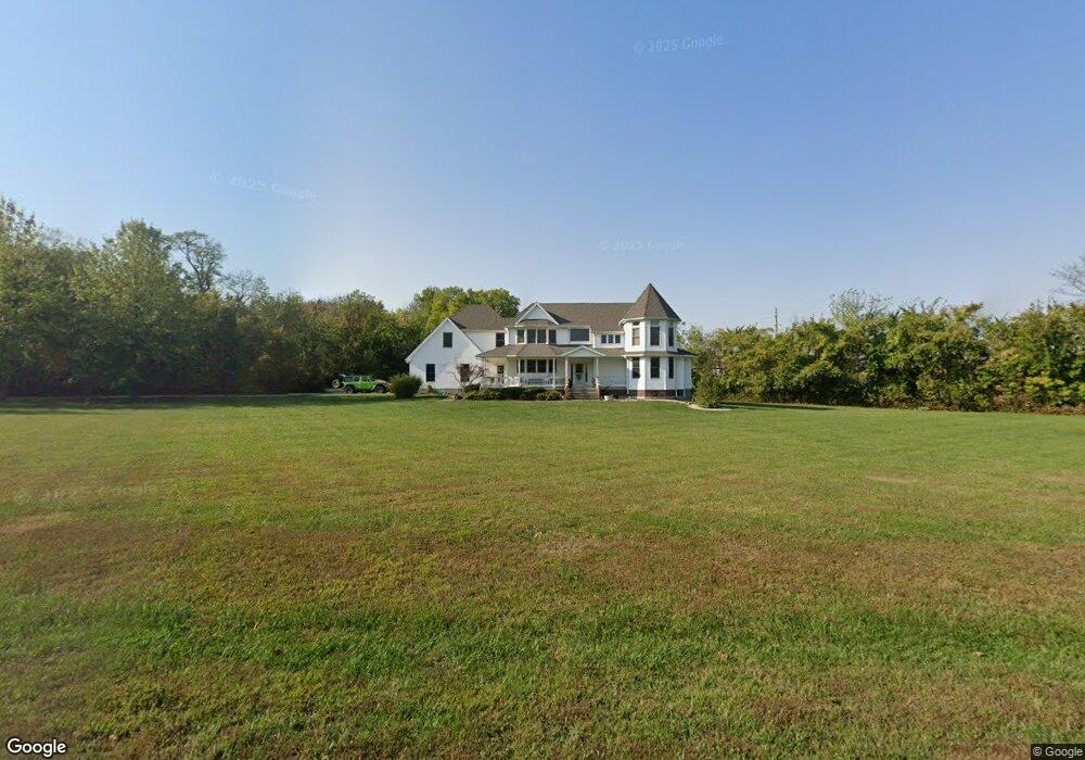
1700 Hawes Ln Oak Grove, MO 64075
Estimated Value: $520,000 - $800,881
4
Beds
4
Baths
3,608
Sq Ft
$177/Sq Ft
Est. Value
About This Home
This home is located at 1700 Hawes Ln, Oak Grove, MO 64075 and is currently estimated at $637,220, approximately $176 per square foot. 1700 Hawes Ln is a home located in Jackson County with nearby schools including Oak Grove Primary School, Oak Grove Elementary School, and Oak Grove Middle School.
Ownership History
Date
Name
Owned For
Owner Type
Purchase Details
Closed on
Jun 27, 2011
Sold by
Federal National Mortgage Association
Bought by
Frazier Shane
Current Estimated Value
Home Financials for this Owner
Home Financials are based on the most recent Mortgage that was taken out on this home.
Original Mortgage
$204,000
Outstanding Balance
$140,831
Interest Rate
4.66%
Mortgage Type
New Conventional
Estimated Equity
$496,389
Purchase Details
Closed on
Oct 4, 2010
Sold by
Hipsher Roger D
Bought by
Federal National Mortgage Association
Purchase Details
Closed on
Jun 22, 2005
Sold by
Hipsher Carrie L
Bought by
Hipsher Roger D
Purchase Details
Closed on
Sep 11, 1998
Sold by
Hawes Heirs Inc
Bought by
Hipsher Roger D and Hipsher Carrie L
Create a Home Valuation Report for This Property
The Home Valuation Report is an in-depth analysis detailing your home's value as well as a comparison with similar homes in the area
Home Values in the Area
Average Home Value in this Area
Purchase History
| Date | Buyer | Sale Price | Title Company |
|---|---|---|---|
| Frazier Shane | -- | Continental Title | |
| Federal National Mortgage Association | $259,400 | None Available | |
| Hipsher Roger D | -- | First American Title Ins Co | |
| Hipsher Roger D | -- | Stewart Title |
Source: Public Records
Mortgage History
| Date | Status | Borrower | Loan Amount |
|---|---|---|---|
| Open | Frazier Shane | $204,000 |
Source: Public Records
Tax History
| Year | Tax Paid | Tax Assessment Tax Assessment Total Assessment is a certain percentage of the fair market value that is determined by local assessors to be the total taxable value of land and additions on the property. | Land | Improvement |
|---|---|---|---|---|
| 2025 | $8,881 | $102,267 | $23,953 | $78,314 |
| 2024 | $8,797 | $113,761 | $3,887 | $109,874 |
| 2023 | $8,797 | $113,761 | $3,887 | $109,874 |
| 2022 | $6,420 | $75,743 | $2,221 | $73,522 |
| 2021 | $6,281 | $75,743 | $2,221 | $73,522 |
| 2020 | $6,135 | $72,044 | $2,221 | $69,823 |
| 2019 | $5,838 | $72,044 | $2,221 | $69,823 |
| 2018 | $4,606 | $63,303 | $2,224 | $61,079 |
| 2017 | $4,606 | $59,573 | $2,224 | $57,349 |
| 2016 | $4,636 | $58,136 | $2,224 | $55,912 |
Source: Public Records
Map
Nearby Homes
- 1203 SW Burns Ct
- 1703 Hawes Ln
- 1602 SW Timberline Rd
- 1112 SW 10th Terrace
- 1103 SW 10th Terrace
- 1104 SW 10th Terrace
- 1202 SW Cardinal Ct
- 1005 SW Bluebird Ln
- 907 SW Bluebird Ln
- 901 SW Redbird Ct
- 903 SW Redbird Ct
- 1402 SW 9th Terrace
- 902 SW Redbird Ct
- 903 SW Bluebird Ln
- 1503 SW Meadowlark Ct
- 1807 SW Cemetery Rd
- 902 SW Bluebird Ln
- 1501 SW 9th St
- 1505 SW Meadowlark Ct
- 1502 SW Meadowlark Ct
- 1203 SW Burns Cir
- 1203 SW Burns Cir
- 1205 SW Burns Cir
- 1200 SW Burns Cir
- 1115 SW 13th St
- 1701 Hawes Ln
- 1113 SW 13th St
- 1117 SW 13th St
- 1204 SW Burns Cir
- 1204 SW Burns Cir
- 1608 Deer Run Rd
- 1611 Deer Run Rd
- 1109 SW 13th St
- 1206 SW Burns Cir
- 1107 SW 13th St
- 1705 SW Red Fox Cir
- 1609 Deer Run Rd
- 1112 SW 13th St
- 1105 SW 13th St
- 1114 SW 13th St
Your Personal Tour Guide
Ask me questions while you tour the home.