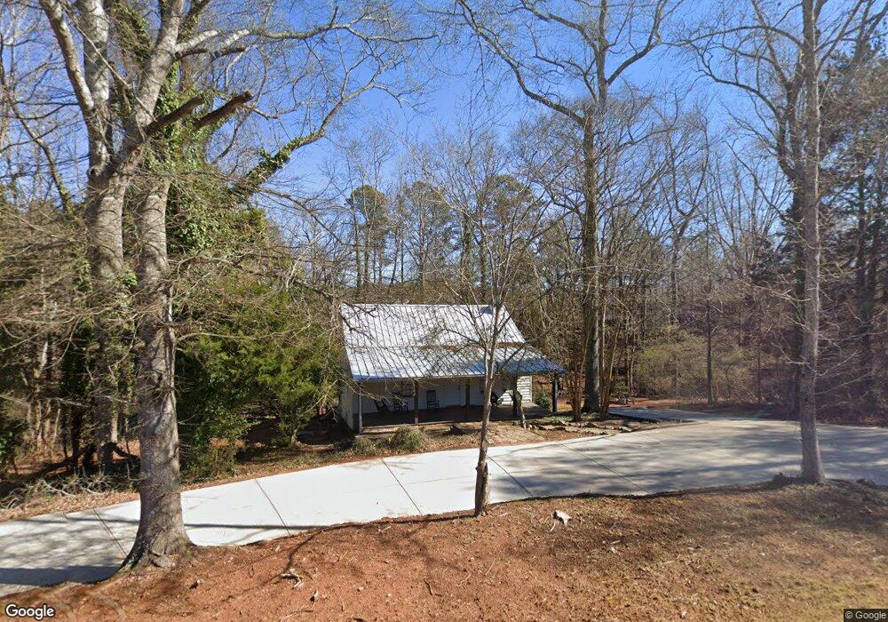
1700 Jimmy Daniel Rd Bogart, GA 30622
Estimated Value: $394,435 - $420,000
--
Bed
--
Bath
1,653
Sq Ft
$244/Sq Ft
Est. Value
About This Home
This home is located at 1700 Jimmy Daniel Rd, Bogart, GA 30622 and is currently estimated at $402,859, approximately $243 per square foot. 1700 Jimmy Daniel Rd is a home located in Oconee County with nearby schools including Malcom Bridge Elementary School, Malcom Bridge Middle School, and North Oconee High School.
Ownership History
Date
Name
Owned For
Owner Type
Purchase Details
Closed on
Jun 30, 2022
Sold by
Ipswich Castle Partners Llc
Bought by
Chapman Daniel C
Current Estimated Value
Purchase Details
Closed on
Apr 16, 2021
Sold by
Mccarthy Leslie
Bought by
Ipswich Castle Partners Llc
Home Financials for this Owner
Home Financials are based on the most recent Mortgage that was taken out on this home.
Original Mortgage
$198,600
Interest Rate
3%
Mortgage Type
New Conventional
Purchase Details
Closed on
Oct 25, 2016
Sold by
Jones Thomas C
Bought by
Mccarthy Leslie and Mccarthy Norman A
Home Financials for this Owner
Home Financials are based on the most recent Mortgage that was taken out on this home.
Original Mortgage
$114,960
Interest Rate
3.42%
Mortgage Type
New Conventional
Purchase Details
Closed on
Feb 28, 1997
Sold by
Hulon James N
Bought by
Jones Thomas Clagge
Create a Home Valuation Report for This Property
The Home Valuation Report is an in-depth analysis detailing your home's value as well as a comparison with similar homes in the area
Home Values in the Area
Average Home Value in this Area
Purchase History
| Date | Buyer | Sale Price | Title Company |
|---|---|---|---|
| Chapman Daniel C | $357,000 | -- | |
| Ipswich Castle Partners Llc | $223,000 | -- | |
| Mccarthy Leslie | $143,700 | -- | |
| Jones Thomas Clagge | $79,500 | -- |
Source: Public Records
Mortgage History
| Date | Status | Borrower | Loan Amount |
|---|---|---|---|
| Previous Owner | Ipswich Castle Partners Llc | $198,600 | |
| Previous Owner | Mccarthy Leslie | $114,960 |
Source: Public Records
Tax History Compared to Growth
Tax History
| Year | Tax Paid | Tax Assessment Tax Assessment Total Assessment is a certain percentage of the fair market value that is determined by local assessors to be the total taxable value of land and additions on the property. | Land | Improvement |
|---|---|---|---|---|
| 2024 | $2,462 | $131,769 | $32,954 | $98,815 |
| 2023 | $2,462 | $119,983 | $27,462 | $92,521 |
| 2022 | $1,914 | $103,152 | $24,965 | $78,187 |
| 2021 | $1,548 | $66,880 | $19,658 | $47,222 |
| 2020 | $1,403 | $60,503 | $16,113 | $44,390 |
| 2019 | $1,345 | $58,001 | $16,113 | $41,888 |
| 2018 | $1,334 | $56,336 | $16,113 | $40,223 |
| 2017 | $1,214 | $51,260 | $15,346 | $35,914 |
| 2016 | $968 | $40,872 | $12,080 | $28,792 |
| 2015 | $964 | $40,624 | $12,080 | $28,545 |
| 2014 | $941 | $38,760 | $11,504 | $27,255 |
| 2013 | -- | $36,949 | $11,504 | $25,444 |
Source: Public Records
Map
Nearby Homes
- 1700 Jimmy Daniel Rd
- 1102 Blackstone Ct
- 3492 Orchard Cir
- 2080 Orchard Walk
- 1191 Arizona Bend
- 2232 Orchard Cir
- 1110 Colorado Bend
- 1266 Orchard Way
- 1090 Kenway Dr
- 1930 New Jimmie Daniel Rd Unit Lot 3
- 1930 New Jimmie Daniel Rd Unit LOT 2
- 425 Classic Rd
- 1011 Meriweather Dr
- 123 Red Maple Dr
- 1080 Ramser Dr Unit 51
- 355 Commerce Blvd
- 310 Marlborough Downs Rd
- 321 Ridge Pointe Dr
- 1171 Blackstone Way
- 1141 Blackstone Way
- 1225 Blackstone Way
- 1109 Blackstone Way
- 1257 Blackstone Way
- 1079 Blackstone Way
- 1079 Blackstone Way
- 1047 Blackstone Way
- 1289 Blackstone Way
- 1289 Blackstone Way
- 1323 Blackstone Way
- 1323 Blackstone Way
- 1740 Jimmy Daniel Rd
- 1100 Silverleaf Rd
- 1359 Blackstone Way
- 1124 Blackstone Way
- 1228 Blackstone Way
- 1421 Blackstone Way Unit A 11
- 1421 Blackstone Way
- 1268 Blackstone Way