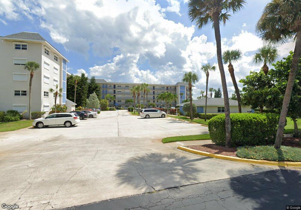
Port Royal 1700 N Atlantic Ave Unit 211 Cocoa Beach, FL 32931
Estimated Value: $373,453 - $476,000
--
Bed
--
Bath
1,572
Sq Ft
$278/Sq Ft
Est. Value
About This Home
This home is located at 1700 N Atlantic Ave Unit 211, Cocoa Beach, FL 32931 and is currently estimated at $437,613, approximately $278 per square foot. 1700 N Atlantic Ave Unit 211 is a home located in Brevard County with nearby schools including Cape View Elementary School, Cocoa Beach Junior/Senior High School, and Our Saviour School.
Ownership History
Date
Name
Owned For
Owner Type
Purchase Details
Closed on
Jan 12, 2015
Sold by
Hagerman Anmarie
Bought by
Krauss Robert J and Krauss Kathleen
Current Estimated Value
Purchase Details
Closed on
Sep 20, 2001
Sold by
Baker Denice B
Bought by
Krauss Robert J and Krauss Kathleen
Home Financials for this Owner
Home Financials are based on the most recent Mortgage that was taken out on this home.
Original Mortgage
$117,200
Interest Rate
6.89%
Mortgage Type
New Conventional
Create a Home Valuation Report for This Property
The Home Valuation Report is an in-depth analysis detailing your home's value as well as a comparison with similar homes in the area
Home Values in the Area
Average Home Value in this Area
Purchase History
| Date | Buyer | Sale Price | Title Company |
|---|---|---|---|
| Krauss Robert J | -- | Attorney | |
| Krauss Robert J | $146,500 | -- |
Source: Public Records
Mortgage History
| Date | Status | Borrower | Loan Amount |
|---|---|---|---|
| Previous Owner | Krauss Robert J | $117,200 |
Source: Public Records
Tax History Compared to Growth
Tax History
| Year | Tax Paid | Tax Assessment Tax Assessment Total Assessment is a certain percentage of the fair market value that is determined by local assessors to be the total taxable value of land and additions on the property. | Land | Improvement |
|---|---|---|---|---|
| 2025 | $2,586 | $203,050 | -- | -- |
| 2024 | $2,526 | $197,330 | -- | -- |
| 2023 | $2,526 | $191,590 | $0 | $0 |
| 2022 | $2,329 | $186,010 | $0 | $0 |
| 2021 | $2,319 | $180,600 | $0 | $0 |
| 2020 | $2,297 | $178,110 | $0 | $0 |
| 2019 | $2,277 | $174,110 | $0 | $0 |
| 2018 | $2,264 | $170,870 | $0 | $0 |
| 2017 | $2,273 | $167,360 | $0 | $0 |
| 2016 | $2,263 | $163,920 | $0 | $0 |
| 2015 | $2,261 | $162,790 | $0 | $0 |
| 2014 | $2,267 | $161,500 | $0 | $0 |
Source: Public Records
About Port Royal
Map
Nearby Homes
- 1700 N Atlantic Ave Unit 135
- 1700 N Atlantic Ave Unit 133
- 1700 N Atlantic Ave Unit 243
- 1830 N Atlantic Ave Unit C503
- 1830 N Atlantic Ave Unit C301
- 1830 N Atlantic Ave Unit C107
- 1890 N Atlantic Ave Unit A403
- 1860 N Atlantic Ave Unit B302
- 1595 N Atlantic Ave Unit 305
- 2020 N Atlantic Ave Unit 308-S
- 2020 N Atlantic Ave Unit S-503
- 2020 N Atlantic Ave Unit 402-N
- 2020 N Atlantic Ave Unit 112-S
- 2020 N Atlantic Ave Unit 614-N
- 2100 N Atlantic Ave Unit P4
- 2100 N Atlantic Ave Unit P3
- 2100 N Atlantic Ave Unit 1207
- 159 Antigua Dr
- 200 S Banana River Blvd Unit 803
- 200 S Banana River Blvd Unit 2424
- 1700 N Atlantic Ave Unit 151 5th Floor
- 1700 N Atlantic Ave
- 1700 N Atlantic Ave Unit 252
- 1700 N Atlantic Ave Unit 116
- 1700 N Atlantic Ave Unit 141
- 1700 N Atlantic Ave Unit 113
- 1700 N Atlantic Ave Unit 223
- 1700 N Atlantic Ave Unit 151
- 1700 N Atlantic Ave Unit 214
- 1700 N Atlantic Ave Unit 144
- 1700 N Atlantic Ave Unit 231
- 1700 N Atlantic Ave Unit 215
- 1700 N Atlantic Ave Unit 111
- 1700 N Atlantic Ave Unit 122
- 1700 N Atlantic Ave Unit 251
- 1700 N Atlantic Ave Unit 245
- 1700 N Atlantic Ave Unit 212
- 1700 N Atlantic Ave Unit 156
- 1700 N Atlantic Ave Unit 146
- 1700 N Atlantic Ave Unit 242