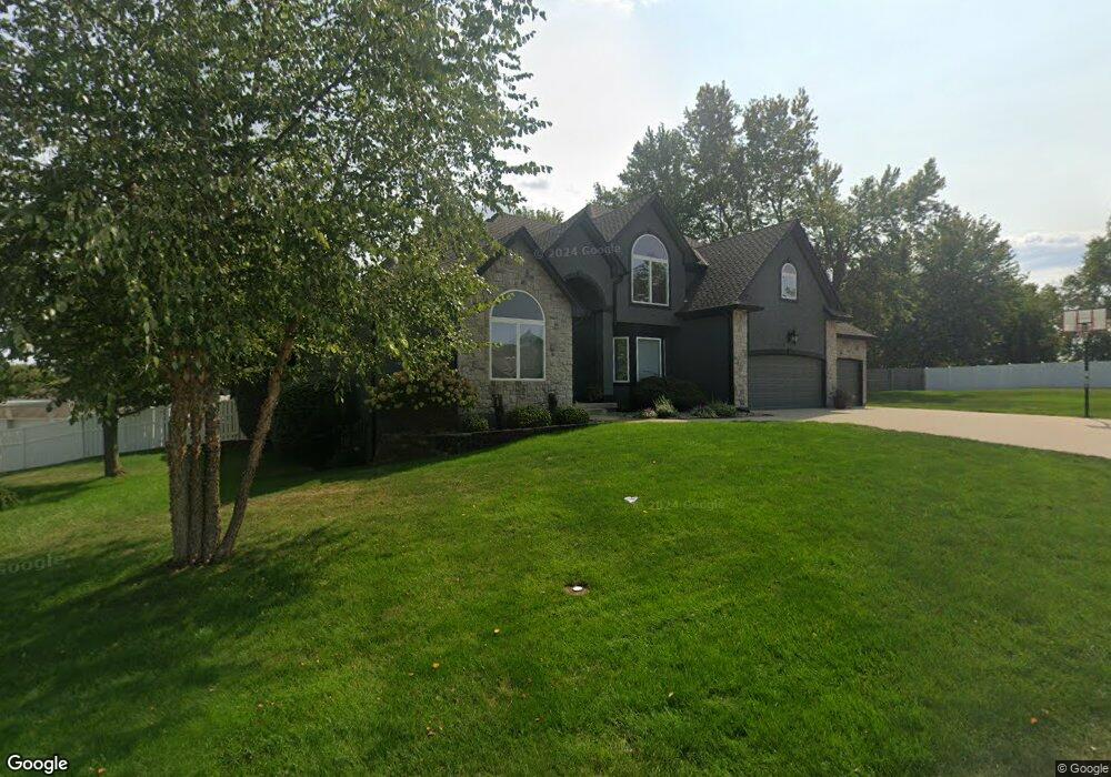
1700 NE Peregrin Dr Blue Springs, MO 64014
Estimated Value: $474,000 - $631,000
4
Beds
4
Baths
3,483
Sq Ft
$162/Sq Ft
Est. Value
About This Home
This home is located at 1700 NE Peregrin Dr, Blue Springs, MO 64014 and is currently estimated at $563,375, approximately $161 per square foot. 1700 NE Peregrin Dr is a home located in Jackson County with nearby schools including Lucy Franklin Elementary School, Brittany Hill Middle School, and Blue Springs High School.
Ownership History
Date
Name
Owned For
Owner Type
Purchase Details
Closed on
Jun 19, 2020
Sold by
Lake Rachel and Lake James
Bought by
Moore Tyler and Moore Jennifer N
Current Estimated Value
Home Financials for this Owner
Home Financials are based on the most recent Mortgage that was taken out on this home.
Original Mortgage
$200,000
Outstanding Balance
$177,285
Interest Rate
3.2%
Mortgage Type
Credit Line Revolving
Estimated Equity
$386,090
Purchase Details
Closed on
Aug 27, 2004
Sold by
Bennett Properties Inc
Bought by
Moore Michael B and Moore Kris M
Home Financials for this Owner
Home Financials are based on the most recent Mortgage that was taken out on this home.
Original Mortgage
$324,000
Interest Rate
5.12%
Mortgage Type
Purchase Money Mortgage
Create a Home Valuation Report for This Property
The Home Valuation Report is an in-depth analysis detailing your home's value as well as a comparison with similar homes in the area
Home Values in the Area
Average Home Value in this Area
Purchase History
| Date | Buyer | Sale Price | Title Company |
|---|---|---|---|
| Moore Tyler | -- | Security 1St Title Llc | |
| Moore Michael B | -- | Security Land Title Company |
Source: Public Records
Mortgage History
| Date | Status | Borrower | Loan Amount |
|---|---|---|---|
| Open | Moore Tyler | $200,000 | |
| Previous Owner | Moore Michael B | $324,000 |
Source: Public Records
Tax History Compared to Growth
Tax History
| Year | Tax Paid | Tax Assessment Tax Assessment Total Assessment is a certain percentage of the fair market value that is determined by local assessors to be the total taxable value of land and additions on the property. | Land | Improvement |
|---|---|---|---|---|
| 2025 | $8,545 | $120,447 | $14,607 | $105,840 |
| 2024 | $8,381 | $104,738 | $10,625 | $94,113 |
| 2023 | $8,381 | $104,738 | $12,829 | $91,909 |
| 2022 | $9,031 | $99,750 | $11,609 | $88,141 |
| 2021 | $9,023 | $99,750 | $11,609 | $88,141 |
| 2020 | $7,723 | $86,849 | $11,609 | $75,240 |
| 2019 | $7,467 | $86,849 | $11,609 | $75,240 |
| 2018 | $6,730 | $75,348 | $8,981 | $66,367 |
| 2017 | $6,730 | $75,348 | $8,981 | $66,367 |
| 2016 | $6,154 | $69,084 | $9,747 | $59,337 |
| 2014 | $5,852 | $65,480 | $9,734 | $55,746 |
Source: Public Records
Map
Nearby Homes
- 1406 NE Hunters Ct
- 2332 NE Andromada Ct
- 2367 NE Skopelos Ct
- 2400 NE Porter Rd
- 2376 NE Skopelos Ct
- 2373 NE Colonnade Ave
- 2369 NE Colonnade Ave
- 1320 NE Quail Walk Dr
- 2344 NE Skopelos Ct
- 2353 NE Colonnade Ave
- 1204 NE Quail Walk Dr
- 2345 NE Colonnade Ave
- 2360 NE Colonnade Ave
- 2341 NE Colonnade Ave
- 2352 NE Colonnade Ave
- 2417 NE Quail Walk Trail
- 2344 NE Colonnade Ave
- 2301 NE Colonnade
- 2340 NE Colonnade Ave
- 2372 NE Colonnade Ave
- 2504 NE Prairie Falcon
- 2501 NE Prairie Falcon Dr
- 2505 NE Prairie Falcon
- 1704 NE Peregrin Dr
- 1655 NE Roanoke Dr
- 1705 NE Peregrin Dr
- 2405 NE Falcon Wood Dr
- 2508 NE Prairie Falcon Dr
- 2509 NE Prairie Falcon Dr
- 2603 NE Prairie Falcon
- 2507 NE Falcon Wood Dr
- 2602 NE Prairie Falcon Dr
- 2401 NE Falcon Wood Dr
- 2601 NE Falcon Wood Dr
- 2410 NE Falcon Wood Dr
- 2502 NE Falcon Wood Dr
- 2404 NE Falcon Wood Dr
- 2607 NE Prairie Falcon Dr
- 2606 NE Prairie Falcon Dr
- 2506 NE Falcon Wood Dr