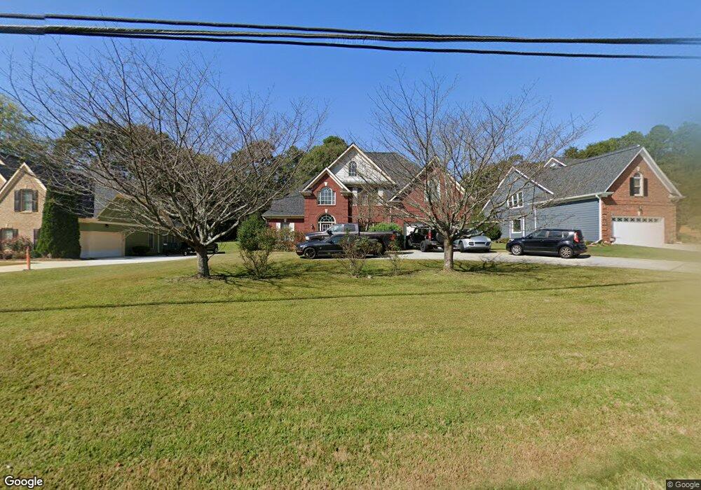
1700 S Gordon Rd Austell, GA 30168
Estimated Value: $440,000 - $551,000
4
Beds
3
Baths
2,750
Sq Ft
$178/Sq Ft
Est. Value
About This Home
This home is located at 1700 S Gordon Rd, Austell, GA 30168 and is currently estimated at $490,279, approximately $178 per square foot. 1700 S Gordon Rd is a home located in Cobb County with nearby schools including Bryant Elementary School, Lindley Middle School, and Pebblebrook High School.
Ownership History
Date
Name
Owned For
Owner Type
Purchase Details
Closed on
Jun 18, 2025
Sold by
Primus Theodore R
Bought by
Broadnax Demitria
Current Estimated Value
Purchase Details
Closed on
Mar 16, 2007
Sold by
Joseph Tyson Hms Inc
Bought by
Primus Theodore R
Home Financials for this Owner
Home Financials are based on the most recent Mortgage that was taken out on this home.
Original Mortgage
$288,000
Interest Rate
6.15%
Mortgage Type
New Conventional
Create a Home Valuation Report for This Property
The Home Valuation Report is an in-depth analysis detailing your home's value as well as a comparison with similar homes in the area
Home Values in the Area
Average Home Value in this Area
Purchase History
| Date | Buyer | Sale Price | Title Company |
|---|---|---|---|
| Broadnax Demitria | -- | None Listed On Document | |
| Broadnax Demitria | -- | None Listed On Document | |
| Primus Theodore R | $288,000 | -- |
Source: Public Records
Mortgage History
| Date | Status | Borrower | Loan Amount |
|---|---|---|---|
| Previous Owner | Primus Theodore R | $288,000 |
Source: Public Records
Tax History
| Year | Tax Paid | Tax Assessment Tax Assessment Total Assessment is a certain percentage of the fair market value that is determined by local assessors to be the total taxable value of land and additions on the property. | Land | Improvement |
|---|---|---|---|---|
| 2025 | $4,875 | $194,684 | $32,600 | $162,084 |
| 2024 | $4,879 | $194,684 | $32,600 | $162,084 |
| 2023 | $3,680 | $164,428 | $32,600 | $131,828 |
| 2022 | $3,470 | $128,644 | $20,588 | $108,056 |
| 2021 | $3,105 | $111,960 | $17,844 | $94,116 |
| 2020 | $2,999 | $107,844 | $13,728 | $94,116 |
| 2019 | $2,999 | $107,844 | $13,728 | $94,116 |
| 2018 | $2,612 | $95,064 | $7,892 | $87,172 |
| 2017 | $1,771 | $70,524 | $5,148 | $65,376 |
| 2016 | $1,772 | $70,524 | $5,148 | $65,376 |
| 2015 | $1,895 | $73,168 | $3,432 | $69,736 |
| 2014 | $1,689 | $65,680 | $0 | $0 |
Source: Public Records
Map
Nearby Homes
- 6559 Brandemere Way
- 6563 Brandemere Way
- 1151 S Gordon Rd
- 6445 Sherwood Trail
- 1784 Brandemere Dr Unit 3
- 1576 S Gordon Rd
- 6595 Malvin Dr
- 6651 Malvin Dr
- 6708 S Dillon Rd
- 1961 Abbey Province
- 1972 Cox Dr Unit 5
- 6718 Roscommon Dr
- 1405 Dillon Rd
- 1531 Withmoor Terrace
- 1541 Withmoor Terrace
- 6627 Coventry Point
- 1603 Pecan Log Place
- 6496 Drake Manor
- 6486 Drake Manor
- 6488 Drake Manor
- 1690 S Gordon Rd
- 1710 S Gordon Rd
- 6347 Milo Dr
- 1676 S Gordon Rd
- 6343 Milo Dr
- 1701 Brandemere Dr
- 455 Brandemere Dr
- 1689 S Gordon Rd
- 6350 Milo Dr
- 1677 S Gordon Rd
- 6339 Milo Dr
- 1705 Brandemere Dr Unit 1
- 6346 Milo Dr
- 1602 Brandemere Ln
- 1602 Brandemere Ln Unit 1602
- 1750 Nan Ct
- 1709 Brandemere Dr
- 1606 Brandemere Ln Unit 1
- 6558 Dunwoody Trail
- 6342 Milo Dr
Your Personal Tour Guide
Ask me questions while you tour the home.