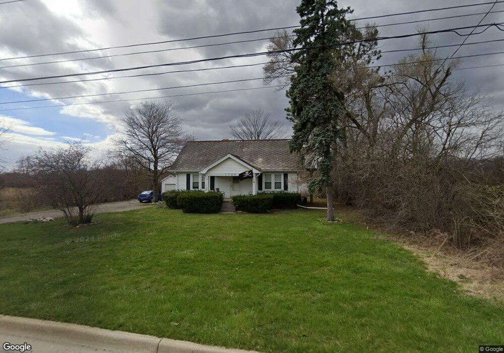
1700 S Wagner Rd Ann Arbor, MI 48103
Estimated Value: $391,000 - $471,000
--
Bed
--
Bath
1,346
Sq Ft
$316/Sq Ft
Est. Value
About This Home
This home is located at 1700 S Wagner Rd, Ann Arbor, MI 48103 and is currently estimated at $425,560, approximately $316 per square foot. 1700 S Wagner Rd is a home located in Washtenaw County with nearby schools including Lakewood Elementary School, Slauson Middle School, and Pioneer High School.
Ownership History
Date
Name
Owned For
Owner Type
Purchase Details
Closed on
May 24, 2017
Sold by
Reiff Andrew A
Bought by
1700 Wanger Llc
Current Estimated Value
Purchase Details
Closed on
Oct 12, 2006
Sold by
Frederick Shirley J
Bought by
Reiff Andrew A
Home Financials for this Owner
Home Financials are based on the most recent Mortgage that was taken out on this home.
Original Mortgage
$200,000
Interest Rate
6.5%
Mortgage Type
Purchase Money Mortgage
Create a Home Valuation Report for This Property
The Home Valuation Report is an in-depth analysis detailing your home's value as well as a comparison with similar homes in the area
Home Values in the Area
Average Home Value in this Area
Purchase History
| Date | Buyer | Sale Price | Title Company |
|---|---|---|---|
| 1700 Wanger Llc | -- | None Available | |
| Reiff Andrew A | $223,107 | Ab |
Source: Public Records
Mortgage History
| Date | Status | Borrower | Loan Amount |
|---|---|---|---|
| Previous Owner | Reiff Andrew A | $200,000 |
Source: Public Records
Tax History Compared to Growth
Tax History
| Year | Tax Paid | Tax Assessment Tax Assessment Total Assessment is a certain percentage of the fair market value that is determined by local assessors to be the total taxable value of land and additions on the property. | Land | Improvement |
|---|---|---|---|---|
| 2025 | -- | $178,900 | $0 | $0 |
| 2024 | $4,103 | $166,400 | $0 | $0 |
| 2023 | $3,914 | $152,800 | $0 | $0 |
| 2022 | $5,972 | $134,100 | $0 | $0 |
| 2021 | $5,786 | $132,500 | $0 | $0 |
| 2020 | $5,760 | $127,500 | $0 | $0 |
| 2019 | $5,382 | $122,300 | $122,300 | $0 |
| 2018 | $5,245 | $112,000 | $0 | $0 |
| 2017 | $3,698 | $118,400 | $0 | $0 |
| 2016 | $2,501 | $98,358 | $0 | $0 |
| 2015 | -- | $98,064 | $0 | $0 |
| 2014 | -- | $95,000 | $0 | $0 |
| 2013 | -- | $95,000 | $0 | $0 |
Source: Public Records
Map
Nearby Homes
- 1860 Chicory Ridge
- 1419 N Bay Dr Unit 73
- 1255 Joyce Ln Unit 1
- 1366 N Bay Dr Unit 144
- 1343 Timmins Dr Unit 8
- 1929 Harley Dr
- 1599 Scio Ridge Rd
- 1008 W Summerfield Glen Cir
- 1740 S Maple Rd Unit 2
- 1041 E Summerfield Glen Cir
- 922 W Summerfield Glen Cir Unit 110
- 818 W Summerfield
- #24 Loon Ln
- #53 Loon Ln
- 1225 S Maple Rd Unit 307
- The Champlain Plan at Cranbrook of Scio
- The Vallecito Plan at Cranbrook of Scio
- The Palisade Plan at Cranbrook of Scio
- The Marion Plan at Cranbrook of Scio
- The Granada Plan at Cranbrook of Scio
- 0 Hawk Crest Unit 4040026
- 0 Hawk Crest Unit 4015851
- 0 Hawk Crest Unit 4016104
- 0 Hawk Crest Unit 4015852
- 0 Hawk Crest Unit 4015854
- 0 Hawk Crest Unit 4165046
- 0 Hawk Crest Unit 4442285
- 0 Hawk Crest Unit 957978
- 0 Hawk Crest Unit 2801536
- 0 Hawk Crest Unit 4536540
- 0 Hawk Crest Unit 2810671
- 0 Hawk Crest Unit 958699
- 0 Hawk Crest Unit 4646261
- 0 Hawk Crest Unit 4659160
- 0 Hawk Crest Unit 4680894
- 0 Hawk Crest Unit 959518
- 0 Hawk Crest Unit 2906247
- 0 Hawk Crest Unit 3005237
- 0 Hawk Crest Unit 3100498
- 0 Hawk Crest Unit 3202006