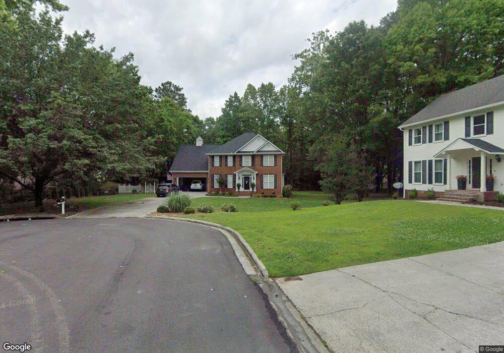
1700 Westchester Dr Dalton, GA 30720
Estimated Value: $473,617 - $530,000
4
Beds
3
Baths
3,020
Sq Ft
$169/Sq Ft
Est. Value
About This Home
This home is located at 1700 Westchester Dr, Dalton, GA 30720 and is currently estimated at $509,904, approximately $168 per square foot. 1700 Westchester Dr is a home located in Whitfield County with nearby schools including Brookwood Elementary School, Dalton Middle School, and Dalton High School.
Ownership History
Date
Name
Owned For
Owner Type
Purchase Details
Closed on
Mar 24, 2023
Sold by
Mitchell David W
Bought by
Brown Justin Lamar and Brown Elizabeth Ashley
Current Estimated Value
Home Financials for this Owner
Home Financials are based on the most recent Mortgage that was taken out on this home.
Original Mortgage
$284,828
Outstanding Balance
$276,187
Interest Rate
6.32%
Mortgage Type
FHA
Estimated Equity
$233,717
Purchase Details
Closed on
Sep 23, 2005
Sold by
Not Provided
Bought by
Mitchell Erwin
Purchase Details
Closed on
Oct 14, 2002
Sold by
Brumlow Michael A and Cooper Les
Bought by
Brumlow Michael A and Brumlow Leslie G
Purchase Details
Closed on
May 23, 2000
Sold by
Corbin Betty Ann
Bought by
Brumlow Michael A and Cooper Leslie G
Purchase Details
Closed on
Oct 1, 1999
Bought by
Corbin Betty Ann
Create a Home Valuation Report for This Property
The Home Valuation Report is an in-depth analysis detailing your home's value as well as a comparison with similar homes in the area
Home Values in the Area
Average Home Value in this Area
Purchase History
| Date | Buyer | Sale Price | Title Company |
|---|---|---|---|
| Brown Justin Lamar | $399,900 | -- | |
| Mitchell Erwin | $261,500 | -- | |
| Brumlow Michael A | -- | -- | |
| Brumlow Michael A | $215,000 | -- | |
| Corbin Betty Ann | $29,000 | -- |
Source: Public Records
Mortgage History
| Date | Status | Borrower | Loan Amount |
|---|---|---|---|
| Open | Brown Justin Lamar | $284,828 |
Source: Public Records
Tax History Compared to Growth
Tax History
| Year | Tax Paid | Tax Assessment Tax Assessment Total Assessment is a certain percentage of the fair market value that is determined by local assessors to be the total taxable value of land and additions on the property. | Land | Improvement |
|---|---|---|---|---|
| 2024 | $4,456 | $188,043 | $24,200 | $163,843 |
| 2023 | $4,456 | $142,870 | $20,000 | $122,870 |
| 2022 | $3,699 | $114,802 | $18,400 | $96,402 |
| 2021 | $3,621 | $112,368 | $18,400 | $93,968 |
| 2020 | $3,750 | $112,368 | $18,400 | $93,968 |
| 2019 | $3,862 | $112,368 | $18,400 | $93,968 |
| 2018 | $4,214 | $112,368 | $18,400 | $93,968 |
| 2017 | $4,056 | $112,368 | $18,400 | $93,968 |
| 2016 | $3,562 | $98,065 | $12,600 | $85,465 |
| 2014 | $3,236 | $98,065 | $12,600 | $85,465 |
| 2013 | -- | $98,064 | $12,600 | $85,464 |
Source: Public Records
Map
Nearby Homes
- 1709 Dug Gap Rd
- 1913 Tara Place
- 1506 Summer Gate Way
- 1506 Summer Gate Way Unit 8
- 1922 Fairfield Dr
- 1704 Southmont Dr
- 1482 Mineral Springs Rd
- 1498 Mineral Springs Rd
- 1608 Ryman Ridge Rd
- 0 Horizon Ct Unit 130497
- 0 Horizon Ct Unit 130499
- 0 Horizon Ct Unit 130479
- 0 Horizon Ct Unit 130477
- 0 Horizon Ct Unit 130478
- 0 Horizon Ct Unit 130496
- 0 Horizon Ct Unit 130498
- 1934 Spring Chase Way
- 00 Rio Vista Dr
- 702 Courtland Dr
- 1908 Valley Brook Dr
- 1701 Westchester Dr
- 1703 Habersham Way
- 1909 Villa Way
- 1706 Habersham Way
- 1703 Westchester Dr
- 1702 Westchester Dr
- 1907 Villa Way
- 1915 Fairington Dr
- 1908 Villa Way
- 1704 Westchester Dr
- 1705 Westchester Dr
- 1704 Habersham Way
- 713 Hackney Dr
- 1905 Villa Way Unit 3
- 1917 Fairington Dr
- 1906 Villa Way Unit 9
- 2006 Sheffield Place
- 1706 Dug Gap Rd
- 1708 Dug Gap Rd
- 1706 Westchester Dr