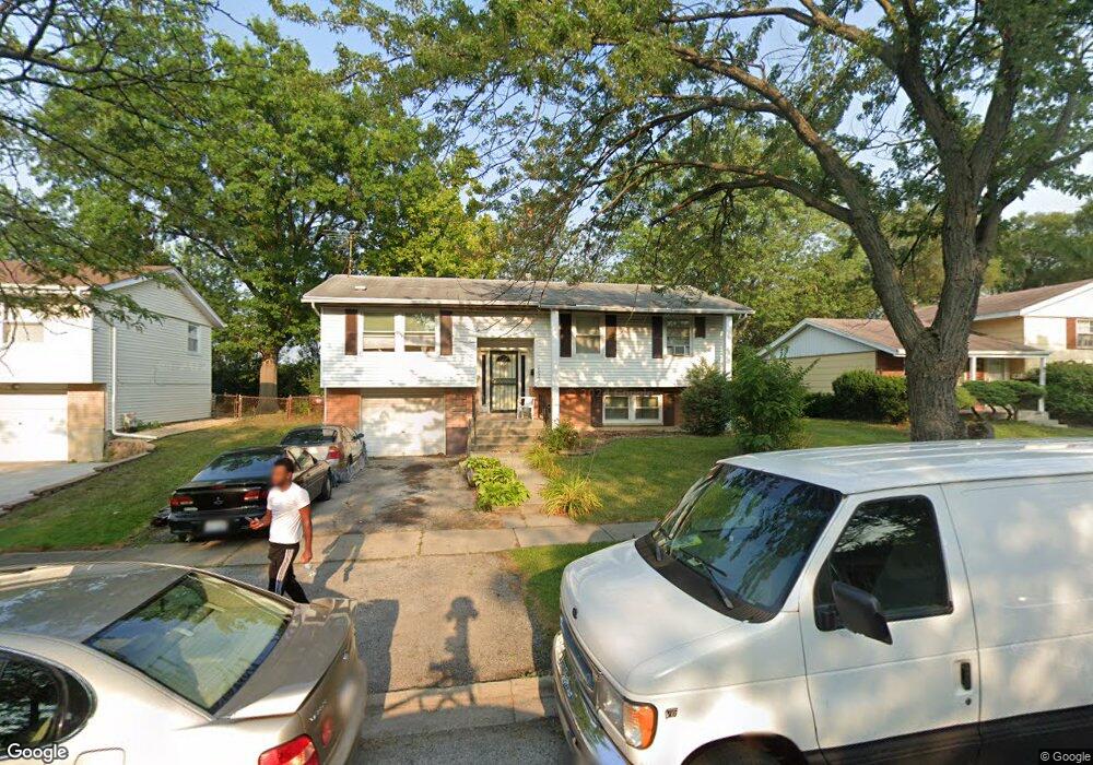
17005 Locust Dr Hazel Crest, IL 60429
Estimated Value: $172,000 - $243,000
3
Beds
2
Baths
1,056
Sq Ft
$195/Sq Ft
Est. Value
About This Home
This home is located at 17005 Locust Dr, Hazel Crest, IL 60429 and is currently estimated at $205,573, approximately $194 per square foot. 17005 Locust Dr is a home located in Cook County with nearby schools including Highlands Elementary School, Prairie-Hills Junior High School, and Hillcrest High School.
Ownership History
Date
Name
Owned For
Owner Type
Purchase Details
Closed on
Jun 22, 1998
Sold by
Hud
Bought by
Valentine Lawanda F
Current Estimated Value
Home Financials for this Owner
Home Financials are based on the most recent Mortgage that was taken out on this home.
Original Mortgage
$92,600
Interest Rate
6.9%
Mortgage Type
FHA
Purchase Details
Closed on
Oct 19, 1993
Sold by
Roberson Jimmie L and Roberson Hortense D
Bought by
Burns Edward R
Create a Home Valuation Report for This Property
The Home Valuation Report is an in-depth analysis detailing your home's value as well as a comparison with similar homes in the area
Home Values in the Area
Average Home Value in this Area
Purchase History
| Date | Buyer | Sale Price | Title Company |
|---|---|---|---|
| Valentine Lawanda F | -- | -- | |
| Burns Edward R | $51,333 | -- |
Source: Public Records
Mortgage History
| Date | Status | Borrower | Loan Amount |
|---|---|---|---|
| Previous Owner | Valentine Lawanda F | $92,600 |
Source: Public Records
Tax History
| Year | Tax Paid | Tax Assessment Tax Assessment Total Assessment is a certain percentage of the fair market value that is determined by local assessors to be the total taxable value of land and additions on the property. | Land | Improvement |
|---|---|---|---|---|
| 2025 | $6,498 | $16,000 | $2,535 | $13,465 |
| 2024 | $6,498 | $16,000 | $2,535 | $13,465 |
| 2023 | $4,208 | $16,000 | $2,535 | $13,465 |
| 2022 | $4,208 | $9,152 | $2,145 | $7,007 |
| 2021 | $4,119 | $9,152 | $2,145 | $7,007 |
| 2020 | $4,064 | $9,152 | $2,145 | $7,007 |
| 2019 | $3,656 | $8,889 | $1,950 | $6,939 |
| 2018 | $3,539 | $8,889 | $1,950 | $6,939 |
| 2017 | $3,342 | $8,889 | $1,950 | $6,939 |
| 2016 | $2,996 | $7,621 | $1,755 | $5,866 |
| 2015 | $2,799 | $7,621 | $1,755 | $5,866 |
| 2014 | $2,760 | $7,621 | $1,755 | $5,866 |
| 2013 | $3,368 | $9,662 | $1,755 | $7,907 |
Source: Public Records
Map
Nearby Homes
- 3509 Birchwood Dr
- 3511 Laurel Ln
- 3425 Birchwood Dr
- 17000 Magnolia Dr
- 16916 Magnolia Dr
- 17007 Elm Dr
- 17113 Elm Dr
- 17206 Elm Dr
- 3318 Tulip Dr
- 3312 Maple Ln
- 3316 Birchwood Dr
- 17213 Springtide Ln
- 3735 169th St
- 16827 Glen Oaks Dr
- 3737 168th Place
- 3806 172nd St
- 17316 Central Park Ave
- 3214 Birchwood Dr
- 16948 Briargate Dr
- 17303 Appletree Dr
- 17003 Locust Dr
- 17007 Locust Dr
- 17006 Locust Dr
- 17008 Locust Dr
- 17011 Locust Dr
- 17004 Locust Dr
- 17010 Locust Dr
- 17002 Locust Dr
- 17012 Locust Dr
- 17001 Locust Dr
- 17001 Locust Dr
- 17000 Locust Dr
- 17014 Locust Dr
- 17011 Central Park Ave
- 17013 Central Park Ave
- 17009 Central Park Ave
- 17015 Central Park Ave
- 17105 Locust Dr
- 3519 Chestnut Dr
Your Personal Tour Guide
Ask me questions while you tour the home.