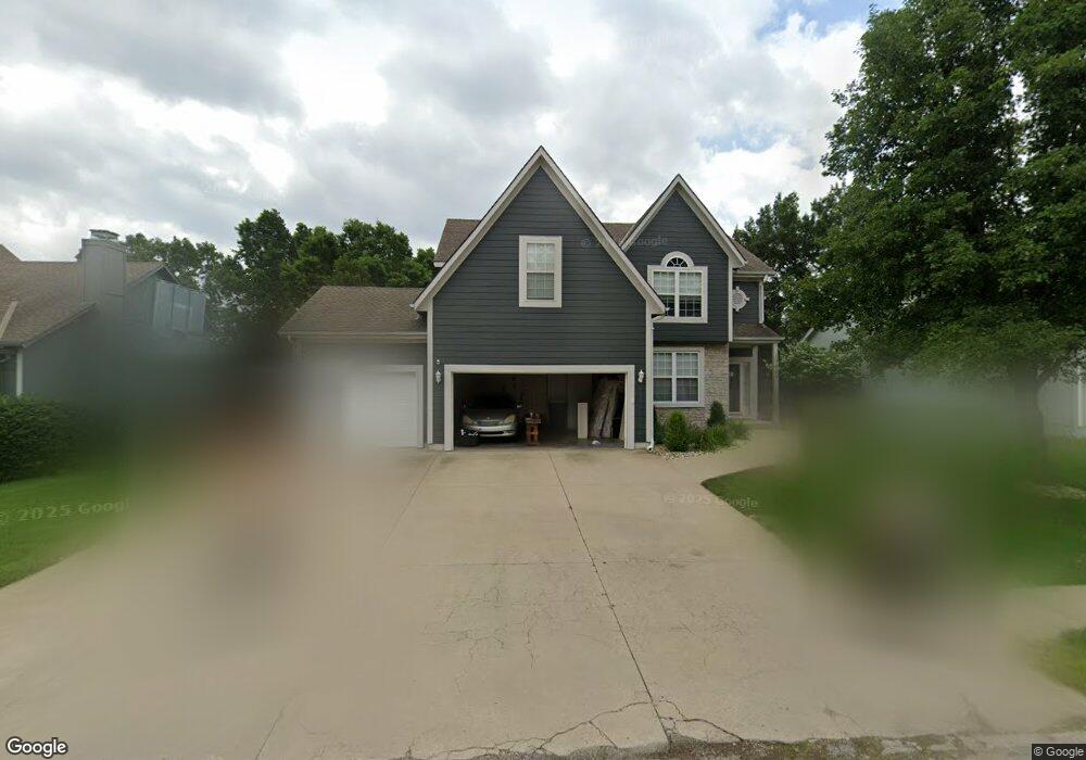
17009 E 43rd St S Independence, MO 64055
39th East NeighborhoodEstimated Value: $351,000 - $364,000
5
Beds
4
Baths
2,260
Sq Ft
$158/Sq Ft
Est. Value
About This Home
This home is located at 17009 E 43rd St S, Independence, MO 64055 and is currently estimated at $356,124, approximately $157 per square foot. 17009 E 43rd St S is a home located in Jackson County with nearby schools including William Yates Elementary School, Delta Woods Middle School, and Blue Springs High School.
Ownership History
Date
Name
Owned For
Owner Type
Purchase Details
Closed on
Sep 29, 2017
Sold by
Nimmo Jeff M and Nimmo Patricia A
Bought by
Davis Theron M and Davis Theron
Current Estimated Value
Home Financials for this Owner
Home Financials are based on the most recent Mortgage that was taken out on this home.
Original Mortgage
$171,200
Outstanding Balance
$142,656
Interest Rate
3.82%
Mortgage Type
New Conventional
Estimated Equity
$213,468
Purchase Details
Closed on
Dec 8, 1999
Sold by
Vaughn Patricia A and Nimmo Patricia A
Bought by
Nimmo Jeff M and Nimmo Patricia A
Create a Home Valuation Report for This Property
The Home Valuation Report is an in-depth analysis detailing your home's value as well as a comparison with similar homes in the area
Home Values in the Area
Average Home Value in this Area
Purchase History
| Date | Buyer | Sale Price | Title Company |
|---|---|---|---|
| Davis Theron M | -- | Alpha Title Guaranty Inc | |
| Nimmo Jeff M | -- | Security Land Title Co |
Source: Public Records
Mortgage History
| Date | Status | Borrower | Loan Amount |
|---|---|---|---|
| Open | Davis Theron M | $171,200 |
Source: Public Records
Tax History
| Year | Tax Paid | Tax Assessment Tax Assessment Total Assessment is a certain percentage of the fair market value that is determined by local assessors to be the total taxable value of land and additions on the property. | Land | Improvement |
|---|---|---|---|---|
| 2025 | $3,304 | $55,391 | $9,135 | $46,256 |
| 2024 | $3,235 | $48,167 | $6,832 | $41,335 |
| 2023 | $3,235 | $48,167 | $5,339 | $42,828 |
| 2022 | $4,114 | $53,580 | $5,931 | $47,649 |
| 2021 | $4,112 | $53,580 | $5,931 | $47,649 |
| 2020 | $3,646 | $46,799 | $5,931 | $40,868 |
| 2019 | $3,524 | $46,799 | $5,931 | $40,868 |
| 2018 | $3,161 | $40,730 | $5,162 | $35,568 |
| 2016 | $3,068 | $39,710 | $6,213 | $33,497 |
Source: Public Records
Map
Nearby Homes
- 16904 E 43rd St S
- 4315 S Davidson Dr
- 17205 E 44th Street Ct S
- 17215 E 44th Street Ct S
- 4225 S Milton Dr
- 4310 S Atherton Ct
- 4301 S Atherton Ct
- 17221 E 44th Terrace Ct S
- 17317 E 41st St S
- 17105 E 45th St S
- 16405 E 40th St S
- 16201 E 40th St S
- 3717 S Bolger Ct
- 3702 S Bolger Ct
- 3700 S Bolger Ct
- 3609 S Bolger Ct
- 17800 E Bolger Rd Unit 147
- 17800 E Bolger Rd Unit 101
- 3524 S Maybrook Ave
- 4916 S Shrank Dr
- 17005 E 43rd St S
- 17013 E 43rd St S
- 17004 E 43rd Terrace Ct S
- 17017 E 43rd St S
- 4301 S Marshall Dr
- 4217 S Marshall Dr
- 17016 E 43rd St S
- 4305 S Marshall Dr
- 4218 S Marshall Dr
- 4304 S Shrank Ct
- 17008 E 43rd Terrace Ct S
- 17000 E 43rd St S
- 17020 E 43rd St S
- 4210 S Marshall Dr
- 4308 S Shrank Ct
- 4213 S Marshall Dr
- 4212 S Shrank Ct
- 16912 E 43rd St S
- 4301 S Shrank Ct
- 16907 E 43rd St S
Your Personal Tour Guide
Ask me questions while you tour the home.