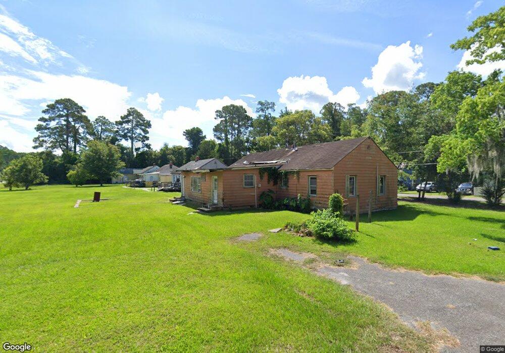
1701 Cate St Brunswick, GA 31520
Estimated Value: $95,000 - $165,000
3
Beds
1
Bath
2,000
Sq Ft
$66/Sq Ft
Est. Value
About This Home
This home is located at 1701 Cate St, Brunswick, GA 31520 and is currently estimated at $131,019, approximately $65 per square foot. 1701 Cate St is a home located in Glynn County with nearby schools including Goodyear Elementary School, Jane Macon Middle School, and Brunswick High School.
Ownership History
Date
Name
Owned For
Owner Type
Purchase Details
Closed on
Nov 28, 2022
Sold by
Butler Investment Grp Llc
Bought by
Rawls Herman
Current Estimated Value
Purchase Details
Closed on
Jun 2, 2022
Sold by
L & A Trucking Of Brunswick Llc
Bought by
Butler Investment Grp Llc
Purchase Details
Closed on
Feb 2, 2021
Sold by
Glynn County Tax Commissioner
Bought by
L & A Trucking Of Brunswick Llc
Purchase Details
Closed on
Nov 30, 2010
Sold by
The Bank Of New York Mellon
Bought by
Thompson Sammie
Purchase Details
Closed on
Mar 2, 2010
Sold by
Tyler Damon
Bought by
The Bank Of New York Mellon and The Bank Of New York
Purchase Details
Closed on
Oct 25, 2005
Sold by
Callaway Jack
Bought by
Tyler Damon
Home Financials for this Owner
Home Financials are based on the most recent Mortgage that was taken out on this home.
Original Mortgage
$67,500
Interest Rate
9.12%
Mortgage Type
New Conventional
Create a Home Valuation Report for This Property
The Home Valuation Report is an in-depth analysis detailing your home's value as well as a comparison with similar homes in the area
Home Values in the Area
Average Home Value in this Area
Purchase History
| Date | Buyer | Sale Price | Title Company |
|---|---|---|---|
| Rawls Herman | $30,000 | -- | |
| Butler Investment Grp Llc | -- | -- | |
| L & A Trucking Of Brunswick Llc | -- | -- | |
| Thompson Sammie | $17,000 | -- | |
| The Bank Of New York Mellon | $43,000 | -- | |
| Tyler Damon | $57,000 | -- |
Source: Public Records
Mortgage History
| Date | Status | Borrower | Loan Amount |
|---|---|---|---|
| Previous Owner | Tyler Damon | $67,500 |
Source: Public Records
Tax History
| Year | Tax Paid | Tax Assessment Tax Assessment Total Assessment is a certain percentage of the fair market value that is determined by local assessors to be the total taxable value of land and additions on the property. | Land | Improvement |
|---|---|---|---|---|
| 2025 | $1,217 | $48,520 | $12,400 | $36,120 |
| 2024 | $1,217 | $48,520 | $12,400 | $36,120 |
| 2023 | $1,127 | $40,760 | $5,320 | $35,440 |
| 2022 | $732 | $24,200 | $2,920 | $21,280 |
| 2021 | $743 | $23,880 | $2,920 | $20,960 |
| 2020 | $645 | $19,920 | $2,920 | $17,000 |
| 2019 | $645 | $19,920 | $2,920 | $17,000 |
| 2018 | $512 | $14,840 | $4,360 | $10,480 |
| 2017 | $520 | $15,120 | $4,360 | $10,760 |
| 2016 | $488 | $15,120 | $4,360 | $10,760 |
| 2015 | $605 | $19,920 | $4,360 | $15,560 |
| 2014 | $605 | $19,920 | $4,360 | $15,560 |
Source: Public Records
Map
Nearby Homes
- 1800 Townsend St
- 2261 Townsend St
- 3620 Fulk Bohannon Dr
- 3420 Brailsford Ave
- 2202 Tara Ln
- 800 5th St
- 3310 Franklin Ave
- 3403 Treville Ave
- 2243 Pinewood Dr
- 3000 N Cleburne St
- 2536 Cherry St
- 3107 Prim Place
- 2640 Canary Dr
- 2637 Oriole St
- 2706 Canary Dr
- 801 R St
- 2721 Wolfe St
- 2711 Wolfe St
- 2626 Gordon St
- 3015 E 3rd St
Your Personal Tour Guide
Ask me questions while you tour the home.