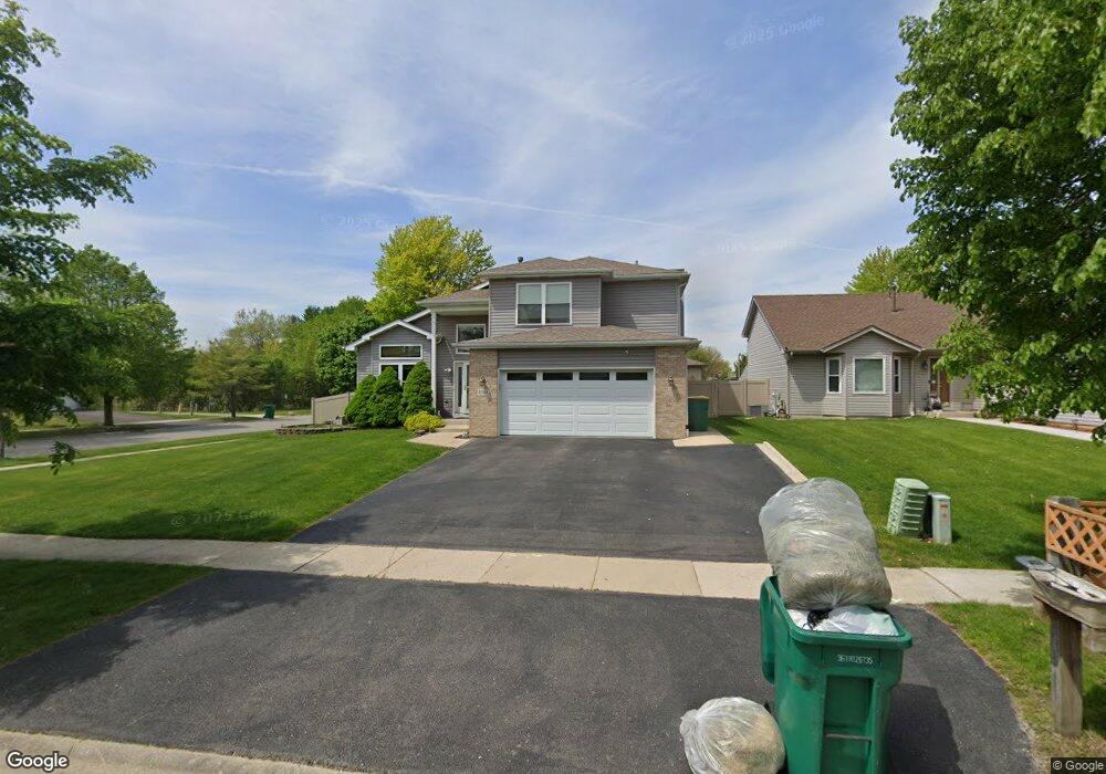
1701 Foxfield Dr Joliet, IL 60435
Estimated Value: $275,251 - $330,000
3
Beds
2
Baths
1,204
Sq Ft
$262/Sq Ft
Est. Value
About This Home
This home is located at 1701 Foxfield Dr, Joliet, IL 60435 and is currently estimated at $315,063, approximately $261 per square foot. 1701 Foxfield Dr is a home located in Will County with nearby schools including Grand Prairie Elementary School, Timber Ridge Middle School, and Plainfield Central High School.
Ownership History
Date
Name
Owned For
Owner Type
Purchase Details
Closed on
Apr 27, 2011
Sold by
Marshall Daniel W
Bought by
Marshall Daniel W and Marshall Kimberly Jean
Current Estimated Value
Purchase Details
Closed on
Mar 26, 2004
Sold by
Grundy Jason T
Bought by
Marshall Daniel W
Home Financials for this Owner
Home Financials are based on the most recent Mortgage that was taken out on this home.
Original Mortgage
$29,325
Interest Rate
5.66%
Mortgage Type
Stand Alone Second
Create a Home Valuation Report for This Property
The Home Valuation Report is an in-depth analysis detailing your home's value as well as a comparison with similar homes in the area
Home Values in the Area
Average Home Value in this Area
Purchase History
| Date | Buyer | Sale Price | Title Company |
|---|---|---|---|
| Marshall Daniel W | -- | None Available | |
| Marshall Daniel W | $195,500 | -- |
Source: Public Records
Mortgage History
| Date | Status | Borrower | Loan Amount |
|---|---|---|---|
| Open | Marshall Daniel W | $158,730 | |
| Closed | Marshall Daniel W | $29,325 | |
| Closed | Marshall Daniel W | $156,400 | |
| Previous Owner | Grundy Jason T | $160,704 |
Source: Public Records
Tax History Compared to Growth
Tax History
| Year | Tax Paid | Tax Assessment Tax Assessment Total Assessment is a certain percentage of the fair market value that is determined by local assessors to be the total taxable value of land and additions on the property. | Land | Improvement |
|---|---|---|---|---|
| 2024 | $5,873 | $90,000 | $24,233 | $65,767 |
| 2023 | $5,873 | $81,286 | $21,887 | $59,399 |
| 2022 | $5,262 | $73,005 | $19,657 | $53,348 |
| 2021 | $4,981 | $68,229 | $18,371 | $49,858 |
| 2020 | $4,902 | $66,293 | $17,850 | $48,443 |
| 2019 | $4,724 | $63,166 | $17,008 | $46,158 |
| 2018 | $4,514 | $59,348 | $15,980 | $43,368 |
| 2017 | $4,372 | $56,399 | $15,186 | $41,213 |
| 2016 | $4,276 | $53,791 | $14,484 | $39,307 |
| 2015 | $3,974 | $50,390 | $13,568 | $36,822 |
| 2014 | $3,974 | $48,611 | $13,089 | $35,522 |
| 2013 | $3,974 | $48,611 | $13,089 | $35,522 |
Source: Public Records
Map
Nearby Homes
- 1802 Maserati Dr
- 1804 Maserati Dr
- 1810 Foxfield Dr
- 2703 Oak Ridge Ln
- 3001 Theodore St
- 2528 Silver Rock Dr
- 1874 Corregidor St
- 1921 Cecily Dr
- 2533 Waterford Dr
- 1900 Essington Rd
- 1219 Cedarwood Dr Unit B
- 1945 Calla Dr
- 1422 Citadel Dr Unit 4
- 2508 Meer Park Ct Unit 151
- 3107 Ingalls Ave Unit 3B
- 3107 Ingalls Ave Unit 1D
- 2812 Vimy Ridge Dr
- 2390 Bicentennial Ave
- 2516 Lotus Ln
- 7 Rock Run Dr
- 1703 Foxfield Dr
- 1700 Maserati Dr
- 1705 Foxfield Dr
- 1702 Maserati Dr
- 2716 Wake Island Dr
- 2714 Wake Island Dr
- 1700 Foxfield Dr
- 1707 Foxfield Dr
- 1702 Foxfield Dr
- 2712 Wake Island Dr
- 1704 Maserati Dr
- 1704 Foxfield Dr
- 1709 Foxfield Dr
- 1706 Maserati Dr
- 1706 Foxfield Dr
- 1701 Maserati Dr
- 2804 Wake Island Dr
- 1701 Prairie Wind Dr
- 1701 Prairie Wind Dr
- 1703 Prairie Wind Dr