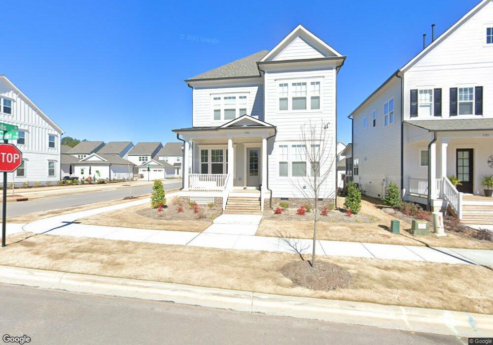
1701 Highpoint St Unit HVGT Lot 255 Wake Forest, NC 27587
Estimated Value: $494,000 - $526,000
4
Beds
3
Baths
2,150
Sq Ft
$234/Sq Ft
Est. Value
About This Home
This home is located at 1701 Highpoint St Unit HVGT Lot 255, Wake Forest, NC 27587 and is currently estimated at $504,065, approximately $234 per square foot. 1701 Highpoint St Unit HVGT Lot 255 is a home located in Wake County with nearby schools including Wake Forest Elementary School, Wake Forest-Rolesville Middle School, and Wake Forest High School.
Ownership History
Date
Name
Owned For
Owner Type
Purchase Details
Closed on
Mar 19, 2022
Sold by
Rene Remington-Carter Michelle and Wa Cris
Bought by
Miles Stephan Lawrence and Miles Teresa Sue
Current Estimated Value
Home Financials for this Owner
Home Financials are based on the most recent Mortgage that was taken out on this home.
Original Mortgage
$475,000
Outstanding Balance
$444,986
Interest Rate
4.16%
Mortgage Type
New Conventional
Estimated Equity
$59,079
Purchase Details
Closed on
Mar 29, 2018
Sold by
Pilte Home Company Llc
Bought by
Carter Cris Ward and Remington Carter Michelle Rene
Home Financials for this Owner
Home Financials are based on the most recent Mortgage that was taken out on this home.
Original Mortgage
$299,669
Interest Rate
3.99%
Mortgage Type
FHA
Create a Home Valuation Report for This Property
The Home Valuation Report is an in-depth analysis detailing your home's value as well as a comparison with similar homes in the area
Home Values in the Area
Average Home Value in this Area
Purchase History
| Date | Buyer | Sale Price | Title Company |
|---|---|---|---|
| Miles Stephan Lawrence | $500,000 | None Listed On Document | |
| Carter Cris Ward | $309,500 | None Available |
Source: Public Records
Mortgage History
| Date | Status | Borrower | Loan Amount |
|---|---|---|---|
| Open | Miles Stephan Lawrence | $475,000 | |
| Previous Owner | Carter Cris Ward | $299,669 |
Source: Public Records
Tax History Compared to Growth
Tax History
| Year | Tax Paid | Tax Assessment Tax Assessment Total Assessment is a certain percentage of the fair market value that is determined by local assessors to be the total taxable value of land and additions on the property. | Land | Improvement |
|---|---|---|---|---|
| 2025 | $4,683 | $484,636 | $100,000 | $384,636 |
| 2024 | $4,665 | $484,636 | $100,000 | $384,636 |
| 2023 | $3,755 | $321,420 | $75,000 | $246,420 |
| 2022 | $3,602 | $321,420 | $75,000 | $246,420 |
| 2021 | $3,540 | $321,420 | $75,000 | $246,420 |
| 2020 | $3,540 | $321,420 | $75,000 | $246,420 |
| 2019 | $3,668 | $294,065 | $55,800 | $238,265 |
| 2018 | $1,652 | $140,700 | $55,800 | $84,900 |
| 2017 | $633 | $55,800 | $55,800 | $0 |
Source: Public Records
Map
Nearby Homes
- 1724 Highpoint St
- 515 Forestville Rd
- 529 Forestville Rd
- 541 Forestville Rd
- 547 Forestville Rd
- 549 Forestville Rd
- 553 Forestville Rd
- 555 Forestville Rd
- 557 Forestville Rd
- Tupelo Plan at Forestville Towns
- Hawthorne Plan at Forestville Towns
- Twinberry Plan at Forestville Towns
- 1508 Pointon Way
- 218 Forestville Rd
- 664 Old Dairy Dr
- 1344 Highland Dr
- 304 Rivella Dr
- 1713 Thicketon Cir
- 816 Lilyquist Way
- 1454 Cimarron Pkwy
- 1701 Highpoint St
- 1705 Highpoint St Unit HVGT Lot 256
- 1705 Highpoint St
- 1709 Highpoint St Unit HVGT - 257
- 1713 Highpoint St
- 1713 Highpoint St Unit HVGT Lot 258
- 1665 Highpoint St
- 400 Old Dairy Dr
- 404 Old Dairy Dr Unit HVGA - 241
- 1717 Highpoint St
- 1661 Highpoint St
- 408 Old Dairy Dr Unit HVGA - 240
- 325 Brookboro Dr
- 1700 Highpoint St
- 1700 Highpoint St Unit HVG - 269
- 1704 Highpoint St Unit HVG - 268
- 1657 Highpoint St
- 321 Brookboro Dr
- 1672 Highpoint St Unit HVG - 270
- 1708 Highpoint St Unit HV Lot 267