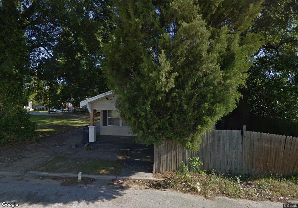
1701 Slaton St Unit 1 Augusta, GA 30904
Pendleton King NeighborhoodEstimated Value: $146,000 - $214,000
3
Beds
1
Bath
1,170
Sq Ft
$140/Sq Ft
Est. Value
About This Home
This home is located at 1701 Slaton St Unit 1, Augusta, GA 30904 and is currently estimated at $163,562, approximately $139 per square foot. 1701 Slaton St Unit 1 is a home located in Richmond County with nearby schools including Monte Sano Elementary School, Johnson Magnet, and Tutt Middle School.
Ownership History
Date
Name
Owned For
Owner Type
Purchase Details
Closed on
Sep 29, 2021
Sold by
Guy Adrienne
Bought by
Guy Tyrone Anthony
Current Estimated Value
Purchase Details
Closed on
Sep 12, 2006
Sold by
Leazenby Jane G
Bought by
Guy Tyrone Anthony
Home Financials for this Owner
Home Financials are based on the most recent Mortgage that was taken out on this home.
Original Mortgage
$90,500
Interest Rate
6.58%
Mortgage Type
Seller Take Back
Purchase Details
Closed on
Sep 30, 1997
Sold by
Prescott Corner Trust
Bought by
Prescott Corner Trust
Purchase Details
Closed on
Jul 29, 1994
Sold by
Prescott Floyd E
Bought by
Prescott Corner Trust
Create a Home Valuation Report for This Property
The Home Valuation Report is an in-depth analysis detailing your home's value as well as a comparison with similar homes in the area
Home Values in the Area
Average Home Value in this Area
Purchase History
| Date | Buyer | Sale Price | Title Company |
|---|---|---|---|
| Guy Tyrone Anthony | -- | -- | |
| Guy Tyrone Anthony | $92,500 | None Available | |
| Prescott Corner Trust | -- | -- | |
| Prescott Corner Trust | $18,000 | -- |
Source: Public Records
Mortgage History
| Date | Status | Borrower | Loan Amount |
|---|---|---|---|
| Previous Owner | Guy Tyrone Anthony | $90,500 |
Source: Public Records
Tax History
| Year | Tax Paid | Tax Assessment Tax Assessment Total Assessment is a certain percentage of the fair market value that is determined by local assessors to be the total taxable value of land and additions on the property. | Land | Improvement |
|---|---|---|---|---|
| 2025 | $2,141 | $47,784 | $5,200 | $42,584 |
| 2024 | $2,141 | $44,718 | $5,200 | $39,518 |
| 2023 | $1,931 | $41,525 | $5,200 | $36,325 |
| 2022 | $1,769 | $37,551 | $5,200 | $32,351 |
| 2021 | $1,485 | $25,734 | $5,200 | $20,534 |
| 2020 | $1,548 | $28,055 | $8,000 | $20,055 |
| 2019 | $1,614 | $28,055 | $8,000 | $20,055 |
| 2018 | $1,623 | $28,055 | $8,000 | $20,055 |
| 2017 | $1,618 | $28,055 | $8,000 | $20,055 |
| 2016 | $1,618 | $28,055 | $8,000 | $20,055 |
| 2015 | $1,625 | $28,055 | $8,000 | $20,055 |
| 2014 | $1,550 | $28,055 | $8,000 | $20,055 |
Source: Public Records
Map
Nearby Homes
- 1409 Maddox St
- 1740 Verdery St
- 1718 Verdery St
- 1716 Verdery St
- 1321 Holden St
- 1729 Verdery St
- 1802 Wilson Place
- 1823 Wrightsboro Rd
- 1307 Beman St
- 1316 Wilson St
- 1307 Merry St
- 1712 Central Ave
- 1834 Woodrow St
- 1827 Mcdowell St
- 1122 Murphy St
- 2014 Richmond Ave
- 1421 Hunter St
- 1102 Murphy St
- 1136 Beman St
- 1004 Murphy St
- 1404 Maddox St
- 1407 Holden St
- 1409 Holden St
- 1405 Holden St
- 1407 Maddox St
- 1405 Maddox St
- 1722 Wrightsboro Rd
- 1724 Wrightsboro Rd
- 1702 Wrightsboro Rd
- 1408 Merry St
- 1406 Merry St
- 1404 Merry St
- 1408 Merry St
- 1405 Maddox St
- 1728 Wrightsboro Rd
- 1730 Wrightsboro Rd
- 1705 Wrightsboro Rd
- 1703 Wrightsboro Rd
- 1719 Wrightsboro Rd
- 1701 Wrightsboro Rd
Your Personal Tour Guide
Ask me questions while you tour the home.