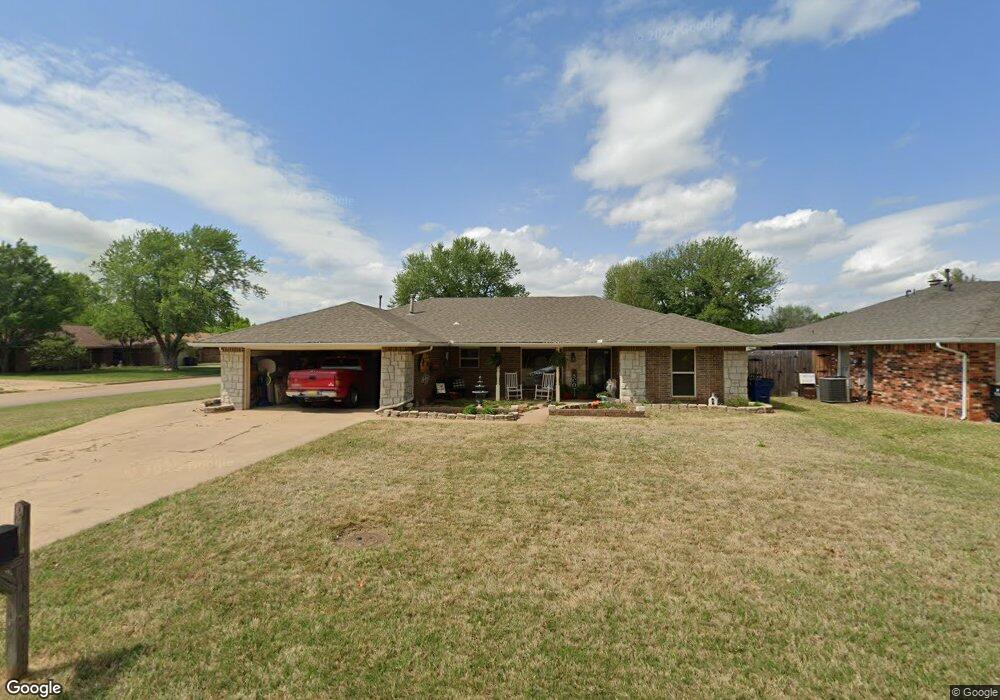
1701 Wilshire Dr Duncan, OK 73533
Estimated Value: $171,000 - $192,000
3
Beds
2
Baths
1,656
Sq Ft
$109/Sq Ft
Est. Value
About This Home
This home is located at 1701 Wilshire Dr, Duncan, OK 73533 and is currently estimated at $180,329, approximately $108 per square foot. 1701 Wilshire Dr is a home located in Stephens County with nearby schools including Horace Mann Elementary School, Duncan Middle School, and Duncan High School.
Ownership History
Date
Name
Owned For
Owner Type
Purchase Details
Closed on
Dec 6, 2022
Sold by
Scott Randall G and Scott Carole Ann
Bought by
Scott Randall G and Scott Carole Ann
Current Estimated Value
Purchase Details
Closed on
Dec 21, 2010
Sold by
Scott Randall G and Scott Carole Ann
Bought by
Scott Randall G and Scott Carole Ann
Purchase Details
Closed on
May 16, 2007
Sold by
Scott Randall G and Scott Carole Ann
Bought by
Scott Randall G
Home Financials for this Owner
Home Financials are based on the most recent Mortgage that was taken out on this home.
Original Mortgage
$80,000
Interest Rate
6.22%
Mortgage Type
New Conventional
Purchase Details
Closed on
Aug 27, 2004
Sold by
Yates Kristi Lynn and Yates Illy
Purchase Details
Closed on
Aug 6, 2004
Sold by
Scott Randall and Scott Carole
Create a Home Valuation Report for This Property
The Home Valuation Report is an in-depth analysis detailing your home's value as well as a comparison with similar homes in the area
Home Values in the Area
Average Home Value in this Area
Purchase History
| Date | Buyer | Sale Price | Title Company |
|---|---|---|---|
| Scott Randall G | -- | -- | |
| Scott Randall G | -- | None Available | |
| Scott Randall G | -- | None Available | |
| -- | -- | -- | |
| -- | -- | -- |
Source: Public Records
Mortgage History
| Date | Status | Borrower | Loan Amount |
|---|---|---|---|
| Previous Owner | Scott Randall G | $80,000 |
Source: Public Records
Tax History Compared to Growth
Tax History
| Year | Tax Paid | Tax Assessment Tax Assessment Total Assessment is a certain percentage of the fair market value that is determined by local assessors to be the total taxable value of land and additions on the property. | Land | Improvement |
|---|---|---|---|---|
| 2025 | $1,104 | $14,376 | $1,024 | $13,352 |
| 2024 | $1,104 | $13,958 | $1,024 | $12,934 |
| 2023 | $1,104 | $13,958 | $1,024 | $12,934 |
| 2022 | $1,034 | $13,551 | $1,024 | $12,527 |
| 2021 | $1,007 | $12,828 | $1,024 | $11,804 |
| 2020 | $984 | $12,401 | $1,024 | $11,377 |
| 2019 | $955 | $12,040 | $1,024 | $11,016 |
| 2018 | $1,009 | $12,704 | $1,024 | $11,680 |
| 2017 | $943 | $12,100 | $1,024 | $11,076 |
| 2016 | $903 | $11,626 | $1,024 | $10,602 |
| 2015 | $869 | $11,626 | $1,024 | $10,602 |
| 2014 | $869 | $11,589 | $1,024 | $10,565 |
Source: Public Records
Map
Nearby Homes
- 1829 1829 Terrace Dr
- 2120 2120 Flamingo Ln
- 2360 Rockwell Dr
- 2321 Rockwell Dr
- 1706 Windsor Dr
- 2202 W Canary Ave
- 1311 1311 N 20 St
- 2403 Meadow View Dr
- 1601 1601 Pearl
- 1404 1404 Ne Aspen
- 1927 High Meadow Dr
- 1302 N 21st St
- 1405 Evergreen Dr
- 1212 1212 N 21st
- 1527 1527 N 13th
- 1402 1402 W Elk Ave
- 1508 N 13th St
- 1902 W Randall Ave
- 1929 W Chisholm Dr
- 2108 W Club Rd
- 1703 Wilshire Dr
- 1718 Overland Dr
- 1713 Wilshire Dr
- 1702 1702 Wilshire Dr
- 1713 1713 Wilshire Dr
- 1715 Overland Dr
- 1702 Wilshire Dr
- 1713 Overland Dr
- 1704 Wilshire Dr
- 1717 Overland Dr
- 1720 Overland Dr
- 1717 Wilshire Dr
- 1719 Overland Dr
- 1706 Wilshire Dr
- 1605 Brookline Dr
- 1722 Overland Dr
- 1719 Wilshire Dr
- 1710 Wilshire Dr
- 1712 Wilshire Dr
- 1603 Brookline Dr