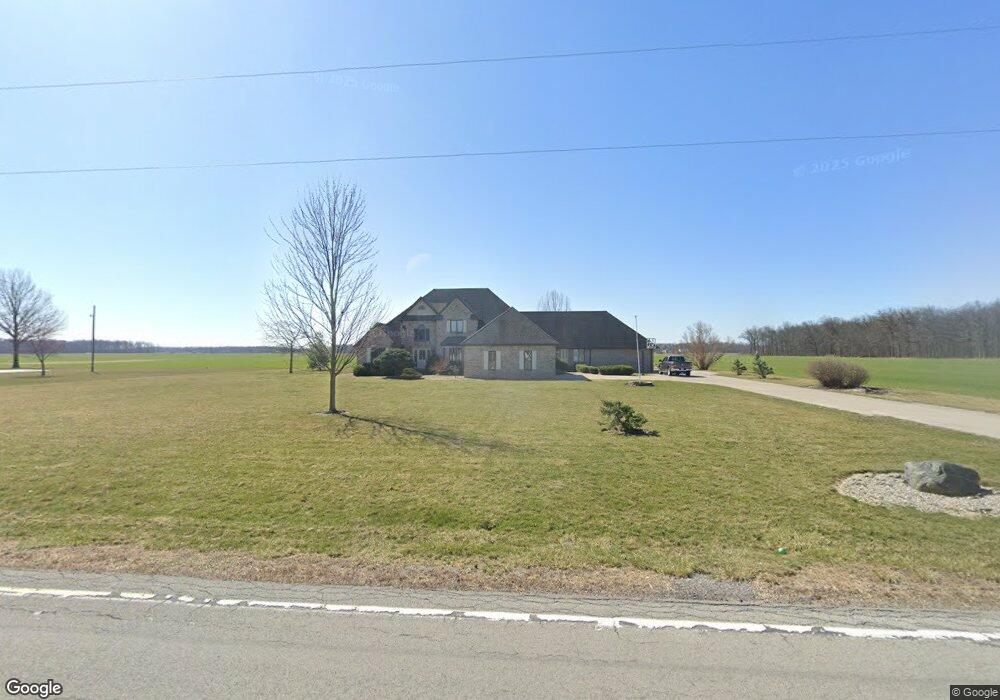
17013 State Route 694 Ottawa, OH 45875
Estimated Value: $479,000 - $559,172
4
Beds
5
Baths
3,981
Sq Ft
$130/Sq Ft
Est. Value
About This Home
This home is located at 17013 State Route 694, Ottawa, OH 45875 and is currently estimated at $515,543, approximately $129 per square foot. 17013 State Route 694 is a home located in Putnam County with nearby schools including Kalida Elementary School and Kalida High School.
Ownership History
Date
Name
Owned For
Owner Type
Purchase Details
Closed on
Sep 25, 2020
Sold by
Gardner Michelle L and Estate Of Frank R Gardner Jr
Bought by
Williams Kc and Williams Tiffany
Current Estimated Value
Home Financials for this Owner
Home Financials are based on the most recent Mortgage that was taken out on this home.
Original Mortgage
$302,800
Interest Rate
2.9%
Mortgage Type
Construction
Purchase Details
Closed on
Dec 10, 2007
Sold by
Lehman Earl Eugene and Lehman Karen Kay
Bought by
Gardner Frank R
Home Financials for this Owner
Home Financials are based on the most recent Mortgage that was taken out on this home.
Original Mortgage
$296,506
Interest Rate
6.31%
Mortgage Type
VA
Create a Home Valuation Report for This Property
The Home Valuation Report is an in-depth analysis detailing your home's value as well as a comparison with similar homes in the area
Home Values in the Area
Average Home Value in this Area
Purchase History
| Date | Buyer | Sale Price | Title Company |
|---|---|---|---|
| Williams Kc | $338,000 | None Available | |
| Gardner Frank R | $307,500 | None Available |
Source: Public Records
Mortgage History
| Date | Status | Borrower | Loan Amount |
|---|---|---|---|
| Closed | Williams Kc | $302,800 | |
| Previous Owner | Gardner Frank R | $296,506 |
Source: Public Records
Tax History Compared to Growth
Tax History
| Year | Tax Paid | Tax Assessment Tax Assessment Total Assessment is a certain percentage of the fair market value that is determined by local assessors to be the total taxable value of land and additions on the property. | Land | Improvement |
|---|---|---|---|---|
| 2024 | $5,370 | $181,350 | $6,580 | $174,770 |
| 2023 | $6,045 | $144,180 | $5,050 | $139,130 |
| 2022 | $5,368 | $144,180 | $5,051 | $139,129 |
| 2021 | $5,382 | $144,180 | $5,051 | $139,129 |
| 2020 | $5,503 | $117,050 | $4,190 | $112,860 |
| 2019 | $4,618 | $120,990 | $5,050 | $115,940 |
| 2018 | $4,461 | $120,990 | $5,050 | $115,940 |
| 2017 | $4,282 | $120,990 | $5,050 | $115,940 |
| 2016 | $4,282 | $117,050 | $4,190 | $112,860 |
| 2015 | $4,271 | $117,050 | $4,190 | $112,860 |
| 2014 | $4,148 | $117,050 | $4,190 | $112,860 |
| 2013 | $4,333 | $117,050 | $4,190 | $112,860 |
Source: Public Records
Map
Nearby Homes
- 0 Sr 115 & Rd J Unit 6128830
- 0 Sr 115 & Rd J
- 106 Carnation St
- 12806 Road K
- 15105 Road 15m
- 15735 Road E
- E Road Unit LotWP001
- 202 S Main St
- 204 E Sugar St
- 203 E Ash St
- 20501 U S 224
- 305 S Main St
- 402 S 5th St
- 202 S 5th St
- 13100 Ohio 613
- 406 N Main St
- 301 W Forrest St
- 5054 Ohio 634
- 4548 Road 13c
- 717 & 717 1/2 & 721 E Third St
- 16961 State Route 694
- 10475 Country Acres Dr
- 10482 Country Acres Dr
- 17111 State Route 694
- 10450 Country Acres Dr
- 10433 Country Acres Dr
- 10412 Country Acres Dr
- 17154 State Route 694
- 17141 State Route 694
- 10371 Country Acres Dr
- 16854 State Route 694
- 10356 Country Acres Dr
- 16825 State Route 694
- 10343 Country Acres Dr
- 10384 Country Acres Dr
- 17175 State Route 694
- 17207 State Route 694
- 10436 Country Acres Dr
- 10436 Country Acres Dr