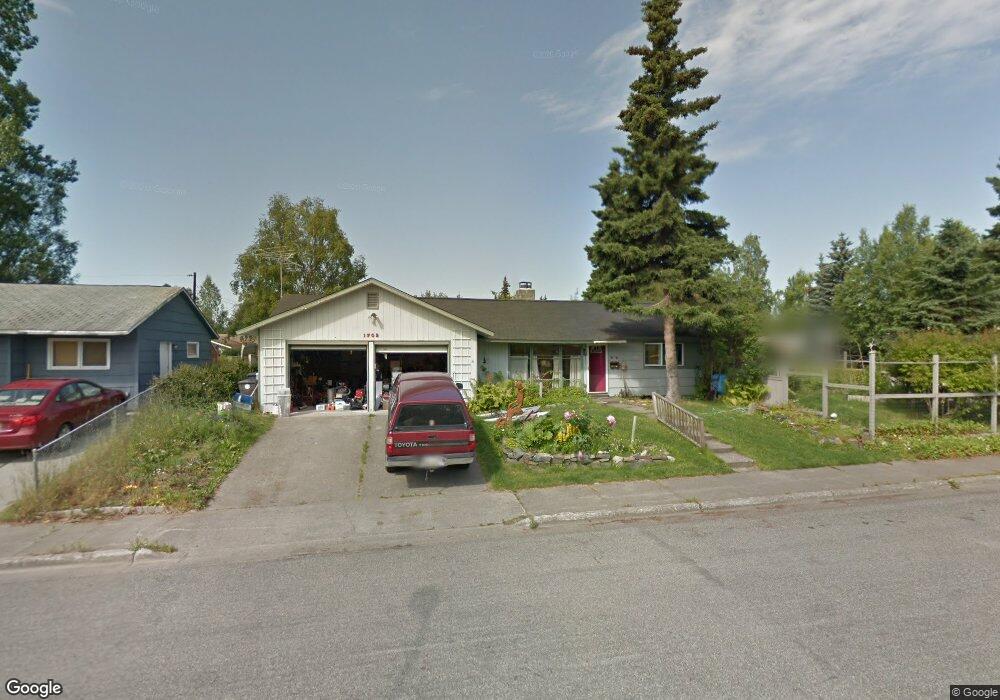
1702 Aleutian St Anchorage, AK 99508
Airport Heights NeighborhoodEstimated Value: $235,000 - $411,150
3
Beds
2
Baths
1,368
Sq Ft
$239/Sq Ft
Est. Value
About This Home
This home is located at 1702 Aleutian St, Anchorage, AK 99508 and is currently estimated at $326,788, approximately $238 per square foot. 1702 Aleutian St is a home located in Anchorage Municipality with nearby schools including Airport Heights Elementary School, Wendler Middle School, and Bettye Davis East Anchorage High School.
Ownership History
Date
Name
Owned For
Owner Type
Purchase Details
Closed on
Jul 21, 1998
Sold by
Harle Mary Lu
Bought by
Mason Rona I
Current Estimated Value
Purchase Details
Closed on
Nov 8, 1993
Sold by
Wilson Sandra Widney
Bought by
Harle Mary Lu
Home Financials for this Owner
Home Financials are based on the most recent Mortgage that was taken out on this home.
Original Mortgage
$102,000
Interest Rate
6.97%
Mortgage Type
New Conventional
Create a Home Valuation Report for This Property
The Home Valuation Report is an in-depth analysis detailing your home's value as well as a comparison with similar homes in the area
Home Values in the Area
Average Home Value in this Area
Purchase History
| Date | Buyer | Sale Price | Title Company |
|---|---|---|---|
| Mason Rona I | -- | -- | |
| Mason Rona I | -- | -- | |
| Harle Mary Lu | -- | -- |
Source: Public Records
Mortgage History
| Date | Status | Borrower | Loan Amount |
|---|---|---|---|
| Previous Owner | Harle Mary Lu | $102,000 | |
| Closed | Mason Rona I | $0 |
Source: Public Records
Tax History Compared to Growth
Tax History
| Year | Tax Paid | Tax Assessment Tax Assessment Total Assessment is a certain percentage of the fair market value that is determined by local assessors to be the total taxable value of land and additions on the property. | Land | Improvement |
|---|---|---|---|---|
| 2025 | $2,276 | $388,400 | $100,100 | $288,300 |
| 2024 | $2,276 | $366,000 | $100,100 | $265,900 |
| 2023 | $1,776 | $329,300 | $100,100 | $229,200 |
| 2022 | $2,284 | $335,600 | $100,100 | $235,500 |
| 2021 | $5,363 | $297,600 | $100,100 | $197,500 |
| 2020 | $1,672 | $299,500 | $100,100 | $199,400 |
| 2019 | $1,533 | $293,700 | $100,100 | $193,600 |
| 2018 | $1,538 | $293,800 | $100,100 | $193,700 |
| 2017 | $1,987 | $296,900 | $100,100 | $196,800 |
| 2016 | $3,813 | $288,400 | $85,000 | $203,400 |
| 2015 | $3,813 | $284,400 | $85,000 | $199,400 |
| 2014 | $3,813 | $278,500 | $79,500 | $199,000 |
Source: Public Records
Map
Nearby Homes
- 1701 Aleutian St
- 1811 Talkeetna St
- 2215 Sunburst Cir
- 1760 Eastridge Dr
- 1833 Parkside Dr
- 1414 Airport Heights Dr
- 2068 Cliffside Dr Unit 11
- 1625 Sitka St Unit 103
- 000 Tr A Thurston
- 1803 Parkside Dr
- 2553 Lovejoy Dr
- 1430 Columbine St
- 3401 E 15th Ave
- 2124 Sorbus Way
- 2624 Darby Cir
- 2028 Shepherdia Dr
- 1826 E 27th Ave
- 1421 E 17th Ave Unit 3
- 3964 Reka Dr Unit D3
- 1403 Nelchina St
- 2614 E 17th Ave
- 2614 E 17th Ave
- 1718 Aleutian St
- 1728 Aleutian St
- 2606 E 17th Ave
- 2709 E 17th Ave
- 1711 Logan St
- 2623 E 17th Ave
- 2613 E 17th Ave
- 2633 E 17th Ave
- 1727 Logan St
- 2706 E 17th Ave
- 1736 Aleutian St
- 1736 Aleutian St
- 1627 Logan St
- 2701 E 17th Ave
- 1629 Logan St
- 2719 E 17th Ave
- 1737 Logan St
- 1737 Aleutian St