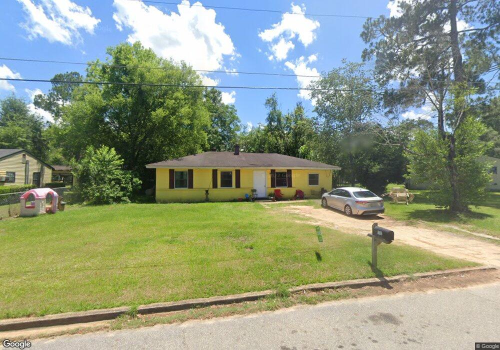
1702 Ann Ave Albany, GA 31705
Estimated Value: $52,000 - $82,000
4
Beds
2
Baths
1,381
Sq Ft
$46/Sq Ft
Est. Value
About This Home
This home is located at 1702 Ann Ave, Albany, GA 31705 and is currently estimated at $63,381, approximately $45 per square foot. 1702 Ann Ave is a home located in Dougherty County with nearby schools including Robert H. Harvey Elementary School, Albany Middle School, and Dougherty Comprehensive High School.
Ownership History
Date
Name
Owned For
Owner Type
Purchase Details
Closed on
Aug 13, 2021
Sold by
Meeks Jonathan
Bought by
Bp Property Holdings Llc
Current Estimated Value
Purchase Details
Closed on
Jul 28, 2005
Sold by
Eubanks Roy Heyman
Bought by
Meeks Jonathan and Meeks Beverly
Purchase Details
Closed on
Jul 13, 2005
Sold by
Bunn Kerry Paige
Bought by
Eubanks Heyman
Purchase Details
Closed on
Jun 14, 1988
Bought by
Flanagan Raleigh C
Create a Home Valuation Report for This Property
The Home Valuation Report is an in-depth analysis detailing your home's value as well as a comparison with similar homes in the area
Home Values in the Area
Average Home Value in this Area
Purchase History
| Date | Buyer | Sale Price | Title Company |
|---|---|---|---|
| Bp Property Holdings Llc | $25,000 | -- | |
| Bp Property Holdings Llc | $25,000 | -- | |
| Meeks Jonathan | $26,000 | -- | |
| Eubanks Roy Heyman | -- | -- | |
| Eubanks Heyman | -- | -- | |
| Flanagan Raleigh C | -- | -- |
Source: Public Records
Mortgage History
| Date | Status | Borrower | Loan Amount |
|---|---|---|---|
| Closed | Eubanks Roy Heyman | $0 |
Source: Public Records
Tax History Compared to Growth
Tax History
| Year | Tax Paid | Tax Assessment Tax Assessment Total Assessment is a certain percentage of the fair market value that is determined by local assessors to be the total taxable value of land and additions on the property. | Land | Improvement |
|---|---|---|---|---|
| 2024 | $527 | $11,048 | $1,760 | $9,288 |
| 2023 | $515 | $11,048 | $1,760 | $9,288 |
| 2022 | $468 | $11,048 | $1,760 | $9,288 |
| 2021 | $479 | $11,048 | $1,760 | $9,288 |
| 2020 | $480 | $11,048 | $1,760 | $9,288 |
| 2019 | $482 | $11,048 | $1,760 | $9,288 |
| 2018 | $484 | $11,048 | $1,760 | $9,288 |
| 2017 | $451 | $11,048 | $1,760 | $9,288 |
| 2016 | $451 | $11,048 | $1,760 | $9,288 |
| 2015 | $578 | $14,120 | $1,760 | $12,360 |
| 2014 | $571 | $14,120 | $1,760 | $12,360 |
Source: Public Records
Map
Nearby Homes
- 1618 Beverly Ave
- 1500 Evelyn Ave
- 1901 S Flintlock Dr
- 1978 S Riverview Cir
- 1604, 1606, 1607 Cromartie Beach Dr
- 1980 S Riverview Cir
- 1982 S Riverview Cir
- 1616 Cromartie Beach Dr
- 2034 N Riverview Cir
- 1412 Westcliff Ct
- 1405 Westcliff Ct
- 1323 E Society Ave
- 1107 E 4th Ave
- 1418 E Roosevelt Ave
- 119 N West Rd
- 1410 E Roosevelt Ave
- 309 Acorn St
- 1318 E Roosevelt Ave
- 1007 Swift St
- 307 Acorn St